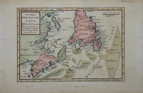
NEWFOUNDLAND SAINT PIERRE MIQUELON map 1849
Similar Sale History
View More Items in Maps & Atlases![Carte de l'Isle de Saint Domingue'. Hispaniola. Dominican Rep. BELLIN 1759 map: Title: Carte de l'Isle de Saint Domingue'. Hispaniola. Dominican Rep. BELLIN 1759 map Description: Carte de l'Isle de Saint Domingue [Map of the island of Hispaniola] by Jacques-Nicolas Bellin (1759).](https://p1.liveauctioneers.com/5584/311298/166542821_2_x.jpg?height=310&quality=70&version=1701811430)
Related Maps & Atlases

More Items in Maps & Atlases
View MoreRecommended Transportation & Travel Collectibles
View More


Item Details
Description
NEWFOUNDLAND & Saint Pierre et Miquelon islands french map from Atlas Illustre published in 1849 in Paris, french copper plate engraving, 9 3/4" x 12 1/4" and good condition.
Dimensions: 9 3/4" x 12 1/4"
Artist Name: N/A
Literature: Atlas Illustre published in 1849 in Paris
Medium: copper plate engraving
Circa: 1849
HANDLING and SHIPPING For USA $5.
FOR INTERNATIONAL SHIPPING, ask for an estimate.
Dimensions: 9 3/4" x 12 1/4"
Artist Name: N/A
Literature: Atlas Illustre published in 1849 in Paris
Medium: copper plate engraving
Circa: 1849
HANDLING and SHIPPING For USA $5.
FOR INTERNATIONAL SHIPPING, ask for an estimate.
Buyer's Premium
- 0%
NEWFOUNDLAND SAINT PIERRE MIQUELON map 1849
Estimate $100 - $200
Shipping & Pickup Options
Item located in Palmetto, FL, usOffers In-House Shipping
Payment
Accepts seamless payments through LiveAuctioneers

TOP


![Bellin: Antique Map of Saint Lawrence River, 1764: Title/Content of Map: 'Cours du Fleuve de Saint Laurent depuis la mer jusqu'à Quebec [Course of the Saint Lawrence river from the sea to the city of Quebec]' A map of the St Lawrence river estuary an](https://p1.liveauctioneers.com/5584/110975/56961948_1_x.jpg?height=310&quality=70&version=1508432804)


![Bellin Map of St. Salvador, Brazil -- Plan de la ville de St. Salvador [with] Vue de la Ville de St.: Title: Bellin Map of St. Salvador, Brazil -- Plan de la ville de St. Salvador [with] Vue de la Ville de St. Salvador du Cote de la Baye Cartographer: J Bellin Year / Place: 1757, Paris Map Dimension (](https://p1.liveauctioneers.com/5584/328338/176911634_1_x.jpg?height=310&quality=70&version=1715113718)


![[NEW YORK CITY – PICTORIAL MAPS]. Group of 3 pictorial maps...: [NEW YORK CITY – PICTORIAL MAPS]. Group of 3 pictorial maps. Including: ANNAND, George (1890—1980). Sinclair Pictorial Map of New York/New York World’s Fair. 26 ¾ x 27 5/8”](https://p1.liveauctioneers.com/928/325952/175495562_1_x.jpg?height=310&quality=70&version=1712935174)


![[Maps] Gio. Ant. Magnini, Italia, 1620: [Maps] Gio. Ant. Magnini, Italia, 1620, Giovanni Antonio Magnini. Italia, data in luce da Fabio suo figliuolo al Serenissimo Ferdinado Gonzaga Duca di Matoua edi Monserrato etc. Bologna, for Sebastian](https://p1.liveauctioneers.com/188/326797/176317457_1_x.jpg?height=310&quality=70&version=1713847031)
![[Maps] Martin Zeiler, Itinerarium Italiae, 1640: [Maps] Martin Zeiler, Itinerarium Italiae, 1640, Martini Zeilleri. Itinerarium Italiae Nov-Antiquae: oder, Raiss-Beschreibung durch Italien, Matthaus Merian, Frankfurt, 40 plates, most double-page, in](https://p1.liveauctioneers.com/188/326797/176317459_1_x.jpg?height=310&quality=70&version=1713847031)


