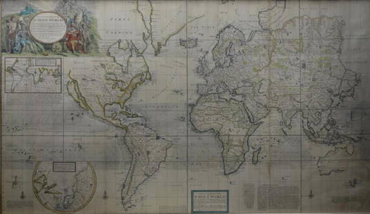
A framed 18th Century map of the road from London to Poole by John Ogleby 36 x 45 cm.
Similar Sale History
View More Items in Maps & Atlases
Related Maps & Atlases
More Items in Maps & Atlases
View MoreRecommended Transportation & Travel Collectibles
View More


Item Details
Description
A framed 18th Century map of the road from London to Poole by John Ogleby 36 x 45 cm.
Buyer's Premium
- 28%
A framed 18th Century map of the road from London to Poole by John Ogleby 36 x 45 cm.
Estimate £50 - £75
Shipping & Pickup Options
Item located in Selborne, Hampshire , ukOffers In-House Shipping
Local Pickup Available
Payment

TOP


![[ANTIQUE MAPS] OGILBY--YORK TO WHITBY, SCARBORO 1675: [ANTIQUE MAPS] OGILBY, John "YORK TO WHITBY, SCARBORO" London, UK 1675. 50X36cm. Scrolled road map. Framed. Hand-coloured. The complete route, with a spur from New Malton to Scarborough. Frame not inc](https://p1.liveauctioneers.com/8321/253807/131946541_1_x.jpg?height=310&quality=70&version=1657215628)
![Map of Turky, Arabia and Persia. Corrected from the: [In A New general atlas : containing a geographical and historical account of all the empires, kingdoms and other dominions of the world, by John Senex][London, 1721]47 cm x 57 cm Watermarked paper. O](https://p1.liveauctioneers.com/6940/190006/95714289_1_x.jpg?height=310&quality=70&version=1609447005)


![OGILBY, John (1600-1676). The Road from Cambridg: OGILBY, John (1600-1676). The Road from Cambridg to Coventry. [London, ca 1570s]. Engraved scroll map hand-colored in wash and outline, visible area 17 1/4 x 14 1/14 in. (444 x 360 mm). Deco](https://p1.liveauctioneers.com/197/151909/76680351_1_x.jpg?height=310&quality=70&version=1570472488)


![[MAP]. SPEED, John. A New Mappe of the Romane Empire. 1676.: [MAP]. SPEED, John (ca 1551-1629). A New Mappe of the Romane Empire. London: Basset & Chiswell, 1676. Engraved map with hand-coloring. Framed and double glazed, sight 419 x 559 mm. Decorative cartouch](https://p1.liveauctioneers.com/197/329395/177650541_1_x.jpg?height=310&quality=70&version=1715364962)
![Antique Map of Scotland: [Antique Map of Scotland] "A New and Correct Map of Scotland or North Britain. with all the Post and Military roads, divisions & ca. Drawn from the most approved surveys, Illustrated with many additio](https://p1.liveauctioneers.com/268/328386/176967773_1_x.jpg?height=310&quality=70&version=1714748870)

![Pair of Robert Morden Antique Maps Herefordshire Barkshire: Morden, Robert, Pair of Hand Colored Antique Maps: Hereford Shite [Herefordshire] and Bark Shire [Barkshire], printed for Abel Swale [Swall] and John Churchill, 14 x 16.5 inches, uniformly matted and](https://p1.liveauctioneers.com/184/328649/177016430_1_x.jpg?height=310&quality=70&version=1714770323)
![1790 Pazzini Carli Map of English Midlands, East and Southeast -- Le Provincie Che Sono al Sud Est: Title: 1790 Pazzini Carli Map of English Midlands, East and Southeast -- Le Provincie Che Sono al Sud Est Dell' Inghilterra Cartographer: Pazzini Carli [family] Year / Place: 1790, Siena Map Dimension](https://p1.liveauctioneers.com/5584/328338/176911604_1_x.jpg?height=310&quality=70&version=1715113718)


![[Maps] Gio. Ant. Magnini, Italia, 1620: [Maps] Gio. Ant. Magnini, Italia, 1620, Giovanni Antonio Magnini. Italia, data in luce da Fabio suo figliuolo al Serenissimo Ferdinado Gonzaga Duca di Matoua edi Monserrato etc. Bologna, for Sebastian](https://p1.liveauctioneers.com/188/326797/176317457_1_x.jpg?height=310&quality=70&version=1713847031)
![[Maps] Martin Zeiler, Itinerarium Italiae, 1640: [Maps] Martin Zeiler, Itinerarium Italiae, 1640, Martini Zeilleri. Itinerarium Italiae Nov-Antiquae: oder, Raiss-Beschreibung durch Italien, Matthaus Merian, Frankfurt, 40 plates, most double-page, in](https://p1.liveauctioneers.com/188/326797/176317459_1_x.jpg?height=310&quality=70&version=1713847031)


![[MAP]. TODESCHI, Pietro. [Nova et Acurata Totius Americae Tabula auct. G.I. Blaeu] America quarta: [MAP]. TODESCHI, Pietro. [Nova et Acurata Totius Americae Tabula auct. G.I. Blaeu] America quarta pars orbis quam plerunq, nuvum orbem appellitant primo detecta est anno 1492 a Christophoro Columbo...](https://p1.liveauctioneers.com/197/329395/177650542_1_x.jpg?height=310&quality=70&version=1715364962)


