
 Discovery- InteriorsBonhamsSponsored.Your ad here?


Discovery- Interiors
Bonhams
Sponsored.Your ad here?


 Discovery- InteriorsBonhamsSponsored.Your ad here?


Discovery- Interiors
Bonhams
Sponsored.Your ad here?

J. H. Colton’s Topographical Map of Louisiana, Mississippi and Alabama. & parts
Similar Sale History
View More Items in Maps & AtlasesRelated Maps & Atlases
More Items in Maps & Atlases
View MoreRecommended Transportation & Travel Collectibles
View More


Item Details
Description
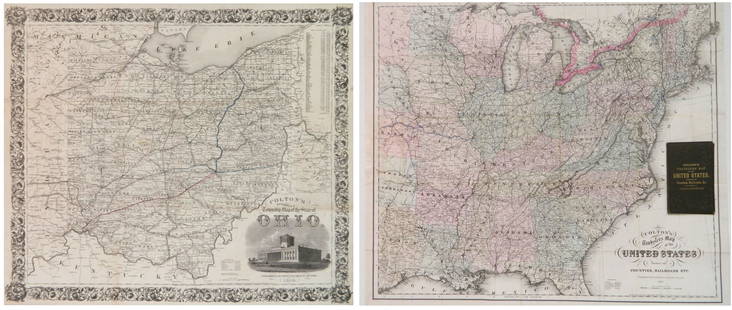
Rare Colton large format pocket map (without covers) of the lower Mississippi River and Gulf coast region of the "Confederate States" during the Civil War. The map only appeared once in 30 years of Antique Map Price Record, versus 23 sales of similar large Colton Civil War maps. Not is Stephenson's Civil War Maps. Rarely does a dealer enjoy the privilege of having two examples of a very rare map at one time. We noted only one example of this map in 30 years of AMPR, and only two examples of the map listed in OCLC, an inventory of most institutional libraries worldwide. Both examples are prior to the time in 1865 when J. H. Colton's sons, G. W. and C. B. Colton, began to manage the firm. This map was removed from its original embossed cloth covers, and minor restoration has been done to the extreme western panel where the map had been attached. Professionally encapsulated in mylar. The map was the result of Colton's use of a larger existing set of lithographic stones to create more than one map. Hence, this map appears to have been printed from the lithographic stones used in "J. H. Colton's Map of the Southern States". Neither this nor the 1865 edition by Colton's sons, of which one example is shown in OCLC, is listed in Stephenson's Civil War Maps. This example is 3/16 inch (width of printed area) narrower than our map in original covers. Although both maps are in unusually good condition, the map in covers has sharper definition in the printed portion, indicating that it was probably printed somewhat earlier than this map. Very Rare Civil War Pocket Map of Louisiana, Mississippi and Alabama. & Part of Adjoining States.
Reserve: 1,500
Shipping:
Your purchase is protected:
Photos, descriptions, and estimates were prepared with the utmost care by a fully certified expert and appraiser. All items in this sale are guaranteed authentic.
In the rare event that the item did not conform to the lot description in the sale, Jasper52 specialists are here to help. Buyers may return the item for a full refund provided you notify Jasper52 within 5 days of receiving the item.
Condition
Very Good
Buyer's Premium
- 15%
J. H. Colton’s Topographical Map of Louisiana, Mississippi and Alabama. & parts
Estimate $2,500 - $3,000
2 bidders are watching this item.
Shipping & Pickup Options
Item located in Tennessee, US$24 shipping in the US
Payment
Accepts seamless payments through LiveAuctioneers
See More Items From This Jasper52 Seller

TOP


![[MAPS & ATLASES]. COLTON, J.H. (1800-1893). Colton's New Topographical Map of The States Of: [MAPS & ATLASES]. COLTON, J.H. (1800-1893). Colton's New Topographical Map of The States Of Virginia, Maryland and Delaware, Showing Also Eastern Tennessee & Parts Of Other Adjoining States. New York:](https://p1.liveauctioneers.com/197/265299/138516337_1_x.jpg?height=310&quality=70&version=1666051328)


![1852 CROTONS MAP OF THE UNITED STATES & CANADAS: COLTON, J[oseph] H[utchins]. Colton’s Map of the United States & Canadas. Routes are by Railroads, Stage-Roads, and Canals. Lithograph map with original color. Original red cover with gold gilt lett](https://p1.liveauctioneers.com/4597/97465/50069280_1_x.jpg?height=310&quality=70&version=1482846039)


![[WALL MAP]. Colton's map of the U.S.A . NY: 1853: J.H. COLTON (publisher) [WALL MAP]. Colton's map of the United States of America, the British provinces, Mexico and the West Indies. [WALL MAP]. Colton's map of the United States of America, the Briti](https://p1.liveauctioneers.com/7142/218924/116475153_1_x.jpg?height=310&quality=70&version=1636469267)


![[Maps] Gio. Ant. Magnini, Italia, 1620: [Maps] Gio. Ant. Magnini, Italia, 1620, Giovanni Antonio Magnini. Italia, data in luce da Fabio suo figliuolo al Serenissimo Ferdinado Gonzaga Duca di Matoua edi Monserrato etc. Bologna, for Sebastian](https://p1.liveauctioneers.com/188/326797/176317457_1_x.jpg?height=310&quality=70&version=1713847031)


