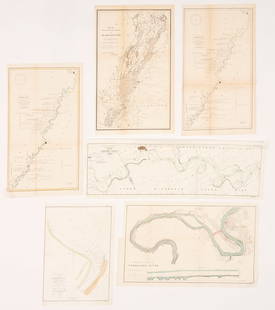
18th Century Ross Map of the Mississippi River
Similar Sale History
Recommended Items


Item Details
Description
18th Century Ross Map of the Mississippi River
COURSE OF THE RIVER MISSISSIPI FROM THE BALISE TO FORT CHARTRES; TAKEN ON AN EXPEDITION TO THE ILLINOIS, IN THE LATTER END OF THE YEAR 1765, BY LIEU'T ROSS OF THE 54TH REGIMENT (London: Robert Sayer, 1775), copperplate engraving printed on two sheets, with original hand-colored outlines of the river and gulf coast.
46.25 x 21.5 in.
Condition
Browning to top and side edges; minor chipping and a few small splits to edges; crease to lower left corner; a strong impression retaining vibrant color.
Buyer's Premium
- 20%
18th Century Ross Map of the Mississippi River
Estimate $1,000 - $2,000
3 bidders are watching this item.
Shipping & Pickup Options
Item located in Hillsborough, NC, usSee Policy for Shipping
Payment

Related Searches
TOP


![1852 Owen Maps of Mississippi River from Minneapolis to: Title: 1852 Owen Maps of Mississippi River from Minneapolis to Upriver the Wisconsin -- Series of Sections on the Wisconsin River from the Mouth to Whitney's Rapids [on sheet with] Series of Sections](https://p1.liveauctioneers.com/5584/234329/121339920_1_x.jpg?height=310&quality=70&version=1643151143)
![[MANUSCRIPT MAP-FLORIDA & MISSISSIPPI RIVER] Map Showing Raiford's Proposed Artificial River and: [MANUSCRIPT MAP-FLORIDA & MISSISSIPPI RIVER] Map Showing Raiford's Proposed Artificial River and Plan to Continue the Western and Southern Inland System of Navigation to Harbors in the Atlantic. [Fern](https://p1.liveauctioneers.com/292/250642/130213644_1_x.jpg?height=310&quality=70&version=1654271664)


![John Senex Map of Louisiana & Mississippi River: John Senex A Map of Louisiana and the River Mississipi [sic], London, 1721, engraving with hand coloring; English translation after Guillaume Delisle's 1718 map. Lower right reads "This map of the Mis](https://p1.liveauctioneers.com/7691/320359/172153416_1_x.jpg?height=310&quality=70&version=1708543789)


![HOMANN, Johann Baptist. Amplissimae Regionis Mississipi Seu Provinciae Ludovicianae. Nuremburg, [ca: [MAP]. HOMANN, Johann Baptist (1663-1724). Amplissimae Regionis Mississipi Seu Provinciae Ludovicianae. Nuremburg, [ca 1720]. Engraved map of the Mississippi region or Louisiana Province with surround](https://p1.liveauctioneers.com/197/329395/177650531_1_x.jpg?height=310&quality=70&version=1715364962)


