A Van Santen Colored Map of the Low Countries by Visscher
Similar Sale History
View More Items in Maps & AtlasesRelated Maps & Atlases
More Items in Maps & Atlases
View MoreRecommended Transportation & Travel Collectibles
View More


Item Details
Description
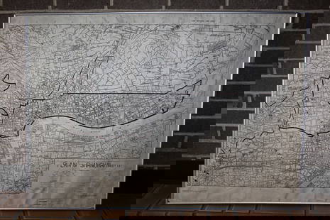
VISSCHER, Nicholas (1618-1679).
[Map of Belgium, Netherlands, France & Germany]
Tabula Geographica qua pars septentrionalis sive inferior Rheni, Mosae, et Mosellae.
Engraved map with exceptional original hand color by Van Santen.Amsterdam, c. 1680.
21 1/8" x 24 3/4" sheet.
A Van Santen Map, the best colorist of all time; Exceptionally colored map of the Rhine River.
Buyer's Premium
- 25%
A Van Santen Colored Map of the Low Countries by Visscher
Estimate $2,500 - $5,000
2 bidders are watching this item.
Shipping & Pickup Options
Item located in New York, NY, usOffers In-House Shipping
Local Pickup Available
Payment

Related Searches
TOP


![Visscher Map of Middleburgh, Holland: VISSCHER, Nicolas II (1649-1702). Untitled [Middelburgh] Engraved map with original hand color. Amsterdam, c.1690 21 1/2" x 24 3/8" sheet. Antique Map showing the then Island of Middleburgh in Holland](https://p1.liveauctioneers.com/1968/297676/158406682_1_x.jpg?height=310&quality=70&version=1690906360)
![VAN DER AA - Map of America, Leiden 1720: VAN DER AA, Pieter (1659-1733). Nouvelle Carte de l'Amerique. Leiden: [circa 1720]. Copper-engraved map. Sheet size: 18 x 21 1/4 inches. (Expert restoration along the side margins). Decorative early 1](https://p1.liveauctioneers.com/7533/208644/106251140_1_x.jpg?height=310&quality=70&version=1624641782)


![Visscher Atlas Minor Atlas: VISSCHER, Nicolaes II (1649-1702). Atlas minor, sive geographia compendiosa qua orbis terrarum per paucas attamen novissimas tabulas Ostenditura. Amsterdam: Nicolaes Visscher, [ca 1689, or later]. Com](https://p1.liveauctioneers.com/1968/250616/130196468_1_x.jpg?height=310&quality=70&version=1654190895)


![[MAP]. TODESCHI, Pietro. [Nova et Acurata Totius Americae Tabula auct. G.I. Blaeu] America quarta: [MAP]. TODESCHI, Pietro. [Nova et Acurata Totius Americae Tabula auct. G.I. Blaeu] America quarta pars orbis quam plerunq, nuvum orbem appellitant primo detecta est anno 1492 a Christophoro Columbo...](https://p1.liveauctioneers.com/197/329395/177650542_1_x.jpg?height=310&quality=70&version=1715364962)


![[MAPS]. HOMANN, Johann Baptist, HOMANN HEIRS, and Georg Matthäus SEUTTER. [Composite Atlas].: [MAPS]. HOMANN, Johann Baptist (1663-1724), HOMANN HEIRS, and Georg Matthäus SEUTTER (1678-1757). [Composite Atlas]. [Nuremberg, Augsburg, and others: Homann Heirs and others, maps dated between](https://p1.liveauctioneers.com/197/329395/177650530_1_x.jpg?height=310&quality=70&version=1715364962)


