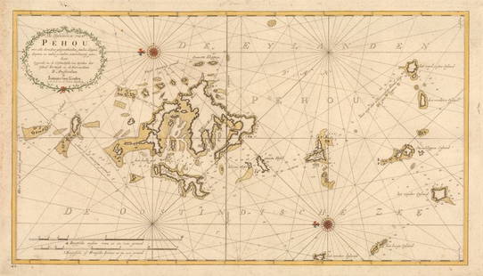
Guyana. VAN LOON. Pascaerte van de cust van Guaiana.
Nautica Sale History
View Price Results for Nautica
Related Maps & Atlases
More Items from Nautica
View MoreRecommended Transportation & Travel Collectibles
View More


Item Details
Description
VAN LOON, Johannes. Pascaerte van de cust van Guaiana.Amsterdam, 1661Incisione su rame. Immagine: 426x535 mm. Piccoli margini. Il mare colorato in verde chiaro. Rinforzi sul verso.La carta nautica molto rara di Johannes van Loon della "costa selvaggia" delle Guyana, con le coste nordorientali del Brasile e includendo Trinidad e le Antille Leaser. La tavola copre le coste da Olinda/Pernambuco a Trinidad, compresi gli estuari dei fiumi Rio delle Amazzoni e Orinoco. Le Piccole Antille mostrano Tobago, Granada, Barbados, Saint Vincent, Santa Lucia, Martinica, Dominica, Guadalupa, Antigua e Barbuda. Nel mare, lossodromie.Johannes van Loon, 1611-1686, fu un abile matematico e astronomo. I suoi primi coinvolgimenti cartografici furono con Theunis Jacobsz durante il 1640. Dal 1650 lavorò con Joannes Janssonius, incidendo tra le altre opere le tavole per il suo Celestial Atlas di Cellarius, 1660. Nel 1661 pubblicò la sua prima opera con il fratello Gillis; lo "Zee Atlas", che conteneva trentacinque mappe. Nel 1666 realizzò tavole con Jan Jansson van Waesberge, con il quale ha poi co-pubblicato l'atlante. Questa edizione è stata ampliata a quarantasette mappe, e nel 1676 ce n'erano cinquanta."
Condition
Copper engraving. Image: 426x535 mm. Little margins. The sea colored in light green. Paper reinforcements on the verso.
Johannes van Loon's very rare sea chart of the "wild coast" of the mythical Guyanas, with the northeastern coasts of Brazil and including Trinidad and the Leaser Antilles. The plate covers the coasts from Olinda/Pernambuco to Trinidad, including the estuaries of the Amazon and Orinoco rivers. The Lesser Antilles show Tobago, Granada, Barbados, Saint Vincent, Santa Lucia, Martinique, Dominica, Guadeloupe, Antigua and Barbuda. In the sea, rhumb lines.Johannes van Loon,1611-1686, was an accomplished mathematician and astronomer. His first cartographic involvements were with Theunis Jacobsz during the 1640s. From 1650 he worked with Joannes Janssonius, engraving amongst other worksthe plates for his Celestial Atlas by Cellarius, 1660. In 1661 he published his first work with his brother, Gillis; the 'Zee Atlas' contained thirty-five maps. In 1666 the plates were Jan Jansson van Waesberge, with whom he then co-published the atlas. This edition was expanded to forty-seven maps, and by 1676 there were fifty."
Johannes van Loon's very rare sea chart of the "wild coast" of the mythical Guyanas, with the northeastern coasts of Brazil and including Trinidad and the Leaser Antilles. The plate covers the coasts from Olinda/Pernambuco to Trinidad, including the estuaries of the Amazon and Orinoco rivers. The Lesser Antilles show Tobago, Granada, Barbados, Saint Vincent, Santa Lucia, Martinique, Dominica, Guadeloupe, Antigua and Barbuda. In the sea, rhumb lines.Johannes van Loon,1611-1686, was an accomplished mathematician and astronomer. His first cartographic involvements were with Theunis Jacobsz during the 1640s. From 1650 he worked with Joannes Janssonius, engraving amongst other worksthe plates for his Celestial Atlas by Cellarius, 1660. In 1661 he published his first work with his brother, Gillis; the 'Zee Atlas' contained thirty-five maps. In 1666 the plates were Jan Jansson van Waesberge, with whom he then co-published the atlas. This edition was expanded to forty-seven maps, and by 1676 there were fifty."
Buyer's Premium
- 30%
Guyana. VAN LOON. Pascaerte van de cust van Guaiana.
Estimate €1,200 - €1,500
2 bidders are watching this item.
Shipping & Pickup Options
Item located in Padova, ITALY, itOffers In-House Shipping
Payment

TOP


