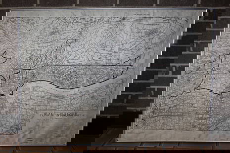
Map of North America and Canada 1780
Similar Sale History
View More Items in Maps & AtlasesRelated Maps & Atlases
More Items in Maps & Atlases
View MoreRecommended Transportation & Travel Collectibles
View More


Item Details
Description
A scarce linen-backed map of North America and Canada which reads “A New and Correct Map of North America in which the Principal Places of Engagements during the Present War are accurately Inserted, London: Published as the Act directs. April 16th, 1780. by Richardson & Urquhart. Royal Exchange”. This is a Revolutionary War map in black and white, showing Canada and the American colonies westward to Louisiana and the Great Lakes three years before the end of the Revolutionary War. Substantial topographical details are shown, including the locations of forts, towns, rivers, mines, land grants, borders between the colonies, and areas occupied by native North American tribes; it also includes the five Great Lakes as they were known at the time. The location "Walker 1750" is marked in what is now southern Kentucky, the location of the royal grant of land to the "Loyal Land Company" founded by the explorer Thomas Walker, and the whole map would be reissued in 1783 to show "The Rebel Colonies Now The United States of America”.Richardson & Urquhart were booksellers in London between 1765 and 1784. They were located at Cornhill, a street and ward in the center of London’s financial district. The map measures 15 1/2 x 11 1/4 in. wide, with some light paper loss along the left fold - it is hidden by the linen backing - and there is light soiling near the top left corner of the map, and overall a very informative map about the American colonies during the Revolutionary War.
Buyer's Premium
- 26%
Map of North America and Canada 1780
Estimate $60 - $90
19 bidders are watching this item.
Shipping & Pickup Options
Item located in SARASOTA, FL, usOffers In-House Shipping
Local Pickup Available
Payment
Accepts seamless payments through LiveAuctioneers

Related Searches
TOP


![Walker, John C1805 Antique Map. North America USA Canada: Copper Engraved Map Published C1805, London for "The Universal Gazetteer: Being a Concise Description" [Walker's Geography] by John Walker. Folds as issued. Paper Size: 10 x 8 inch (25 x 20cm) Good Co](https://p1.liveauctioneers.com/3952/311930/166897810_1_x.jpg?height=310&quality=70&version=1701713718)


![d'Anville (Jean Baptiste Bourguignon) [Untitled Composite Atlas with 102 map sheets], [probably: d'Anville (Jean Baptiste Bourguignon) [Untitled Composite Atlas with 102 map sheets], comprising 20 double-page maps, 9 two-sheet double-page maps, 3 two-sheet maps on folding double-pages [Asia, Afri](https://p1.liveauctioneers.com/5458/329231/177514974_1_x.jpg?height=310&quality=70&version=1715269091)


![[MAP]. TODESCHI, Pietro. [Nova et Acurata Totius Americae Tabula auct. G.I. Blaeu] America quarta: [MAP]. TODESCHI, Pietro. [Nova et Acurata Totius Americae Tabula auct. G.I. Blaeu] America quarta pars orbis quam plerunq, nuvum orbem appellitant primo detecta est anno 1492 a Christophoro Columbo...](https://p1.liveauctioneers.com/197/329395/177650542_1_x.jpg?height=310&quality=70&version=1715364962)


![[MAPS]. HOMANN, Johann Baptist, HOMANN HEIRS, and Georg Matthäus SEUTTER. [Composite Atlas].: [MAPS]. HOMANN, Johann Baptist (1663-1724), HOMANN HEIRS, and Georg Matthäus SEUTTER (1678-1757). [Composite Atlas]. [Nuremberg, Augsburg, and others: Homann Heirs and others, maps dated between](https://p1.liveauctioneers.com/197/329395/177650530_1_x.jpg?height=310&quality=70&version=1715364962)


![[MAP]. ORTELIUS, Abraham. Turcici Imperii Descriptio.1592.: [MAP]. ORTELIUS, Abraham (1527-1598). Turcici Imperii Descriptio. Antwerp, 1592. Engraved map with hand-coloring. Matted, framed, and double glazed, sight 406 x 521 mm (unexamined out of frame). Decor](https://p1.liveauctioneers.com/197/329395/177650538_1_x.jpg?height=310&quality=70&version=1715364962)
![[MAP]. ORTELIUS, Abraham. Americae Sive Novi Orbis, Nova Descriptio. 1573.: [MAP]. ORTELIUS, Abraham (1527-1598). Americae Sive Novi Orbis, Nova Descriptio. Antwerp, 1573. Engraved map with hand-coloring. Framed and double glazed, visible area 375 x 521 mm (unexamined out of](https://p1.liveauctioneers.com/197/329395/177650534_1_x.jpg?height=310&quality=70&version=1715364962)


