Collection of 18th/Early 19th Century Maps-American
Similar Sale History
View More Items in Maps & AtlasesRelated Maps & Atlases
More Items in Maps & Atlases
View MoreRecommended Transportation & Travel Collectibles
View More


Item Details
Description
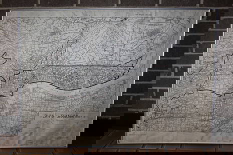
Collection of 9 American maps from the late 18th/early 19th century including; 1.) "Map of Maine, New Hampshire and Vermont" by Hinton, Simpkin & Marshall, London, 1832. Map is matted, not colored and measures 14.75" x 10.25" and is housed in matt measuring 20" x 16". Map exhibits some toning. 2.) Map titled "Les Etats Unis de l'Amerique Septentrionale Partie orientale et occidentale" by Rigobert Bonne and printed by Scattaglia, 1787. Map shows eastern coast of the United States. Map is hand-colored and measures 18.5" x 12.5" and exhibits some toning. 3.) Map titled "Boston, and Its Environs" by Richard Phillips, London, 1806. This map from the London edition of John Marshall's Life of George Washington. Matted map is not colored and measures 7.25" x 12.5" and is housed in matt measuring 14" x 18.5". Map exhibits folds and some light toning. 4.) Map titled "Various Plans and Draughts, of Cities, Towns, Harbours & c. drawn for the latest Authorities" by Thomas Conder, London, 1785. Sheet shows maps of Charlestown, South Carolina; Elizabethtown, New Jersey; New York, New York; Boston, Massachusetts; Philadelphia, Pennsylvania and Havanna, Cuba. Map is hand-colored, exhibits slight toning and measures 14" x 8.75". 5.) Map titled "A Chart of the Delaware Bay and River" by Joshua Fisher and published in the London Magazine, 1779. Matted map is not colored and measures 8.5" x 10.5" and is housed in matt measuring 11" x 13.25". Map exhibits some light toning. 6.) Map titled "The State of Rhode Island compiled from the Surveys and Observations of Caleb Harris" by Harding Harris., published by Mathew Carey, Philadelphia, 1795. Framed map is hand-colored and measures 14" x 9.75" (sight) and is housed in frame measuring 19.75" x 15.25". Map exhibits some light toning. 7.) Map titled "The State of New Hampshire. Compiled chiefly from Actual Surveys" by Samuel Lewis, published by Mathew Carey, Philadelphia, 1795. Framed map is hand-colored and measures 7.75" x6" (sight) and is housed in frame measuring 14" x 11.5". Map exhibits some light toning. 8.) Map titled "A new and accurate map of Connecticut and Rhode Island, from best authorities" by J. Hinton, 1780. Published for the Universal Magazine, London. Framed map is not colored and measures 11.5" x 14" (sight) and is housed in frame measuring 12.75" x 15.75". Map exhibits some light toning and folds. 9.) Map titled "A Map of Massachusetts : from the Best Authorities" by J. Denison, 1796. Published Thomas & Andrews, Boston. Framed map is hand- colored and measures 7.5" x 9.75" (sight) and is housed in frame measuring 15" x 17.25". Map exhibits some light toning.
Buyer's Premium
- 28%
Collection of 18th/Early 19th Century Maps-American
Estimate $300 - $500
9 bidders are watching this item.
Shipping & Pickup Options
Item located in Hatfield, PA, usSee Policy for Shipping
Payment
Accepts seamless payments through LiveAuctioneers

Related Searches
TOP


![[MAP]. TODESCHI, Pietro. [Nova et Acurata Totius Americae Tabula auct. G.I. Blaeu] America quarta: [MAP]. TODESCHI, Pietro. [Nova et Acurata Totius Americae Tabula auct. G.I. Blaeu] America quarta pars orbis quam plerunq, nuvum orbem appellitant primo detecta est anno 1492 a Christophoro Columbo...](https://p1.liveauctioneers.com/197/329395/177650542_1_x.jpg?height=310&quality=70&version=1715364962)


![[MAPS]. HOMANN, Johann Baptist, HOMANN HEIRS, and Georg Matthäus SEUTTER. [Composite Atlas].: [MAPS]. HOMANN, Johann Baptist (1663-1724), HOMANN HEIRS, and Georg Matthäus SEUTTER (1678-1757). [Composite Atlas]. [Nuremberg, Augsburg, and others: Homann Heirs and others, maps dated between](https://p1.liveauctioneers.com/197/329395/177650530_1_x.jpg?height=310&quality=70&version=1715364962)


![[MAP]. ORTELIUS, Abraham. Turcici Imperii Descriptio.1592.: [MAP]. ORTELIUS, Abraham (1527-1598). Turcici Imperii Descriptio. Antwerp, 1592. Engraved map with hand-coloring. Matted, framed, and double glazed, sight 406 x 521 mm (unexamined out of frame). Decor](https://p1.liveauctioneers.com/197/329395/177650538_1_x.jpg?height=310&quality=70&version=1715364962)


