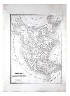
Northern Ireland, Two Antique Maps, Sir Charles Coote
Similar Sale History
View More Items in Maps & AtlasesRelated Maps & Atlases
More Items in Maps & Atlases
View MoreRecommended Transportation & Travel Collectibles
View More


Item Details
Description
Description: Two antique maps of Northern Ireland from the 1804 Statistical Survey by Sir Charles Coote, including a of Lough Neagh and County Adjacent, and a map of the county of Armagh taken from Rocque's survey.
Type: Map
Materials: Paper
Date: 1804
Maker: Sir Charles Coote
Dimensions: Lough Neagh: 19" x 16". Armagh: 14" x 16".
Provenance: From a Glenside, Pennsylvania collection.
Type: Map
Materials: Paper
Date: 1804
Maker: Sir Charles Coote
Dimensions: Lough Neagh: 19" x 16". Armagh: 14" x 16".
Provenance: From a Glenside, Pennsylvania collection.
Condition
Good condition, creases from folding, light toning, edgewear.
Buyer's Premium
- 25%
Northern Ireland, Two Antique Maps, Sir Charles Coote
Estimate $50 - $100
4 bidders are watching this item.
Shipping & Pickup Options
Item located in West Chester, PA, usSee Policy for Shipping
Local Pickup Available
Payment
Accepts seamless payments through LiveAuctioneers

Related Searches
TOP


![John SPEED: Two Antique Maps of Ireland: Two framed antique maps of Ireland by John Speed, a well known English cartographers circa 17th century. [Maps: 15" H x 20" W; Frames: 24" H x 28 1/2" W].](https://p1.liveauctioneers.com/1221/264089/138965458_1_x.jpg?height=310&quality=70&version=1667576821)


![Ireland. [in Counties]: Reserve Reduced! Title: Ireland. [in Counties] Publication Date: 1847 Cartographer: Sidney Hall Publisher: Adam & Charles Black Size: 19X15.25 Larger of two maps of Ireland showing highways, topograph](https://p1.liveauctioneers.com/5584/130079/66157224_1_x.jpg?height=310&quality=70&version=1540941379)


![Descrittione dell' Isola d'Irlanda. PORCACCHI. Ireland 1590 old antique map: Title: Descrittione dell' Isola d'Irlanda. PORCACCHI. Ireland 1590 old antique map Description: Descrittione dell' Isola d'Irlanda [Description of the island of Ireland] by Tomaso Porcacchi (1590). An](https://p1.liveauctioneers.com/5584/314775/168780324_1_x.jpg?height=310&quality=70&version=1704837726)


![South-west Europe. Swiss Savoy. British Hanover. THOMSON 1817 old antique map: TITLE/CONTENT OF MAP: [South-west sheet of] A map of Europe, with the political divisions after the Peace of Paris and Congress of Vienna The map shows south west Europe after the Congress of Vienna.](https://p1.liveauctioneers.com/5584/328641/177014448_1_x.jpg?height=310&quality=70&version=1715113718)


![[Maps] Gio. Ant. Magnini, Italia, 1620: [Maps] Gio. Ant. Magnini, Italia, 1620, Giovanni Antonio Magnini. Italia, data in luce da Fabio suo figliuolo al Serenissimo Ferdinado Gonzaga Duca di Matoua edi Monserrato etc. Bologna, for Sebastian](https://p1.liveauctioneers.com/188/326797/176317457_1_x.jpg?height=310&quality=70&version=1713847031)
![[Maps] Martin Zeiler, Itinerarium Italiae, 1640: [Maps] Martin Zeiler, Itinerarium Italiae, 1640, Martini Zeilleri. Itinerarium Italiae Nov-Antiquae: oder, Raiss-Beschreibung durch Italien, Matthaus Merian, Frankfurt, 40 plates, most double-page, in](https://p1.liveauctioneers.com/188/326797/176317459_1_x.jpg?height=310&quality=70&version=1713847031)


