


 Discovery- InteriorsBonhamsSponsored.Your ad here?
Discovery- Interiors
Bonhams
Sponsored.Your ad here?


Discovery- InteriorsBonhamsSponsored.Your ad here?
Discovery- Interiors
Bonhams
Sponsored.Your ad here?

Colored map of Holy Land 1705
Similar Sale History

![Antique Map of The Holy Land, Dated 1792: "Generaale Kaart Van Het Beloofde Land" colored map of The Holy Land, covering present-day Israel and Palestine, bordered by Egypt and Syria. Dated 1792, unframed. [22 x 26 inches]. Dry, losses, creas](https://p1.liveauctioneers.com/1221/303742/163342134_1_x.jpg?height=310&quality=70&version=1697564518)

![6 Decorative Old Maps of 16th-18th Centuries: Set of six vintage "Decorative Old Maps of 16th, 17th, 18th Centuries" including colored maps of Europe, The Holy Land, Asia, Belgium, and Canada and the Great Lakes. [Sheets: 16" H x 20" W]. In good](https://p1.liveauctioneers.com/1221/316726/170695118_1_x.jpg?height=310&quality=70&version=1706931805)


Recommended Items


Item Details
Description
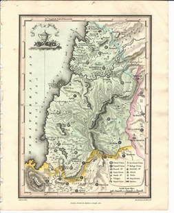
Heading: (Middle East)
Author: De la Rue, Philippe
Title: Terra Chanaan ad Abrahami Tempora per Populos XI item per Toparchias Idumeae totidem...
Place Published: Amsterdam
Publisher:P. Mortier
Date Published: 1705
Description:
Author: De la Rue, Philippe
Title: Terra Chanaan ad Abrahami Tempora per Populos XI item per Toparchias Idumeae totidem...
Place Published: Amsterdam
Publisher:P. Mortier
Date Published: 1705
Description:
Copper-engraved map, hand-colored. 41.8x55 cm. (16½x21¾").
Peter Mortier's publication of De la Rue's map of the Holy Land which came out in 1651, printed on thick paper with rich contemporary hand coloring. Shows ancient Palestine and the Nile Delta, with inset of "Abrahae Peregrinatio..." east to Babylon and Assyria. (Laor 415).
Condition
A few mostly marginal repairs on verso; very good.
Buyer's Premium
- 23%
Colored map of Holy Land 1705
Estimate $500 - $800
3 bidders are watching this item.
Shipping & Pickup Options
Item located in San Francisco, CA, usSee Policy for Shipping
Payment

Related Searches
TOP