


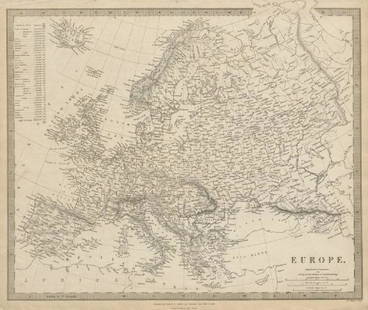
General map of the field from 699 years. Europe. 1866.
Similar Sale History


![Jansson (Jan) - [Atlas Novus: Germany],: single vol. lacking title, 106 mostly regional maps of Germany and northern Europe, but also including a general map of Germany, and classical maps of both Germany and Scandinavia, and several city pl](https://p1.liveauctioneers.com/410/80717/41962763_1_x.jpg?height=310&quality=70&version=1445353131)

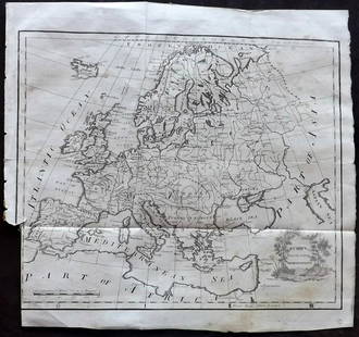
![Bartholomew's Large Scale Map of Central Europe.: Title/Content of Map: Bartholomew's Large Scale Map of Central Europe. Date Printed: 1914 Cartographer: BARTHOLOMEW, JOHN & CO. Size: 23.5x35.25 [cover title] "General map showing European frontiers,](https://p1.liveauctioneers.com/5584/120928/61572013_1_x.jpg?height=310&quality=70&version=1524615138)


Recommended Items


Item Details
Description
Lithography titled, „Uebersichtskarte des feldzuges vom jahre 699“.Author F. Köke.Engraved by Erhard Schiebe.From „Geschichte Julius Cäsars. Atlas (Karten um weiten Theil), published by Carl Gerold‘s Sohn, in Wien, 1866.Notes: Tafel. 14.Around 696 AUC, Caesar left Rome for Gaul; he would not return for nine years, in the course of which he would conquer most of what now is central Europe, opening these lands to the Mediterranean civilization. The conquest of Gaul effectively completed, Caesar set up an efficient provincial administration to govern the vast territories; he published his history: The Gallic Wars.Approx. image size 27, 3 x 19, 6/35, 8 x 26 cm.
Condition
Condition: good.
Buyer's Premium
- 0%
General map of the field from 699 years. Europe. 1866.
Estimate €15 - €30
Get approved to bid.
Shipping & Pickup Options
Item located in Vilnius, ltSee Policy for Shipping
Payment

Related Searches
TOP