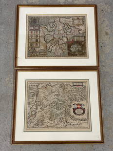
Map, Ducatus Silesiae Grotganus, J Janssonius
Similar Sale History

Recommended Items


Item Details
Description
An antique map of Upper Silesia, showing the area around Nysa and Grodkow. 17th century. Titled Ducatus Silesiae Grotganus cum Districtu Episcopali Nissensi Delineatore Iona Sculteto, Silesio. Cartographer: Johannes Janssonius, Published: Amsterdam. A copperplate engraving in full color. The sheet measures 20.5" x 24". Appears to be from The Atlas Maior, the final version of Joan Blaeu's atlas, published in Amsterdam between 1662 and 1672.
Buyer's Premium
- 19%
Map, Ducatus Silesiae Grotganus, J Janssonius
Estimate $200 - $300
1 bidder is watching this item.
Shipping & Pickup Options
Item located in Seattle, WA, usSee Policy for Shipping
Payment

TOP


![1692 Four Peeters Maps of Central Netherlands -- Ultraiectini Dominie [with] Ducatus Gelgriare…: Title: 1692 Four Peeters Maps of Central Netherlands -- Ultraiectini Dominie [with] Ducatus Gelgriare… [with] Comitatus Zutphaniae[with] Over-Yssel Cartographer: J Peeters Year / Place: 1692, An](https://p1.liveauctioneers.com/5584/280713/147899109_1_x.jpg?height=310&quality=70&version=1678227404)


