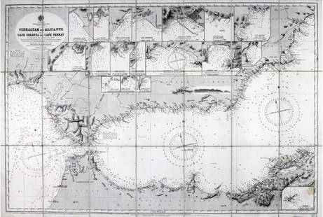
Chart of Gibraltar 1756
Similar Sale History
View More Items in Collectibles
Related Collectibles
More Items in Collectibles
View More


Item Details
Description
Heading: (Gibraltar)
Author: Homann Heirs
Title: Carte Topographique des Pays et Cotes Maritimes qui Forment le Detroit de Gibraltar... / Topographische Carte der Lander und Kusten Welche die Meer Enge von Gibraltar...
Place Published: Augsburg
Publisher:
Date Published: 1756
Description:
Author: Homann Heirs
Title: Carte Topographique des Pays et Cotes Maritimes qui Forment le Detroit de Gibraltar... / Topographische Carte der Lander und Kusten Welche die Meer Enge von Gibraltar...
Place Published: Augsburg
Publisher:
Date Published: 1756
Description:
Copper-engrave map, hand-colored. 42x55.9 cm. (16½x22").
The strategic Strait of Gibraltar is the focus of this unusual chart that provides exacting detail of the fortifications on both the Spanish and African coasts. Four tidal tables compare tide levels and times at different seas with notes on the currents. A large inset map illustrates the major shipping routes between the British Isles and Marseilles, France.
Condition
Some staining mostly to margins, dust soiling; overall very good.
Buyer's Premium
- 23%
Shipping & Pickup Options
Item located in San Francisco, CA, usSee Policy for Shipping
Payment

Related Searches
TOP


![George Washington Signed Discharge: Partly printed discharge document signed by George Washington, as Commander in Chief of the Armies of the United States. Newburgh, [New York], 4 January 1783. 1 page, ## x ## in. Undersigned by Washin](https://p1.liveauctioneers.com/7226/322253/173251475_1_x.jpg?height=310&quality=70&version=1710004847)


