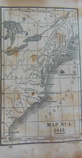
18 maps from ATLAS OF THE COUNTIES OF ENGLAND.
Similar Sale History
View More Items in Maps & AtlasesRelated Maps & Atlases
More Items in Maps & Atlases
View MoreRecommended Transportation & Travel Collectibles
View More


Item Details
Description
[Britain] 18 Maps. Lon: Greenwood & Co., mostly 1831. [From “Atlas of the Counties of England from Actual Surveys Made from the Years 1817 to 1833,” ca. 1834]. Below most maps' titles: "Engraved by J. & C. Walker." Most have thematic engraved view at lower left or right of image. Orig hand-colored outline. About 22 ½” x 27” at outer edge of border, with variation. A couple have minor marginal dampstain. On versos, some c-folds are glued and/or have clear plastic tape (not visible from image sides). Most have blue number in margin at lower right. Map of the County of Lincoln is remargined, affecting upper/lower borders including a small portion of the image that extends past Lincoln’s map border. Images mostly near fine. Includes: ++ MAP OF THE COUNTY OF… ...LINCOLN..., …NOTTINGHAM, …RUTLAND…, …NORTHAMPTON…, …NORFOLK…, …HUNTINGDON…, …STAFFORD…, …SALOP…, …WESTMORELAND…, …WILTS…, …WORCESTER…, …BEDFORD…, …DERBY…, …HEREFORD…, …HERTFORD…, …MONMOUTH. ++ MAP OF THE WEST RIDING OF THE COUNTY OF YORK… ++ MAP OF THE COUNTY PALATINE OF DURHAM…
Buyer's Premium
- 22%
18 maps from ATLAS OF THE COUNTIES OF ENGLAND.
Estimate $300 - $500
1 bidder is watching this item.
Shipping & Pickup Options
Item located in Falls Church, VA, usSee Policy for Shipping
Payment

Related Searches
TOP


!["Counties of England" Book, Circa 1834: "Atlas of the Counties of England" by C&J Greenwood, 1834, comprising partially colored surveys and maps, with folio binding. Provenance: Phyllis Lucas Gallery, NYC. [25 3/4" H x 17 1/4" W]. Cover dis](https://p1.liveauctioneers.com/1221/310017/167287172_1_x.jpg?height=310&quality=70&version=1702345351)


![1875 Walling and Gray Pennsylvania County Maps -- Atlas of Pennsylvania Counties of Chester,: Title: 1875 Walling and Gray Pennsylvania County Maps -- Atlas of Pennsylvania Counties of Chester, Dauphin, Berks, Lebanon, York and Lancaster [with] Cumberland Fraklin and Adams Cartographer: Wallin](https://p1.liveauctioneers.com/5584/319185/171438575_1_x.jpg?height=310&quality=70&version=1707858212)


![Atlas Pages Stark Cty, OH & Townships . c1870-1900's. [180168]: (13) Pages from "Combination Atlas Map of Stark County Ohio", Published by L. H. Everts & Co. Philadelphia, 1875. The Pages include biographies of residents of the township, illustrations of the town](https://p1.liveauctioneers.com/2699/331495/178785794_1_x.jpg?height=310&quality=70&version=1717094933)


![Large Map of Alaska: Large Map of Alaska With map of Washington and Oregon [separately] on versos Cartographer: George Franklin Cram Dated: Circa 1900 Type: Color Lithograph Dimensions: 14](https://p1.liveauctioneers.com/5614/330257/178045317_1_x.jpg?height=310&quality=70&version=1716032806)

![Large Map of Hawaiian Islands & Porto Rico: Large Map of Porto Rico With map of Hawaii - Hawaiian Islands and Samoa [separately] on versos] Cartographer: George Franklin Cram Dated: Circa 1900 Type: Color Lithograph](https://p1.liveauctioneers.com/5614/330257/178045318_1_x.jpg?height=310&quality=70&version=1716032806)

![Large Map of Texas (Western Part): Large Map of Texas (Western Part) With map of Louisiana and Arkansas [separately] on versos Cartographer: George Franklin Cram Dated: Circa 1900 Type: Color Lithograph Dime](https://p1.liveauctioneers.com/5614/330257/178045313_1_x.jpg?height=310&quality=70&version=1716032806)


![Large Map of Montana: Large Map of Montana With map of Utah and Wyoming [separately] on versos Cartographer: George Franklin Cram Dated: Circa 1900 Type: Color Lithograph Dimensions: 14 1/2](https://p1.liveauctioneers.com/5614/330257/178045315_1_x.jpg?height=310&quality=70&version=1716032806)
![Large Map of California: Large Map of California With map of Arizona and Nevada [separately] on versos Cartographer: George Franklin Cram Dated: Circa 1900 Type: Color Lithograph Dimensions: 14](https://p1.liveauctioneers.com/5614/330257/178045314_1_x.jpg?height=310&quality=70&version=1716032806)

![[MAP]. TODESCHI, Pietro. [Nova et Acurata Totius Americae Tabula auct. G.I. Blaeu] America quarta: [MAP]. TODESCHI, Pietro. [Nova et Acurata Totius Americae Tabula auct. G.I. Blaeu] America quarta pars orbis quam plerunq, nuvum orbem appellitant primo detecta est anno 1492 a Christophoro Columbo...](https://p1.liveauctioneers.com/197/329395/177650542_1_x.jpg?height=310&quality=70&version=1715364962)


![[MAPS]. HOMANN, Johann Baptist, HOMANN HEIRS, and Georg Matthäus SEUTTER. [Composite Atlas].: [MAPS]. HOMANN, Johann Baptist (1663-1724), HOMANN HEIRS, and Georg Matthäus SEUTTER (1678-1757). [Composite Atlas]. [Nuremberg, Augsburg, and others: Homann Heirs and others, maps dated between](https://p1.liveauctioneers.com/197/329395/177650530_1_x.jpg?height=310&quality=70&version=1715364962)

![[MAP]. ORTELIUS, Abraham. Americae Sive Novi Orbis, Nova Descriptio. 1573.: [MAP]. ORTELIUS, Abraham (1527-1598). Americae Sive Novi Orbis, Nova Descriptio. Antwerp, 1573. Engraved map with hand-coloring. Framed and double glazed, visible area 375 x 521 mm (unexamined out of](https://p1.liveauctioneers.com/197/329395/177650534_1_x.jpg?height=310&quality=70&version=1715364962)
![Set of Twelve Satirical Anthropomorphic Maps of Europe: [SATIRICAL MAPS] A set of twelve satirical anthropomorphic maps of Europe. London: circa 1868. A set of 12 (believed complete) lithographed maps by Vincent Brooks, Day & Son, London, each offering](https://p1.liveauctioneers.com/292/330597/178279264_1_x.jpg?height=310&quality=70&version=1716409282)


![[MAP]. ORTELIUS, Abraham. Turcici Imperii Descriptio.1592.: [MAP]. ORTELIUS, Abraham (1527-1598). Turcici Imperii Descriptio. Antwerp, 1592. Engraved map with hand-coloring. Matted, framed, and double glazed, sight 406 x 521 mm (unexamined out of frame). Decor](https://p1.liveauctioneers.com/197/329395/177650538_1_x.jpg?height=310&quality=70&version=1715364962)
![[MAP]. ORTELIUS, Abraham. Romani Imperii Imago. 1592.: [MAP]. ORTELIUS, Abraham (1527-1598). Romani Imperii Imago. Antwerp, 1592. Engraved map with hand-coloring. Matted, framed, and double glazed, visible area 381 x 521 mm (unexamined out of frame). 6 de](https://p1.liveauctioneers.com/197/329395/177650537_1_x.jpg?height=310&quality=70&version=1715364962)
![[MAP]. SPEED, John. A New Mappe of the Romane Empire. 1676.: [MAP]. SPEED, John (ca 1551-1629). A New Mappe of the Romane Empire. London: Basset & Chiswell, 1676. Engraved map with hand-coloring. Framed and double glazed, sight 419 x 559 mm. Decorative cartouch](https://p1.liveauctioneers.com/197/329395/177650541_1_x.jpg?height=310&quality=70&version=1715364962)


![[FLAGS]. 31-star American parade flag. Ca 1850-1859.: [FLAGS]. 31-star American parade flag. Ca 1850-1859. 22 x 36 1/2 in. cotton flag with 31 printed stars, configured in a double medallion surrounding a much larger central star, that is haloed in both](https://p1.liveauctioneers.com/197/329785/177758218_1_x.jpg?height=310&quality=70&version=1715625218)


