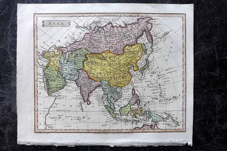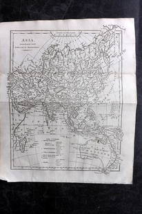
Map of Asia. 1854.
Similar Sale History
View More Items in Maps & AtlasesRelated Maps & Atlases
More Items in Asian Maps & Atlases
View MoreRecommended Transportation & Travel Collectibles
View More


Item Details
Description
Print of hand colored steel engraving titled „Carte Physique & Politique de L’Asie“.
Drawn by L. Dussieux.
Engraved by unknown.
From „Atlas General De Geographie physique, politique et historique par L. Dussieux. Atlas de Geographie ancienne, du moyen age et Moderne“. Paris. 1854.
Louis-Étienne Dussieux, born April 5, 1815 in Lyon and died February 11, 1894 in Paris. He was a French historian-geographer.
Asia is the Earth's largest and most populous continent, located primarily in the eastern and northern hemispheres. Asia covers an area of 44,579,000 square kilometers, about 30% of Earth's total land area and 8.7% of the Earth's total surface area. It has historically been home to the world's first modern civilizations and has always hosted the bulk of the planet's human population. Asia is notable for not only its overall large size and population, but unusually dense and large settlements as well as vast barely populated regions within the continent of 4.4 billion people.
Condition
Approx. image size 38, 9 x 27, 7/43, 1 x 31, 7 cm.
Condition: good.
Buyer's Premium
- 0%
Map of Asia. 1854.
Estimate €7 - €9
1 bidder is watching this item.
Shipping & Pickup Options
Item located in Vilnius, ltSee Policy for Shipping
Payment

TOP


![[Maps] Gio. Ant. Magnini, Italia, 1620: [Maps] Gio. Ant. Magnini, Italia, 1620, Giovanni Antonio Magnini. Italia, data in luce da Fabio suo figliuolo al Serenissimo Ferdinado Gonzaga Duca di Matoua edi Monserrato etc. Bologna, for Sebastian](https://p1.liveauctioneers.com/188/326797/176317457_1_x.jpg?height=310&quality=70&version=1713847031)


![[Maps] Martin Zeiler, Itinerarium Italiae, 1640: [Maps] Martin Zeiler, Itinerarium Italiae, 1640, Martini Zeilleri. Itinerarium Italiae Nov-Antiquae: oder, Raiss-Beschreibung durch Italien, Matthaus Merian, Frankfurt, 40 plates, most double-page, in](https://p1.liveauctioneers.com/188/326797/176317459_1_x.jpg?height=310&quality=70&version=1713847031)

