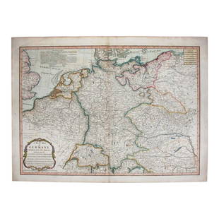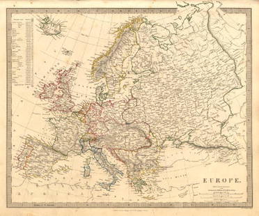
Map of the Empire of Germany. Europe. 1854.
Similar Sale History
View More Items in Maps & AtlasesRelated Maps & Atlases
More Items in European Maps & Atlases
View MoreRecommended Transportation & Travel Collectibles
View More


Item Details
Description
Print of hand colored steel engraving titled „Carte Geographique de L’ Empire D’ Allemagne”.
Drawn by L. Dussieux.
Engraved by unknown.
From „Atlas General De Geographie physique, politique et historique par L. Dussieux. Atlas de Geographie ancienne, du moyen age et Moderne“. Paris. 1854.
Louis-Étienne Dussieux, born April 5, 1815 in Lyon and died February 11, 1894 in Paris. He was a French historian-geographer.
The German Empire (German: Deutsches Kaiserreich), officially the German Reich, was the historical German nation statethat existed from the unification of Germany in 1871 to the abdication of Kaiser Wilhelm II in November 1918, when Germany became a federal republic.The German Empire consisted of 27 constituent territories, with most being ruled by royal families. This included four kingdoms, six grand duchies, six duchies (five after 1876), seven principalities, three free Hanseatic cities, and one imperial territory. Although the Kingdom of Prussia contained most of the Empire's population and territory, it played a lesser role. As Dwyer (2005) points out, Prussia's "political and cultural influence had diminished considerably" by the 1890s.
Condition
Approx. image size 39, 4 x 27, 8/43, 5 x 31, 7 cm.
Condition: good.
Buyer's Premium
- 0%
Map of the Empire of Germany. Europe. 1854.
Estimate €7 - €9
Get approved to bid.
Shipping & Pickup Options
Item located in Vilnius, ltSee Policy for Shipping
Payment

Related Searches
TOP


![1869 Mitchell Map of Much of Western Europe -- XXXII Prussia the German States Holland & Belgium: Title: 1869 Mitchell Map of Much of Western Europe -- XXXII Prussia the German States Holland & Belgium [verso] XXXIII France, Spain, Portugal and Belgium Cartographer: S Mithchell Year / Place: 1869,](https://p1.liveauctioneers.com/5584/328338/176911579_1_x.jpg?height=310&quality=70&version=1715113718)

![1914 Rand McNally Map of Austria-Hungary [verso] German Empire -- Austria-Hungary [verso] German: Title: 1914 Rand McNally Map of Austria-Hungary [verso] German Empire -- Austria-Hungary [verso] German Empire Cartographer: Rand McNally Year / Place: 1914, Chicago Map Dimension (in.): 9.2 X 13 in.](https://p1.liveauctioneers.com/5584/328338/176911532_1_x.jpg?height=310&quality=70&version=1715113718)

![Germaniae / Germania by Bertius / Langenes. Germany & Central Europe 1603 map: CAPTION PRINTED BELOW PICTURE: Descriptio Germaniae / Germania [Germany & Central Europe] DATE PRINTED: 1603 IMAGE SIZE: Approx 10.5 x 17.0cm, 4.25 x 6.5 inches (Small) TYPE: Antique copperplate map C](https://p1.liveauctioneers.com/5584/328641/177014405_1_x.jpg?height=310&quality=70&version=1715113718)


![Empire Romain sous Constantin et sous Trajan. Roman Empire. MALTE-BRUN c1871 map: TITLE/CONTENT OF MAP: Empire Romain sous Constantin et sous Trajan [Roman Empire under Constantine and under Trajan] DATE PRINTED: c1871 IMAGE SIZE: Approx 25.0 x 33.5cm, 10 x 13.25 inches (Large) TYP](https://p1.liveauctioneers.com/5584/328641/177014387_1_x.jpg?height=310&quality=70&version=1715113718)


![[Maps] Gio. Ant. Magnini, Italia, 1620: [Maps] Gio. Ant. Magnini, Italia, 1620, Giovanni Antonio Magnini. Italia, data in luce da Fabio suo figliuolo al Serenissimo Ferdinado Gonzaga Duca di Matoua edi Monserrato etc. Bologna, for Sebastian](https://p1.liveauctioneers.com/188/326797/176317457_1_x.jpg?height=310&quality=70&version=1713847031)


![[Maps] Martin Zeiler, Itinerarium Italiae, 1640: [Maps] Martin Zeiler, Itinerarium Italiae, 1640, Martini Zeilleri. Itinerarium Italiae Nov-Antiquae: oder, Raiss-Beschreibung durch Italien, Matthaus Merian, Frankfurt, 40 plates, most double-page, in](https://p1.liveauctioneers.com/188/326797/176317459_1_x.jpg?height=310&quality=70&version=1713847031)

