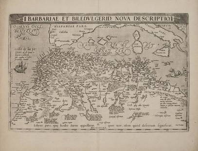
Ortelius: Cornerstone Map of Africa, 1570
Similar Sale History
View More Items in Maps & AtlasesRelated Maps & Atlases
More Items in Maps & Atlases
View MoreRecommended Transportation & Travel Collectibles
View More


Item Details
Description
In his authoritative cartobiliography of Renaissance and Early Modern maps of Africa, Betz refers to this map as one of the cornerstone maps of Africa, alluding to the great influence this map had in how Europeans imagined the shape and characteristics of the African continent until well into the seventeenth century. Ortelius designed the map using elements of three famous contemporary maps: Gastaldi's 1564 wall map, Mercator's 1569 wall map, and likely the 1562 map of Africa by Forlani. He also made use of several written sources, including Ramusio in Navigationi et Viaggi (1550), Joao de Barros in Decadas da Asia (1552), and Leo Africanus in Historiale description de l'Afrique (1556). Of these sources, Ortelius followed most closely Gastaldi, whose 1564 map is the most influential map of Africa of the 16th century. He did, however, introduce several significant changes, making the Cape of Good Hope more pointed, appreciably reducing the eastward extent of the continent (by about 1,700 km, to 7,000 km), and contracting the distance from Ceuta to Cairo (by about 1,600 km, to 3,500 km). As Betz notes, these distances are quite close to the actual measurements today: 6,800 km for east-west axis and 3,450 km from Ceuta to Cairo. For the source of the Nile, Ortelius follows the common two-lake Ptolemaic conception with one important exception: an omission of the Mountains of the Moon, which on many maps are depicted as source for the lakes. Here again he seems to be following Gastaldi, who does not explicitly name the mountains. Most of the nomenclature is taken from Gastaldi. An interesting example of the use of placenames is the term Zanzibar. Ortelius uses a general Zanzibar in southwest Africa to, presumably refer to the people and area of East and Southern Africa, and Zenzibar for the island off the coast. The map is decorated with a classical strapwork title cartouche, with two statues of women and four lions' heads. Additional decorative elements include a grand sea battle (copied from Diego Gutierez' wall map of the Americas) and sea monsters, including a ghost monster barely visible in the sea off the Arabian peninsula. This is the second state with BI=LE=DUL=GERID (an historical region south of the Atlas Mountains) added above and below the Tropic of Cancer. Latin text on verso. Engraved by Frans Hogenberg. A nice example on watermarked paper with marginal soiling and damp stains confined to the top blank margin.
Please note that this lot has a confidential reserve. When you leave a bid in advance of the auction, submit your maximum. Jasper52 will bid on your behalf as much as necessary to ensure that you meet the reserve price or that you remain in the lead, up to your maximum. The bidder who has submitted the highest bid wins the lot, provided the bid exceeds the reserve price.
Shipping:
Authenticity:
Photos, descriptions, and estimates were prepared with the utmost care by a fully certified expert and appraiser. All items in this sale are guaranteed authentic. Please contact us if there is a misrepresentation so that the item can be returned.
Your purchase is protected:
In the rare event that your purchase from this auction does not meet your expectations, Jasper52 specialists are here to help. If the item did not conform to the lot description in the sale, U.S. buyers may return the item for a full refund provided you notify Jasper52 within 5 days of receiving the item.
Condition
Very good. A nice example on watermarked paper with marginal soiling and damp stains confined to the top blank margin.
Buyer's Premium
- 10%
Ortelius: Cornerstone Map of Africa, 1570
Estimate $2,500 - $3,000
10 bidders are watching this item.
Shipping & Pickup Options
Item located in California, USSee Policy for Shipping
Payment
Accepts seamless payments through LiveAuctioneers
See More Items From This Jasper52 Seller

Related Searches
TOP


![[Maps & Atlases] [Africa] Ortelius, Abraham, Group of 2: [Maps & Atlases] [Africa] Ortelius, AbrahamGroup of 2 MapsBarbariae et Biledulgerid, nova descriptio(Antwerp, ca. 1570-1612). Hand-colored engraving. Coastal map of North Africa and the Mediterranean,](https://p1.liveauctioneers.com/65/180189/90674454_1_x.jpg?height=310&quality=70&version=1601308774)


![Africa.- Ortelius (Abraham) Africae Tabula Nova, engraved map, [c.1570-1612].: Africa.- Ortelius (Abraham) Africae Tabula Nova, detailed map of Africa based upon Gastaldi's 8 sheet wall map and Mercator's world map of 1569, decorated with a strapwork title cartouche, a sea battl](https://p1.liveauctioneers.com/5458/269991/141255679_1_x.jpg?height=310&quality=70&version=1669303305)
![EUROPAE. [Ortelius, Ca. 1584-1612.] Map.: [Ortelius, Abraham] EUROPAE. [C. 1584-1612.] Engraved map by Ortelius based on Jenkinson’s Russia map and Gastaldi’s maps of Africa and Asia, Gerard Mercator’s 1564 map of Britain, a map of Scan](https://p1.liveauctioneers.com/179/82189/42599765_1_x.jpg?height=310&quality=70&version=1447864785)


![[Maps] Martin Zeiler, Itinerarium Italiae, 1640: [Maps] Martin Zeiler, Itinerarium Italiae, 1640, Martini Zeilleri. Itinerarium Italiae Nov-Antiquae: oder, Raiss-Beschreibung durch Italien, Matthaus Merian, Frankfurt, 40 plates, most double-page, in](https://p1.liveauctioneers.com/188/326797/176317459_1_x.jpg?height=310&quality=70&version=1713847031)


![[Maps] Gio. Ant. Magnini, Italia, 1620: [Maps] Gio. Ant. Magnini, Italia, 1620, Giovanni Antonio Magnini. Italia, data in luce da Fabio suo figliuolo al Serenissimo Ferdinado Gonzaga Duca di Matoua edi Monserrato etc. Bologna, for Sebastian](https://p1.liveauctioneers.com/188/326797/176317457_1_x.jpg?height=310&quality=70&version=1713847031)


