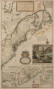
Moll maps of England and Scotland
Similar Sale History
Recommended Items


Item Details
Description
Heading:
Author: Moll, Herman
Title: Two maps, of the northern and southern parts of Great Britain
Place Published: London
Publisher:
Date Published: 1710-1714
Description:
Author: Moll, Herman
Title: Two maps, of the northern and southern parts of Great Britain
Place Published: London
Publisher:
Date Published: 1710-1714
Description:
Includes:
The South Part of Great Britain, Called England and Wales... 61.2x97.7 cm including tables at sides. [1710].
The North Part of Great Britain Called Scotland... 60x101 cm including engraved views and an inset map at sided. 1714.
Copper-engraved maps, hand-colored, the surrounding vignettes on the Scotland map uncolored.
Significant pair of maps, though with some condition issues.
Condition
England map with wear to edges and margins, staining to left portion affecting Ireland and the table; Scotland map with several tears intruding into image, some marginal chipping and edge wear, darkened patch in lower margin intruding into Irish Sea, dampstain at upper left ant top edge affecting some islands and two of the views. Good, sold as is.
Buyer's Premium
- 25%
Moll maps of England and Scotland
Estimate $400 - $600
3 bidders are watching this item.
Shipping & Pickup Options
Item located in San Francisco, CA, usSee Policy for Shipping
Payment

Related Searches
TOP


