Cary Map of the Western Territory, Kentucky,
Similar Sale History
View More Items in Maps & AtlasesRelated Maps & Atlases
More Items in Maps & Atlases
View MoreRecommended Transportation & Travel Collectibles
View More


Item Details
Description
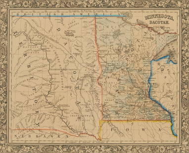
Cary, John (British, 1754-1835). A New Map of Part of the United States of North America, Exhibiting the Western Territory, Kentucky, Pennsylvania, Maryland, Virginia &c. Also, the Lakes Superior, Michigan, Huron, Ontario & Erie; with Upper and Lower Canada &c. London: 1805. Engraved, hand-colored map, 20 x 18 in., not including margins.
At the time the Western Territories extended to the Mississippi River. Cary's map is significant for its detail - Indian tribes (Monomonis, Ootawas, Chippeway, Upper Iowa, etc.); the treaty line "established by General Wayne in 1795" (Treaty of Greenville); plus roads, fords, forts (Pitt, Washington Miami), portages, salt licks, battlefields (General Sinclair's defeat, for ex.) and more. The Great Lakes were pretty well mapped at this time, however, Lewis and Clark had just departed on their journey West, thus not much west of the Mississippi was known other than its junction with the Missouri. Navigability of rivers are noted, such as the Wabash (by batteaux for 412 miles, then by canoe for an additional 197 miles). Various land companies' regions are also included - Illinois Company above St. Louis, Wabash Company (along the Wabash R.), Jersey Company below St. Louis.
This area would become Ohio, Indiana, Illinois, Michigan, Wisconsin, and part of Minnesota. Cary included historical notes, such as "Daniel Boon" [sic] and his exploration of Kentucky in 1769.
Condition
Edge chipping and toning. Does not extend into the print area. Scattered light foxing and surface soil.
Eliminate the Hassle of Third-Party Shippers: Let Cowan's Ship Directly To You!
If you'd like a shipping estimate before the auction, contact Cowan's in-house shipping department at shipping@cowans.com or 513.871.1670 x303
Buyer's Premium
- 23% up to $200,000.00
- 18% above $200,000.00
Cary Map of the Western Territory, Kentucky,
Shipping & Pickup Options
Item located in Cincinnati, OH, usPayment


![[Maps] Gio. Ant. Magnini, Italia, 1620: [Maps] Gio. Ant. Magnini, Italia, 1620, Giovanni Antonio Magnini. Italia, data in luce da Fabio suo figliuolo al Serenissimo Ferdinado Gonzaga Duca di Matoua edi Monserrato etc. Bologna, for Sebastian](https://p1.liveauctioneers.com/188/326797/176317457_1_x.jpg?height=310&quality=70&version=1713847031)


