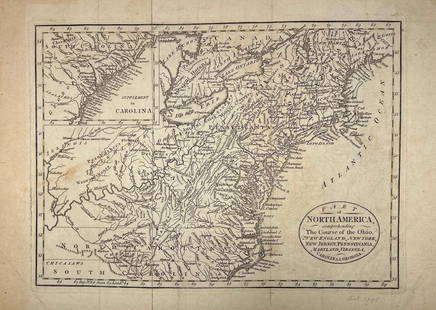
Pair of Maps, North America, 18th c.
Similar Sale History
View More Items in Maps & Atlases
Related Maps & Atlases
More Items in Maps & Atlases
View MoreRecommended Transportation & Travel Collectibles
View More


Item Details
Description
Including ** "A Map of the Island of Orleans with the Environs of Quebec" (hand-colored) and "An Authentic Plan of the River St. Laurence, from the Sillery to the Falls of Montmorency." Both circa 1759, on 8vo leaves, extracted from a book or journal and with some light offsetting from text. As-is.
Buyer's Premium
- 25%
Pair of Maps, North America, 18th c.
Estimate $50 - $80
6 bidders are watching this item.
Shipping & Pickup Options
Item located in Macon, GA, usSee Policy for Shipping
Payment

Related Searches
TOP


![Entrée de Norton & Détroit de Bhering. Bering Strait Norton Sound BONNE 1790 map: TITLE/CONTENT OF MAP: [Cook 3e Voyage] Carte de l'entrée de Norton et du Détroit de Bhering, où l'on voit le Cap le plus Oriental de l'Asie et la pointe la plus Occidentale de l'Amé](https://p1.liveauctioneers.com/5584/326888/175994368_1_x.jpg?height=310&quality=70&version=1713903186)
![Entrée de Norton & Détroit de Bhering. Bering Strait Norton Sound BONNE 1788 map: TITLE/CONTENT OF MAP: [Cook 3e Voyage] Carte de l'entrée de Norton et du Détroit de Bhering, où l'on voit le Cap le plus Oriental de l'Asie et la pointe la plus Occidentale de l'Amé](https://p1.liveauctioneers.com/5584/326888/175994363_1_x.jpg?height=310&quality=70&version=1713903186)
![A desirable early issue of Hondius map of Virginia and Florida: [MAP-NORTH AMERICA] MERCATOR, GERARD and HONDIUS, JOCODUS. Virginiae item et Floridae Americae Provinciarum, nova descriptio. [Amsterdam: Jodocus Hondius, 1607 or later]. Hand-colored engraved map. Wi](https://p1.liveauctioneers.com/292/326828/175962855_1_x.jpg?height=310&quality=70&version=1713473479)
![A highly detailed map of New England after the Jansson-Visscher series: [MAP-NORTH AMERICA] [MONTANUS, ARNOLDUS]. Novi Belgii Quod nune Novi Jorck vocatur, Novae Angliae & Partis](https://p1.liveauctioneers.com/292/326828/175962858_1_x.jpg?height=310&quality=70&version=1713473479)
![Homann's expansive map of North America: [MAP-NORTH AMERICA] HOMANN, JOHANN BAPTISTA.Regni Mexicani seu Novae Hispaniae Ludov](https://p1.liveauctioneers.com/292/326828/175962859_1_x.jpg?height=310&quality=70&version=1713473479)
![After De L'Ise's map of North America: [MAP-NORTH AMERICA] DE L'ISLE, GUILLAUME, after. L'Amerique Septentrionale Dressee sur les Observations de Mrs de l'Academie Royale des Sciences. Amsterdam: R.& J. Ottens, circa 1730 or later. Han](https://p1.liveauctioneers.com/292/326828/175962860_1_x.jpg?height=310&quality=70&version=1713473479)
![Jansson's important early map of New England: [MAP-NORTH AMERICA] JANSSON, JAN. Nova Belgica et Anglia Nova. Amsterdam: circa 1646. Latin text on verso. Neat lines 15 1/4 x 19 3/4 inches (38.7 x 50.5 cm). Marginal tears r](https://p1.liveauctioneers.com/292/326828/175962856_1_x.jpg?height=310&quality=70&version=1713473479)
![A marked improvement on the Hondius map of 1606 (Burden): [MAP-NORTH AMERICA] [JANSSON, JAN]. Virginiae partis australis et Floridae partis orientalis, interjacentiumq, regionum Nova Descriptio. Amsterdam: Blaeu, circa 1640. Second state (left cherub with ta](https://p1.liveauctioneers.com/292/326828/175962857_1_x.jpg?height=310&quality=70&version=1713473479)


