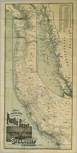
Map of Fonte's odd view of Pacific Northwest
Similar Sale History
View More Items in Maps & Atlases
Related Maps & Atlases
More Items in Maps & Atlases
View MoreRecommended Transportation & Travel Collectibles
View More


Item Details
Description
Heading:
Author: De Vaugondy, Robert
Title: Carte Generale des Découvertes de l'Amiral de Fonte et autres Navigateurs Espagnols, Anglois et Russes pour la recherche du Passage a la Mer du Sud. Par M. De l'Isle de l'Acedemie royale des Sciences &c. Publiee a Paris en Septembre 1752
Place Published: Paris
Publisher:
Date Published: 1772
Description:
Copper-engraved map with inset, modern hand-coloring. 31.5x40 cm. (12½x16").
With the curious configurations which various cartographers gave to the northwest coast of America in an effort to give credence to a Northwest Passage. Issued in the supplement to Diderot's Encyclopedie as part of the series of ten maps by De Vaugondy illustrating the then-current views of the geography of the northwest of America, with folds. Wagner, N.W. Coast, 637.
Condition
Lower half of left margin trimmed to neat line for folding, as issued; old folds; shrink-wrapped; very good.
Buyer's Premium
- 25%
Map of Fonte's odd view of Pacific Northwest
Estimate $200 - $300
1 bidder is watching this item.
Shipping & Pickup Options
Item located in San Francisco, CA, usSee Policy for Shipping
Payment

Related Searches
TOP


![[PACIFIC NORTHWEST]. Two pictorial maps of Oregon and Washi...: [PACIFIC NORTHWEST]. Two pictorial maps of Oregon and Washington. Including: -- PETRUCCELLI, Antonio (1907-1994). Pictorial map of Washington and Oregon. 1940. Art Deco style map of the Pacific Northw](https://p1.liveauctioneers.com/928/255324/132836177_1_x.jpg?height=310&quality=70&version=1658268357)


![1831 Woodbridge Map of North America, Europe, Asia and on verso Map of Pacific Ocean -- Polar: Title: 1831 Woodbridge Map of North America, Europe, Asia and on verso Map of Pacific Ocean -- Polar Projection of North America and Asia [verso] Pacific Ocean with a View of Australia and Polynesia C](https://p1.liveauctioneers.com/5584/285598/150695018_1_x.jpg?height=310&quality=70&version=1681855790)
![1831 Woodbridge Map of North America, Europe, Asia and: Title: 1831 Woodbridge Map of North America, Europe, Asia and on verso Map of Pacific Ocean -- Polar Projection of North America and Asia [verso] Pacific Ocean with a View of Australia and Polynesia C](https://p1.liveauctioneers.com/5584/231769/120064716_1_x.jpg?height=310&quality=70&version=1641336545)


![Carte réduite de la Mer du Sud'. Pacific Ocean. BELLIN/SCHLEY 1757 old map: CAPTION PRINTED BELOW PICTURE: Carte réduite de la Mer du Sud [Map of the South Seas] Pacific Ocean DATE PRINTED: 1757 IMAGE SIZE: Approx 22.0 x 37.0cm, 8.75 x 14.5 inches (Large); Please note th](https://p1.liveauctioneers.com/5584/326888/175994494_1_x.jpg?height=310&quality=70&version=1713903186)


![Océanique Iles de la Société #42 Tahiti Rangiroa Polynesia VANDERMAELEN 1827 map: CAPTION PRINTED BELOW PICTURE: Océanique - Archipel des iles de la Société [Note sur l'Archipel des îles de la Société] - No. 42 Part of the Society islands of French Pol](https://p1.liveauctioneers.com/5584/326888/175994674_1_x.jpg?height=310&quality=70&version=1713903186)
![Océanique Iles de la Société #42 Tahiti Rangiroa Polynesia VANDERMAELEN 1827 map: CAPTION PRINTED BELOW PICTURE: Océanique - Archipel des iles de la Société [Note sur l'Archipel des îles de la Société] - No. 42 Part of the Society islands of French Pol](https://p1.liveauctioneers.com/5584/326888/175994371_1_x.jpg?height=310&quality=70&version=1713903186)
![POLYNESIA/PACIFIC ISLANDS. inc Sandwich/Hawaiian islands. RAPKIN/TALLIS 1851 map: CAPTION PRINTED BELOW PICTURE: 'Polynesia or Islands in the Pacific Ocean' Vignettes: Resolution Bay, Marquesas; Harbour of Dory, New Guinea; Otaheite [Tahiti]; Kalakakooa, Sandwich Islands [Hawaiian](https://p1.liveauctioneers.com/5584/326888/175994560_1_x.jpg?height=310&quality=70&version=1713903186)


