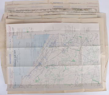
Maps of Jutland and Copenhagen
Similar Sale History
View More Items in Maps & Atlases
Related Maps & Atlases
More Items in Maps & Atlases
View MoreRecommended Transportation & Travel Collectibles
View More


Item Details
Description
Heading: (Maps)
Author:
Title: Map of Jutland and two plans of Copenhagen, offered together
Place Published: Amsterdam & no places
Publisher:
Date Published: 1680. 1728 & 1764
Description:
Author:
Title: Map of Jutland and two plans of Copenhagen, offered together
Place Published: Amsterdam & no places
Publisher:
Date Published: 1680. 1728 & 1764
Description:
Includes:
Wit, Frederick de. Iutiae Tabula in quae sunt Dioeceses Alburgensis, Wiburgensis, Ripensis et Arhusiensis quae et sunt Divisiae in Omnia Dominia. Copper-engraved map, hand-colored; uncolored pictorial cartouche. 58.3x47.5 cm, matted. Amsterdam: c.1680.
Naaukeurige Afteekening der Hoofstad Koppenhagen, Met de Aanwyzing van den Swaaren Brand Van den 20. October en Volgende Dagen des Iaars 1728. Copper-engraved plan. 20x25 cm, matted. 1728.
Den Kongel Residentz Stad Kiöbenhafn I Grundtegning Ao MDCCLXIV. Copper-engraved plan. 53x42.5 cm, matted. 1764
Map of the continental portion of Denmark, and two scarce plans of its capital city.
Condition
Jutland map with overall toning except a 1½" horizontal band along fold, which is lighter; both in very good condition.
Buyer's Premium
- 25%
Maps of Jutland and Copenhagen
Estimate $10 - $100
2 bidders are watching this item.
Get approved to bid.
Shipping & Pickup Options
Item located in San Francisco, CA, usSee Policy for Shipping
Payment

Related Searches
TOP


![[MAP]. FRY & JEFFERSON. A Map of the Most Inhabited Part of Virginia. 1775. FIRST PRINTED MAP OF: [MAPS & ATLASES]. FRY, Joshua (1699-1754) and Peter JEFFERSON (1708-1757). A Map of the Most Inhabited Part of Virginia containing the whole Province of Maryland with Part of Pensilvania, New Jers](https://p1.liveauctioneers.com/197/305583/163286504_1_x.jpg?height=310&quality=70&version=1697143109)


![ZEELANDIA INSULA DANICARUM MAXIMA. Seeland Sjælland Copenhagen BLAEU c1667 map: CAPTION PRINTED BELOW PICTURE: Zeelandia Insula Danicarum Maxima [Zealand (Seeland / Sjælland), the largest island of Denmark] Other places marked or shown on the map include Kiobenhafven (Kø](https://p1.liveauctioneers.com/5584/332390/179262918_1_x.jpg?height=310&quality=70&version=1717528223)


![1636 Hondius Map of Southern Spain -- Andaluzia continens Sevillam et Cordubam: Title: 1636 Hondius Map of Southern Spain -- Andaluzia continens Sevillam et Cordubam Cartographer: Hondius [family] Year / Place: 1636, Amsterdam Map Dimension (in.): 13.8 X 19.4 in. This is a handso](https://p1.liveauctioneers.com/5584/331526/178834458_1_x.jpg?height=310&quality=70&version=1717530687)


![[Maps & Atlases] Oliva, Joan: Portolan Chart of the Mediterranean: [Maps & Atlases] Oliva, Joan: Portolan Chart of the Mediterranean Oliva, Joan Portolan Chart of the Mediterranean Marseille, 1615. Illuminated manuscript portolan chart on vellum, in red, blue, green,](https://p1.liveauctioneers.com/65/332523/179335172_1_x.jpg?height=310&quality=70&version=1717709445)


![Set of Twelve Satirical Anthropomorphic Maps of Europe: [SATIRICAL MAPS] A set of twelve satirical anthropomorphic maps of Europe. London: circa 1868. A set of 12 (believed complete) lithographed maps by Vincent Brooks, Day & Son, London, each offering](https://p1.liveauctioneers.com/292/330597/178279264_1_x.jpg?height=310&quality=70&version=1716409282)


