


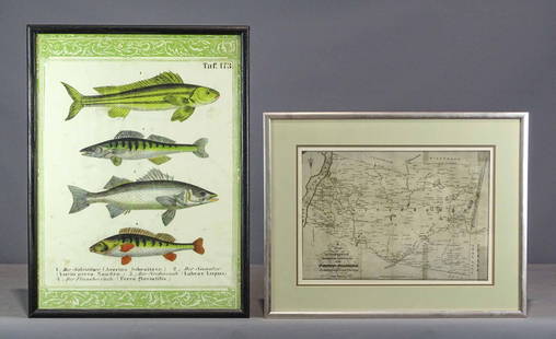
Meyer: New Jersey
Similar Sale History
View More Items in Maps & Atlases


Related Maps & Atlases


![1772 GREEK BIBLE NEW TESTAMENT antique BIBLIA LATIN text MAP NOVUM TESTAMENTUM: Lugduni Batavorum, Apud Wetstenios Londini, Apud Johannem Nourse; 1772 Size 3 3/4 by 6 1/4" Folding map [6] 699 pp. Repaired spine Some toning. Otherwise very good condition Text in Greek and Latin in](https://p1.liveauctioneers.com/5584/332364/179251568_1_x.jpg?height=310&quality=70&version=1718142848)


More Items in Maps & Atlases
View More
![[Maps & Atlases] Oliva, Joan: Portolan Chart of the Mediterranean: [Maps & Atlases] Oliva, Joan: Portolan Chart of the Mediterranean Oliva, Joan Portolan Chart of the Mediterranean Marseille, 1615. Illuminated manuscript portolan chart on vellum, in red, blue, green,](https://p1.liveauctioneers.com/65/332523/179335172_1_x.jpg?height=310&quality=70&version=1717709445)
![Set of Twelve Satirical Anthropomorphic Maps of Europe: [SATIRICAL MAPS] A set of twelve satirical anthropomorphic maps of Europe. London: circa 1868. A set of 12 (believed complete) lithographed maps by Vincent Brooks, Day & Son, London, each offering](https://p1.liveauctioneers.com/292/330597/178279264_1_x.jpg?height=310&quality=70&version=1716409282)


![[Maps & Atlases] Speed, John: The Turkish Empire: [Maps & Atlases] Speed, John: The Turkish Empire Speed, John The Turkish Empire (London): Roger Rea the Elder and younger, 1626 (but, 1662 or after). Engraved hand-colored map, 16 3/4 x 21 1/2 in. (42](https://p1.liveauctioneers.com/65/332523/179335176_1_x.jpg?height=310&quality=70&version=1717709446)


![[Maps & Atlases] Speed, John: Spaine: [Maps & Atlases] Speed, John: Spaine Speed, John Spaine (London): Thomas Bassett and Richard Chiswell, 1626 (but 1675). Engraved hand-colored map, 17 3/8 x 22 in. (441 x 559 mm). Several small tape re](https://p1.liveauctioneers.com/65/332523/179335175_1_x.jpg?height=310&quality=70&version=1717709446)
![[Maps & Atlases] Seutter, Matth(ias).: Novus Orbis sive America...: [Maps & Atlases] Seutter, Matth(ias).: Novus Orbis sive America... Seutter, Matth(ias). Novus Orbis sive America Meridionalis et Septentrionalis… Augsburg, ca. 1730. Engraved hand-colored map of](https://p1.liveauctioneers.com/65/332523/179335174_1_x.jpg?height=310&quality=70&version=1717709447)
![[Maps & Atlases] A New Map of North America, with the West India Islands...: [Maps & Atlases] A New Map of North America, with the West India Islands... A New Map of North America, with the West India Islands. Divided according to the Preliminary Articles of Peace, Signed at V](https://p1.liveauctioneers.com/65/332523/179335173_1_x.jpg?height=310&quality=70&version=1717709447)
![[Maps & Atlases] Braun, Georg, and Frans Hogenberg: Londinum, Feracissimi Angliae...: [Maps & Atlases] Braun, Georg, and Frans Hogenberg: Londinum, Feracissimi Angliae... Braun, Georg, and Frans Hogenberg Londinum, Feracissimi Angliae Regni Metropolis (Cologne, 1574). Engraved hand-col](https://p1.liveauctioneers.com/65/332523/179335170_1_x.jpg?height=310&quality=70&version=1717622830)
![[Philadelphia & Pennsylvania] Howell, Reading: A Map Of The State Of Pennsylvania: [Philadelphia & Pennsylvania] Howell, Reading: A Map Of The State Of Pennsylvania Howell, Reading A Map Of The State Of Pennsylvania… London: Published 1 August 1792 for the Author, & Sold by Ja](https://p1.liveauctioneers.com/65/332523/179335196_1_x.jpg?height=310&quality=70&version=1717622830)


Recommended Transportation & Travel Collectibles
View More


Item Details
Description
Reserve Reduced!
The beautifully detailed and colored map of New Jersey "with its streets, distances between main towns, and steamship routes" from Meyer's Hand-Atlas. Includes a key to canals, railroads, and main roads as well as distances "by post" and "by steamship" between Trenton and Philadelphia, Trenton and New York, etc.
Cartographer: Bibliographischen Instituts. Place/Date: Hildburghausen / 1846 Size: 12 3/4" x 14 1/2"
original outline color; light overall age toning; ; ;
Reserve: $40.00 Jasper52 negotiates the lowest reserves so bidders always get the best prices.
Shipping: Domestic: Flat-rate of $15.00 to anywhere within the contiguous U.S. International: Foreign shipping rates are determined by destination. Combined shipping: Please ask about combined shipping for multiple lots before bidding. Location: This item ships from New York
Your purchase is protected:
Photos, descriptions, and estimates were prepared with the utmost care by a fully certified expert and appraiser. All items in this sale are guaranteed authentic.
In the rare event that the item did not conform to the lot description in the sale, Jasper52 specialists are here to help. Buyers may return the item for a full refund provided you notify Jasper52 within 5 days of receiving the item.
The beautifully detailed and colored map of New Jersey "with its streets, distances between main towns, and steamship routes" from Meyer's Hand-Atlas. Includes a key to canals, railroads, and main roads as well as distances "by post" and "by steamship" between Trenton and Philadelphia, Trenton and New York, etc.
original outline color; light overall age toning; ; ;
Reserve: $40.00
Shipping:
Your purchase is protected:
Photos, descriptions, and estimates were prepared with the utmost care by a fully certified expert and appraiser. All items in this sale are guaranteed authentic.
In the rare event that the item did not conform to the lot description in the sale, Jasper52 specialists are here to help. Buyers may return the item for a full refund provided you notify Jasper52 within 5 days of receiving the item.
Buyer's Premium
- 15%
Shipping & Pickup Options
Item located in New York, US$15 shipping in the US
Payment
See More Items From This Jasper52 Seller

Auction Curated By

Maps Expert
Related Searches
TOP