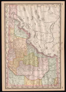
Johnston's Atlas 1843 with 41 double-page maps
Similar Sale History
View More Items in Maps & AtlasesRelated Maps & Atlases
More Items in Maps & Atlases
View MoreRecommended Transportation & Travel Collectibles
View More


Item Details
Description
Heading:
Author: Johnston, Alexander Keith
Title: The National Atlas of Historical, Commercial and Political Geography, constructed from the most Recent and Authentic Sources
Place Published: Edinburgh
Publisher:Cowan & Co.
Date Published: [c.1843]
Description:
Author: Johnston, Alexander Keith
Title: The National Atlas of Historical, Commercial and Political Geography, constructed from the most Recent and Authentic Sources
Place Published: Edinburgh
Publisher:Cowan & Co.
Date Published: [c.1843]
Description:
With 41 double-page steel plate engraved maps with color outlines, plus insets, index. (Folio) 54x34 cm (21x14"), period half morocco, gilt cover and spine; marbled endpapers.
Includes five maps on Australasia, two World maps, one of North America, and one of the United States and Texas. The North America map and U.S./Texas map both have Texas as an independent country, in its enlarged configuration. Phillips Atlases 799.
Condition
Some staining to boards with rubbing to extremities, repair work to top joint; ownership initials in pencil opposite title page, maps bright, scattered fingersoiling and faint foxing, a solid copy; very good.
Buyer's Premium
- 25%
Johnston's Atlas 1843 with 41 double-page maps
Estimate $1,000 - $1,500
7 bidders are watching this item.
Shipping & Pickup Options
Item located in San Francisco, CA, usSee Policy for Shipping
Payment

Related Searches
TOP


![MAPS IN BOOKS, Atlases, Buy de Mornas: Contains 135 Double-Page Maps in Contemporary Color. Atlases. Claude Buy de Mornas, [4 Volumes] Atlas Methodique et Elementaire de Geographie et d'Histoire, 1761-62 (published). Hand Color. A large an](https://p1.liveauctioneers.com/6576/320593/172252664_1_x.jpg?height=310&quality=70&version=1708729193)
![Korean Atlas Book or Ch'onha Chido.: (KOREAN ATLAS.) Ch'onha Chido [Atlas of all under Heaven]. Includes (9) double page maps, and (2) double pages of inscriptions (possibly a key to the maps??). Front and back covers with inscriptions.](https://p1.liveauctioneers.com/483/307467/164324833_1_x.jpg?height=310&quality=70&version=1698431865)


