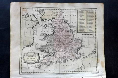
Map of England & Wales 1760
Similar Sale History
View More Items in Maps & AtlasesRelated Maps & Atlases
More Items in Maps & Atlases
View MoreRecommended Transportation & Travel Collectibles
View More


Item Details
Description
Heading: (Maps)
Author: Tirion, Isaac
Title: Nieuwe Kaart van 't Zuider Gedeelte van Groot Britannie behelzende Het Koningryk Engeland…
Place Published: Amsterdam
Publisher:
Date Published: 1760
Description:
Author: Tirion, Isaac
Title: Nieuwe Kaart van 't Zuider Gedeelte van Groot Britannie behelzende Het Koningryk Engeland…
Place Published: Amsterdam
Publisher:
Date Published: 1760
Description:
Copper-engraved map, hand-colored. 32.6x36.1 cm. (12¾x14¼").
Detailed map including major roads, as well as topography and cities. Includes a bit of Ireland, Scotland and the French coast with considerably less detail.
Condition
Fine condition.
Buyer's Premium
- 25%
Map of England & Wales 1760
Estimate $10 - $100
2 bidders are watching this item.
Shipping & Pickup Options
Item located in Berkeley, CA, usSee Policy for Shipping
Payment

Related Searches
TOP


![A block puzzle with maps of Europe, England, Ireland, Scotland, America and the World: [BLOCK PUZZLE] Boxed set of 20 cubical blocks, each face with a portion of one of six hand-colored lithographed maps. Probably Irish: mid-nineteenth century. Blocks overall 7 5/8 x 6 1/4 inches (19.5](https://p1.liveauctioneers.com/292/330597/178279620_1_x.jpg?height=310&quality=70&version=1716409282)


![[Maps & Atlases] Oliva, Joan: Portolan Chart of the Mediterranean: [Maps & Atlases] Oliva, Joan: Portolan Chart of the Mediterranean Oliva, Joan Portolan Chart of the Mediterranean Marseille, 1615. Illuminated manuscript portolan chart on vellum, in red, blue, green,](https://p1.liveauctioneers.com/65/332523/179335172_1_x.jpg?height=310&quality=70&version=1717709445)
![Set of Twelve Satirical Anthropomorphic Maps of Europe: [SATIRICAL MAPS] A set of twelve satirical anthropomorphic maps of Europe. London: circa 1868. A set of 12 (believed complete) lithographed maps by Vincent Brooks, Day & Son, London, each offering](https://p1.liveauctioneers.com/292/330597/178279264_1_x.jpg?height=310&quality=70&version=1716409282)


![[Maps & Atlases] Speed, John: The Turkish Empire: [Maps & Atlases] Speed, John: The Turkish Empire Speed, John The Turkish Empire (London): Roger Rea the Elder and younger, 1626 (but, 1662 or after). Engraved hand-colored map, 16 3/4 x 21 1/2 in. (42](https://p1.liveauctioneers.com/65/332523/179335176_1_x.jpg?height=310&quality=70&version=1717709446)


![[Maps & Atlases] Speed, John: Spaine: [Maps & Atlases] Speed, John: Spaine Speed, John Spaine (London): Thomas Bassett and Richard Chiswell, 1626 (but 1675). Engraved hand-colored map, 17 3/8 x 22 in. (441 x 559 mm). Several small tape re](https://p1.liveauctioneers.com/65/332523/179335175_1_x.jpg?height=310&quality=70&version=1717709446)
![[Maps & Atlases] Seutter, Matth(ias).: Novus Orbis sive America...: [Maps & Atlases] Seutter, Matth(ias).: Novus Orbis sive America... Seutter, Matth(ias). Novus Orbis sive America Meridionalis et Septentrionalis… Augsburg, ca. 1730. Engraved hand-colored map of](https://p1.liveauctioneers.com/65/332523/179335174_1_x.jpg?height=310&quality=70&version=1717709447)
![[Maps & Atlases] A New Map of North America, with the West India Islands...: [Maps & Atlases] A New Map of North America, with the West India Islands... A New Map of North America, with the West India Islands. Divided according to the Preliminary Articles of Peace, Signed at V](https://p1.liveauctioneers.com/65/332523/179335173_1_x.jpg?height=310&quality=70&version=1717709447)
![[Maps & Atlases] Braun, Georg, and Frans Hogenberg: Londinum, Feracissimi Angliae...: [Maps & Atlases] Braun, Georg, and Frans Hogenberg: Londinum, Feracissimi Angliae... Braun, Georg, and Frans Hogenberg Londinum, Feracissimi Angliae Regni Metropolis (Cologne, 1574). Engraved hand-col](https://p1.liveauctioneers.com/65/332523/179335170_1_x.jpg?height=310&quality=70&version=1717622830)
![[Philadelphia & Pennsylvania] Howell, Reading: A Map Of The State Of Pennsylvania: [Philadelphia & Pennsylvania] Howell, Reading: A Map Of The State Of Pennsylvania Howell, Reading A Map Of The State Of Pennsylvania… London: Published 1 August 1792 for the Author, & Sold by Ja](https://p1.liveauctioneers.com/65/332523/179335196_1_x.jpg?height=310&quality=70&version=1717622830)


