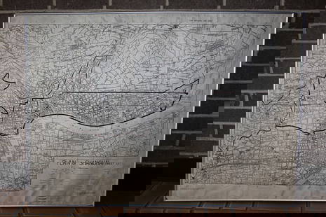
Grp: 15 Maps of France
Similar Sale History
View More Items in Maps & AtlasesRelated Maps & Atlases
More Items in Maps & Atlases
View MoreRecommended Transportation & Travel Collectibles
View More


Item Details
Description
Group of fifteen maps of France and other parts of Northern Europe. Includes Robert Sayer (1725–1794) "The Catholic Netherlands," London, 1788; Jan Jansson (1588-1664), engraved Everard Symonsz Hamersveldt (1591-1653), "La Principaute d'Orange et Comtat de Venaissin," Amsterdam, 1627; Jan Jansson (1588-1664), "L'Evesche d'Aire," Amsterdam, ca. 1647; "The Coast of Britany Between St. Malo's and Cancale Bay, where the English Army Landed June 1758," from Sylvanus Urban"The Gentleman's Magazine: and Historical Chronicle," Edward Cave, London, 1758; "La Bourgogne Divisee par Bailliages," from G. Le Rouge, "Atlas Nouveau Portatif l'usage des militaires et du voyageur..." Paris, 1748; Nicolas de Fer (1646–1720), "Les Gouvernements Generaux de l'Isle de France et ou se Trouvent les Generalitez de Paris et de Chaalons," Paris, 1705; Jacques Nicolas Bellin (1703-1772)"Carte Reduite de Golphe de Gascotne," Paris, 1757; Rigobert Bonne (1727–1794), "Carte des Gouvernements de Dauphine et de Provence avec le Comtat Venaissin et le Princ. d'Orange," Paris, Chez Lattre, 1771; Rigobert Bonne (1727–1794), "Carte Generale des Isles, dont les figures ci-dessus offrent un plus ample detail;" Rigobert Bonne (1727–1794), "Carte du Gouvernement de Champagne et Brie," Partis, Chez Lattre, 1771; Nicolas Sanson (1600-1667), "Champaigne et Brie, etc," Amsterdam, ca. 1690; S. Sanson "Les Dix-Sept Provinces des Pays Bas," Paris, Chez H. Jaillot, 1709; John Blair (d. 1782), engraved Thomas Kitchin (1718–1784), "The Kingdom of France, Divided according to its 38 Military Governments," from Blair's "Tables of Chronology;" "Comitatus Venaysciensis," and "Nova et Exactissima Descriptio nobilis provinciae Guipsuscovae in partibus Hispaniae sitae," printed on one page, G.de Jode, Antwerp, ca. 1578-1593; and "Contea di Savoja."
SKU: 03604
Condition
Please contact us for a detailed condition report. Please note that the lack of a condition statement does not imply perfect condition. Email condition@revereauctions.com with any condition questions.
Buyer's Premium
- 28%
Grp: 15 Maps of France
Estimate $400 - $600
6 bidders are watching this item.
Shipping & Pickup Options
Item located in St. Paul, MN, usSee Policy for Shipping
Payment

TOP


![[MAP]. TODESCHI, Pietro. [Nova et Acurata Totius Americae Tabula auct. G.I. Blaeu] America quarta: [MAP]. TODESCHI, Pietro. [Nova et Acurata Totius Americae Tabula auct. G.I. Blaeu] America quarta pars orbis quam plerunq, nuvum orbem appellitant primo detecta est anno 1492 a Christophoro Columbo...](https://p1.liveauctioneers.com/197/329395/177650542_1_x.jpg?height=310&quality=70&version=1715364962)


![[MAPS]. HOMANN, Johann Baptist, HOMANN HEIRS, and Georg Matthäus SEUTTER. [Composite Atlas].: [MAPS]. HOMANN, Johann Baptist (1663-1724), HOMANN HEIRS, and Georg Matthäus SEUTTER (1678-1757). [Composite Atlas]. [Nuremberg, Augsburg, and others: Homann Heirs and others, maps dated between](https://p1.liveauctioneers.com/197/329395/177650530_1_x.jpg?height=310&quality=70&version=1715364962)


