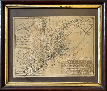
Tobias Lotter Map of New England 1776
Similar Sale History
View More Items in Maps & AtlasesRelated Maps & Atlases
More Items in Maps & Atlases
View MoreRecommended Transportation & Travel Collectibles
View More


Item Details
Description
Tobias Conrad Lotter (1717-1777), "A Map of the Most Inhabited part of New England, containing the Provinces of Massachusets Bay and New Hampshire, with the Colonies of Conecticut and Rhode Island, Divided into Counties and Townships, The whole composed from Actual Surveys and its Situation adjusted by Astronomical Observations," Augsburg, 1776. Hand colored map depicting New England. With an inset map along the upper left depicting Fort Frederick on Iroquois Lake, an inset map along the lower right depicting Boston, and a romantic illustration of the settlers at Plymouth under the title cartouche. Dimensions: Sheet; height: 43 3/4 in x width: 41 in.
SKU: 03590
Condition
Good condition, vertical and horizontal creases, 1 1/2 inch tear along one of the horizontal creases, some tears along the margin, some repaired tears throughout, and some minor soiling.
Buyer's Premium
- 28%
Tobias Lotter Map of New England 1776
Estimate $1,000 - $1,500
8 bidders are watching this item.
Shipping & Pickup Options
Item located in St. Paul, MN, usSee Policy for Shipping
Payment

TOP


![A highly detailed map of New England after the Jansson-Visscher series: [MAP-NORTH AMERICA] [MONTANUS, ARNOLDUS]. Novi Belgii Quod nune Novi Jorck vocatur, Novae Angliae & Partis](https://p1.liveauctioneers.com/292/326828/175962858_1_x.jpg?height=310&quality=70&version=1713473479)
![Jansson's important early map of New England: [MAP-NORTH AMERICA] JANSSON, JAN. Nova Belgica et Anglia Nova. Amsterdam: circa 1646. Latin text on verso. Neat lines 15 1/4 x 19 3/4 inches (38.7 x 50.5 cm). Marginal tears r](https://p1.liveauctioneers.com/292/326828/175962856_1_x.jpg?height=310&quality=70&version=1713473479)
![Three maps of the United States: [MAPS - AMERICA] A Group of three maps of the United States, including [SHAFFNER TALIAFERRO PRESTON, ] United States. [London,1862]. Hand-colored lithographed folding map from The War in Am](https://p1.liveauctioneers.com/292/326828/175962868_1_x.jpg?height=310&quality=70&version=1713473479)


![The first map of China printed in England: [MAP - CHINA] [PURCHAS, SAMUEL]. The Map of China. [Huang Ming yitong fang uy bei lan - Comprehensive view map fo the Imperial Ming.] London: circa 1625. First and only edition, from Purchas his Pilgr](https://p1.liveauctioneers.com/292/326828/175962849_1_x.jpg?height=310&quality=70&version=1713473479)


![The finest and largest map of Long Island of the period: [MAP-NEW YORK] MATHER, W.W. Geological Map of Long & Staten Islands with the Environs of New York. [New York: 1842]. Hand-colored lithographed map on two sheets joined from the topographical surve](https://p1.liveauctioneers.com/292/326828/175962867_1_x.jpg?height=310&quality=70&version=1713473479)


