


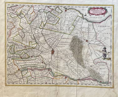
Netherlands 1747 Map of Holland, Utrecht
Similar Sale History
View More Items in Maps & Atlases


Related Maps & Atlases


![1744 ROMAN HISTORY ARMORIAL VELLUM BINDING antique w/ MAP by LUCIUS FLORUS: Lucius Annaeus Florus Epitome Rerum Romanarum Ed. C.A. Duker. Leyden, S. Luchtmans, 1744 2 parts in 1 vol. (58),858[ 874],(120),39[ 47],(1)p. Engraved frontispiece, folding map Original vellum, school](https://p1.liveauctioneers.com/5584/327967/176716972_1_x.jpg?height=310&quality=70&version=1714507672)


More Items in Maps & Atlases
View More


![[Maps] Gio. Ant. Magnini, Italia, 1620: [Maps] Gio. Ant. Magnini, Italia, 1620, Giovanni Antonio Magnini. Italia, data in luce da Fabio suo figliuolo al Serenissimo Ferdinado Gonzaga Duca di Matoua edi Monserrato etc. Bologna, for Sebastian](https://p1.liveauctioneers.com/188/326797/176317457_1_x.jpg?height=310&quality=70&version=1713847031)


Recommended Transportation & Travel Collectibles
View More


Item Details
Description
"A New & Exact Map of the Provinces of Holland, Utrecht, Gelderland, Zeeland, Dutch Flanders and Dutch Brabant" Copper Engraved Map Published 1732-85, London for "The London Magazine" Folds as issued. Paper Size: 10.5 x 8 inch (27 x 20cm) Good Condition
Buyer's Premium
- 22%
Netherlands 1747 Map of Holland, Utrecht
Estimate $30 - $40
1 bidder is watching this item.
Shipping & Pickup Options
Item located in Chesterfield, ukOffers In-House Shipping
Payment

TOP