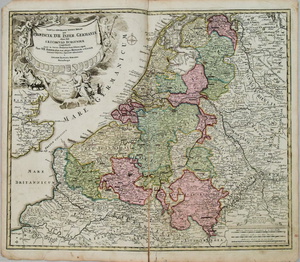
Sold20201720 c. Homann Map of Benelux -- Tabula GeneralisTitle/Content of Map: 1720 c. Homann Map of Benelux -- Tabula Generalis Totius Belgii qua Provinciae XVII. Infer. Germaniae olim sub S.R.I. Circulo BurgundiaeÂ… Cartographer: J Homann Year/Place: 1See Sold Price
Sold20191720 Homann Map of Netherlands, Belgium and LuxemburgReserve Reduced! Map Title/Content: 1720 Homann Map of Netherlands, Belgium and Luxemburg -- Tabula Generalis Totius Belgii qua Provinciae XVII. Infer. Germaniae olim sub S.R.I. Circulo Burgundiae…See Sold Price
Sold20201720 c. Homann Map of Paris and Surroundings -- AgriTitle: 1720 c. Homann Map of Paris and Surroundings -- Agri Parisiensis Tabula partieularis, qua maxima Pars Insulae Franciae, seu Regiae celeberrimaeq Parisiorum Urbis vicina Regio in fuas CastellaniSee Sold Price
Sold20201720 c. Homann Map of Central Germany's ThuringianTitle: 1720 c. Homann Map of Central Germany's Thuringian Forest Area -- Tabula Geographica in qua ... Principatus Gotha, Coburg et Altenburg Cartographer: J Homann Year/Place: 1720 c., Nurnberg DimenSee Sold Price
Sold20211720 c. Homann Map of Czech Republic, Slovakia andTitle: 1720 c. Homann Map of Czech Republic, Slovakia and Poland -- Regni Bohemiae, Ducatus Silesiae, Marchionatus Moraviae et Lusatiae. Tabula Generalis Cartographer: J Homann Year / Place: 1720 c.,See Sold Price
Sold20221720 c. Homann Map of Czech Republic, Slovakia and Poland -- Regni Bohemiae, Ducatus Silesiae,Title: 1720 c. Homann Map of Czech Republic, Slovakia and Poland -- Regni Bohemiae, Ducatus Silesiae, Marchionatus Moraviae et Lusatiae. Tabula Generalis Cartographer: J Homann Year / Place: 1720 c.,See Sold Price
Sold2016Decprative world map 1720Heading: Author: Homann, Johann Baptiste Title: Planiglobii Terrestris cum Utroq Hemisphaerio Caelesti Generalis Exhibitio Place Published: Nuremberg Publisher: Date Published: c.1720See Sold Price
Sold20201720 c. Homann Map of Poland, Lithuania to the BlackTitle/Content of Map: 1720 c. Homann Map of Poland, Lithuania to the Black Sea -- Regni Poloniae Magnique Ducatus Lithuaniae Nova et Exacta Tabula Cartographer: J Homann Year/Place: 1720 c. Nurnberg SSee Sold Price
Sold20211720 c. Homann Map of Northern Poland to Lithuania --Title: 1720 c. Homann Map of Northern Poland to Lithuania -- Regnum Borussiae Gloriosis auspicys Serenissimi et Potentissimi Princ Friderici III Cartographer: J Homann Year / Place: 1720 c., NurnbergSee Sold Price
Sold20211720 c. Homann Map of Norteast Italy, Venice IncludedTitle: 1720 c. Homann Map of Norteast Italy, Venice Included -- Dominii Veneti cum vicinis Parme Mutinae Mantuae et Mirandole Statibus Cartographer: J Homann Year / Place: 1720 c., Nurnberg Map DimensSee Sold Price
Sold20211720 c. Homann Map of Northern Poland to Lithuania --Title: 1720 c. Homann Map of Northern Poland to Lithuania -- Regnum Borussiae Gloriosis auspicys Serenissimi et Potentissimi Princ Friderici III Cartographer: J Homann Year / Place: 1720 c., NurnbergSee Sold Price
Sold20211720 c. Homann Map of Central Germany Near Fulda -- S.Title: 1720 c. Homann Map of Central Germany Near Fulda -- S. R. I. Principatus Fuldensis in Buchonia… Cartographer: J Homann Year / Place: 1720 c., Nurnberg Map Dimension (in.): 19.1 X 22.6 in. ThiSee Sold Price
Sold20201720 c. Homann Map of Belgium, Northern France andTitle/Content of Map: 1720 c. Homann Map of Belgium, Northern France and Western Germany -- Arena Martis in Belgio, Qua Provinciae X. Catholicae Inferioris Germaniae Cartographer: J Homann Year/Place:See Sold Price
Sold20221720 c. Homann Map of Denmark -- Regni Daniae, in quoTitle: 1720 c. Homann Map of Denmark -- Regni Daniae, in quo sunt Ducatus Holsatia et Slesvicum, Insulae Danicae, Provinciae Iutia Scania Blekingia &c Nova Tabula Cartographer: J Homann Year / Place:See Sold Price
Sold20211720 c. Homann Map of Luxembourg -- Ducatus LuxemburgiTitle: 1720 c. Homann Map of Luxembourg -- Ducatus Luxemburgi tam in Maiores quam Minores Ejusdem Ditiones Accurate Distinctus et Exhibitus Cartographer: J Homann Year / Place: 1720 c., Nurnberg Map DSee Sold Price
Sold20181753 Homann Map of the Low Countries: Tabula GeneralisTitle/Content of Map: 1753 Homann Map of the Low Countries: Tabula Generalis Totius Belgii qua Provinciae XVII. Infer. Germaniae olim sub S.R.I. Circulo Burgundiae… Date: 1753 Nurnberg Cartographer:See Sold Price
Sold20221716 Homann Map of the Danish Jutland Peninsula -- Tabula Generalis Iutiae, continens DioecesesTitle: 1716 Homann Map of the Danish Jutland Peninsula -- Tabula Generalis Iutiae, continens Dioeceses Quatuor, Alburgensem, Wiburgensem, Ripensem et Arhusiensem… Cartographer: J Homann Year / PSee Sold Price
Sold20241720 Tabula Geographica Homann Map of Black Sea18th Century 1720 Tabula Geographica Homann Map of Black Sea - Tabula Geographica qua pars Russiae Magnae Pontus Euxinus seu Mare Nigrum et Tartaria Minor cum finitimis Bulgariae, et Romaniae et NatolSee Sold Price
Sold20221716 Homann Map of Northern Germany with Hamburg --Title: 1716 Homann Map of Northern Germany with Hamburg -- Tabula Generalis Holsatiae Complectens Holsatiae, Dithmarsiae, Stormariae, et Vagriae Ducatus Cartographer: J Homann Year / Place: 1716, NurnSee Sold Price
Sold20181720 Homann Map of Black Sea, Southern Russia andTitle/Content of Map: 1720 Homann Map of Black Sea, Southern Russia and Ukraine -- Tabula Geographica qua pars Russiae Magnae Pontus Euxinus seu Mare Nigrum et Tartaria Minor cum finitimis Bulgariae,See Sold Price
Sold20211753 Homann Map of Spain and Portugal -- RegnorumTitle: 1753 Homann Map of Spain and Portugal -- Regnorum Hispaniae et Portugalliae, Tabula generalis de l' Isliana, aucta et ad Usum Scholarum… Cartographer: J. Homann Year / Place: 1753 Nurnberg MaSee Sold Price
Sold2017Homann Map of Spain and Portugal, 1753Map: 1753 Homann Map of Spain and Portugal -- Regnorum Hispaniae et Portugalliae, Tabula generalis de l' Isliana, aucta et ad Usum Scholarum… Cartographer: J. Homann Year / Place: 1753 Nurnberg MapSee Sold Price
Sold20231753 Homann Map of Germany, Poland, Austria -- Imperii Romano-Germanici in svos Status et CirculosTitle: 1753 Homann Map of Germany, Poland, Austria -- Imperii Romano-Germanici in svos Status et Circulos divisi Tabula Generalis in Usus Iuventutis eru diendae… Cartographer: J. Homann Year / PSee Sold Price
Sold20181753 Homann Map of Germany, Poland, Austria -- ImperiiTitle/Content of Map: 1753 Homann Map of Germany, Poland, Austria -- Imperii Romano-Germanici in svos Status et Circulos divisi Tabula Generalis in Usus Iuventutis eru diendae… Date: 1753 Nurnberg CSee Sold Price
23 hrs LeftJasper521720 antique MAP of LOWER SAXONY GERMANY 18th CENT. Circulus Saxoniae inferioris$75
24 hrs LeftJasper521720 Homann Map of the Caspian Sea Region -- Provinciarum Persicarum Kilaniae nempe Chirvaniae$220
Jun 07Freeman's | HindmanHOMANN, Johann Baptist. Amplissimae Regionis Mississipi Seu Provinciae Ludovicianae. Nuremburg, [ca$400(1 bid)
2 days LeftJasper52The gibeonites deceive Joshua - Dutch Bible Scenes - Antique Engraving (c.1720)$65
Jun 08Early American History Auctionsc 1730 Hand-Colored Colonial Era Map of the Americas, California shown as an Island, Matted + Framed$500(1 bid)
2 days LeftForum AuctionsSermons.- [Butts (Robert, Bishop of Norwich and later Bishop of Ely)] [Twelve Sermons], autograph£400
6 days LeftGold Coast Auctioneers17th-19th c. French Wall Art Collection Map City Sea Scapes Scenes etc.$50


![Sermons.- [Butts (Robert, Bishop of Norwich and later Bishop of Ely)] [Twelve Sermons], autograph (1 of 1)](https://p1.liveauctioneers.com/5458/329231/177514794_1_x.jpg?height=282&quality=70&version=1715269091)
![[MAP]. ORTELIUS, Abraham. Africae Tabula Nova. 1592. (1 of 2)](https://p1.liveauctioneers.com/197/329395/177650533_1_x.jpg?height=282&quality=70&version=1715364962)


