Sold20211747 Map Voyage of Aeneas Described by VirgilAn engraved map "The Voyage of Aeneas as Described by Virgl", printed at London by John and Paul Knapton, 1747. Fine condition, measures 13.5 x 8". Reserve: $30.00 Shipping: Domestic: Flat-rate of $10See Sold Price
Sold20221747 Engraved Map Aeneas VoyageTitle: 1747 Engraved Map Aeneas Voyage Description: "The Voyage of Aeneas as Described by Dionisius ..:, printed at London by Paul and John Knapton, 1747. Fine condition, measures 13.5 x 8". Reserve:See Sold Price
Sold2017Carte Des Voyages Jesus Christ, Map, 1747Carte des Voyages de Norte Seigneur Jesus Christ, Gilles Robert De Vaugondy (French 1688-1766). Map of the Voyages of Our Lord Jesus Christ and those of the Apostles St. Peter and St. Paul in Asia andSee Sold Price
Sold20201747 Voyages INDIA MAPS Japan China Asia Africa Ghana1747 Voyages INDIA MAPS Japan China Asia Africa Ghana Geography Prevost 7v RARE The ‘General History of Voyages’ by abbe Prevost is one of the largest and most impressive collections of stories ofSee Sold Price
Sold20181747 Voyages ATLAS MAPS Caribbean AFRICA Slavery1747 Voyages ATLAS MAPS Caribbean AFRICA Slavery Prevost Illustrated Geography The ‘General History of Voyages’ by abbe Prevost is one of the largest and most impressive collections of stories ofSee Sold Price
Sold20221747 Map of the World of JustinTitle: 1747 Map of the World of Justin Description: "A Map of the World as far as it is described by Justin", printed at London by John and Paul Knapton, 1747. Insets of Italy and Greece and detailedSee Sold Price
Sold20201747 MAP BELGIUM CATHOLICUM SEU DECEM PROVINCIAE1747 MAP BELGIUM CATHOLICUM SEU DECEM PROVINCIAE GERMANIAE INFERIORIS, IN SEE THROUGH FRAME, NICE OVERALL CONDITION, DESCRIBED AS PICTURED, MEASURES 19 1/4" X 22".See Sold Price
Sold20201747 Map of Ancient Europe Asia AfricaA Map of Europe Asia and Africa as far as they are described in Lucan's Pharsalia, published by John and Paul Knapton, London, 1747 in "Geographia Classica". 13.5" x 8" overall and map measureing 9 xSee Sold Price
Sold20211747 Map of Baetica Ancient SpainBaetica or the Southern Part of Spain as it is described by Caesar de Bello Hispanico, published by John and Paul Knapton, London, 1747 in "Geographia Classica". 13.5" x 8" overall and map measureingSee Sold Price
Sold20201747 Engraved Map of Ancient EgyptMap of Egypt as described by Herdotus, printed at London by John and Paul Knapton, 1747. Reserve: $30.00 Shipping: Domestic: Flat-rate of $5.00 to anywhere within the contiguous U.S. International: FoSee Sold Price
Sold2024Voyage a la Baye de Hudson, Fait en 1746...[Exploration] Ellis, Henry. Voyage a la Baye de Hudson, Fait en 1746 & 1747. D'Elie Luzac, Leiden, 1750. 8vo. Frontis folding map, 9 plates, xxviii, 413, [1] pp. Contemporary mottled calf. Minor rubbiSee Sold Price
Sold20171773 Gentlemans Magazine Map Voyage South Seas Cpt CookFirst printing in original blue advertising wrapper of the Supplement issue of Gentleman's Magazine for the year 1773. Bound with the General Title and Preface and 26 pages, engraved folding plate shoSee Sold Price
Sold20191780 HUGE CHINA MAP & Voyages Mandarin Chinese Theatre1780 HUGE CHINA MAP & Voyages Mandarin Chinese Theatre Military Funeral Procession The best book of its kind! A rare book La Harpe’s ‘General History of Voyages’! This extensive work was begun bSee Sold Price
Sold20231765 ATLAS MAPS & Voyages Pluche Geography Asia Arabia Greece America Egypt1765 ATLAS MAPS & Voyages Pluche Geography Asia Arabia Greece America Egypt Noël-Antoine Pluche was an early 18th-century French priest and historian who is most remembered today for his landmark wSee Sold Price
Sold2016Reinecke: Australia/ New Zealand/ Hawaii Map 1804Map: Australia/ New Zealand/ Hawaii/ South Pacific "General Charte von Australien" Publishing: Reinecke, Johann Matthias: Weimar Date: 1804 Size: 17.75 x 24 inches An uncommon map described by TooleySee Sold Price
Sold20211858 1ed David Livingstone Missionary Travels1858 1ed David Livingstone Missionary Travels Illustrated AFRICA MAPS Voyages “If you have men who will only come if they know there is a good road, I don't want them. I want men who will come if thSee Sold Price
Sold2022c1700 Blome Engraved Map Travels Voyages ApostlesFinely engraved "Mapp of the Travels and Voyages of the Apostles in their mission and in particular of St. Paul", attributed to Richard Blome (1641-1705), London. Folding map in fine condition, measurSee Sold Price
Sold20221893 1ed Jamaica at Chicago Worlds Fair Christopher Columbus Voyages MAP1893 1ed Jamaica at Chicago Worlds Fair Christopher Columbus Voyages MAP Charles Wards “Jamaica at Chicago” is a rare account of the history of Jamaica published for the Worlds Fair in 189See Sold Price
Sold2022c. 1781 Captain Cook Voyages Map, London by Alexander HoggHistoric Maps "A Plan of Success Bay in Strait Le Maire / A Chart of the S.E. part of Terra del Fuego... by Captn. Cook 1769" c. 1781, A "Dual" Map from Captain Cook's Voyages, titled: "A Plan of SuccSee Sold Price
Sold2022c. 1781 Captain Cook Voyages Map, London by Alexander HoggHistoric Maps "A Plan of Success Bay in Strait Le Maire / A Chart of the S.E. part of Terra del Fuego... by Captn. Cook 1769" c. 1781, Dual Map from Captain Cook's Voyages, titled: "A Plan of SuccessSee Sold Price
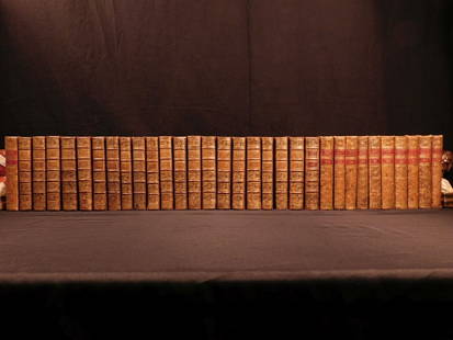
Sold20181780 1ed RARE Complete VOYAGES Maps Captain Cook Americ1780 1ed RARE Complete VOYAGES Maps Captain Cook America Explorers Africa 32v The best book of its kind! An extremely rare, 32-volume complete set of La Harpe’s ‘General History of Voyages’! ThiSee Sold Price
Sold20181780 1ed RARE Complete VOYAGES Maps Captain Cook1780 1ed RARE Complete VOYAGES Maps Captain Cook America Explorers Africa 32v The best book of its kind! An extremely rare, 32-volume complete set of La Harpe’s ‘General History of Voyages’! ThiSee Sold Price
Sold20231781 ATLAS Vaugondy 17 MAPS FAMOUS Voyages Geography Asia Africa Europe French1781 ATLAS Vaugondy 17 MAPS FAMOUS Voyages Geography Asia Africa Europe French Collectors, of both maps and atlases, agree that Vaugondy maps are among the best and most accurate maps! This collectionSee Sold Price
Sold20231781 CHINA MAPS Jesuit Voyages Missions Penghu Island Formosa ASIA Lettres Edifiantes1781 CHINA MAPS Jesuit Voyages Missions Penghu Island Formosa ASIA Lettres Edifiantes The Lettres Edifiantes et Curieuses is a collection of reports and letters from Jesuit missions from around the woSee Sold Price
Featured10 hrs LeftJasper52Suite de la Coste de Guinée'. Ghana Togo Benin coast. Whidah. BELLIN 1747 map$30
10 hrs LeftJasper52Plan du Portendic, appellé aussi…' Portendick Mauritania BELLIN/SCHLEY 1747 map$15
10 hrs LeftJasper52Coste d’Afrique…' Guinea-Bissau & Bissagos archipelago. BELLIN/SCHLEY 1747 map$25
10 hrs LeftJasper52Coste Orientale d’Afrique'. South Africa Mozambique BELLIN/SCHLEY 1747 map$25
10 hrs LeftJasper52Coste Occidentale d’Afrique'. Bay of Arguin, Mauritania. BELLIN/SCHLEY 1747 map$30
10 hrs LeftJasper52Partie de la Coste de Guinée' Sierra Leone Liberia coast BELLIN/SCHLEY 1747 map$35
10 hrs LeftJasper52Partie de la Coste de Guinée'. Sierra Leone & Liberia coast. BELLIN 1747 map$40
10 hrs LeftJasper52Carte du Golfe de Guinée'. Gulf of Guinea. Nigeria & Cameroon. BELLIN 1747 map$45
Jun 12Jasper52Carte de la Nouvelle Zéelande. New Zealand. Cook Strait. Thames. BONNE 1788 map$340
Jun 13Swann Auction Galleries(AMERICAS.) Robert Laurie; and James Whittle. A New Map of the Whole Continent of America,$450
BonhamsSPARRMAN (ANDREW) A Voyage to the Cape of Good Hope, towards the Antarctic Polar Circle, 2 vol.,...£800
BonhamsPHILLIP (ARTHUR) The Voyage of Governor Phillip to Botany Bay; with an Account of the Establishm...£900


![Voyage a la Baye de Hudson, Fait en 1746...: [Exploration] Ellis, Henry. Voyage a la Baye de Hudson, Fait en 1746 & 1747. D'Elie Luzac, Leiden, 1750. 8vo. Frontis folding map, 9 plates, xxviii, 413, [1] pp. Contemporary mottled calf. Minor rubbi](https://p1.liveauctioneers.com/179/322586/173446567_1_x.jpg?height=310&quality=70&version=1710359761)