Sold20191834 Map of the route passed over by an expedition intoThis highly detailed map depicts the territory of the region between the Red River and Lake Superior within present day Minnesota. The map is centered on the course of the Missisippi River above LakeSee Sold Price
Sold2018WERNE, Ferdinand (1800-1874). Expedition to discoverWERNE, Ferdinand (1800-1874). Expedition to discover the sources of the White Nile, in the years 1840, 1841. London: Richard Bentley, 1849. 2 volumes, 8vo (201 x 118 mm). Folding route map, lithographSee Sold Price
Sold20231861. South America with routes of expeditions. By Johnson and Browning $100Title: 1861. South America with routes of expeditions. By Johnson and Browning $100 Date/Period: 1861 Materials: Steel engraved Size: 26 x 18” Fascinating maps shows the routes of many explorersSee Sold Price
Sold2022Alaska Map, 1898 [155038]1898 Alaska route of military expedition in charge of Captain EF Glenn, from Knik Arm to Tanana River. 31x12".Date: Country (if not USA): State: AlaskaCity: Provenance:See Sold Price
Sold2022Rare 1836 Col. Dodge Expedition map - 1st printing, SteenLarge and important early copper engraved map of the western U. S. showing the route of Col. Henry Dodge’s 1835 Expedition from Fort Leavenworth to the Rocky Mountains. Rare first printing withSee Sold Price
Sold2024Early handbook for overland expedition 1859Heading: Author: Marcy, Randolph B. Title: The Prairie Traveler. A Hand-Book for Overland Expeditions. With Maps Illustrations, and Itineraries of the Principal Routes Between the Mississippi and theSee Sold Price
Sold20221834 Map of the Cumberland River TennesseeMap of the Cumberland River from the Falls to Nashville / Made to accompany a Report on the Improvements of that Stream for the navigation of it by Steam Boats; in obedience to a Resolution of CongresSee Sold Price
Sold20231950s Pan Am World Route Maps -- Route Maps Pan AmericanTitle: 1950s Pan Am World Route Maps -- Route Maps Pan American Cartographer: PanAm Year / Place: late 1950s c. Map Dimension (in.): 9 x 12 in. single page This is an outstanding 6 double page fold-ouSee Sold Price
Sold20241951 Chicago, Milwaukee, St. Paul & Pacific Railroad Wall Map - Route of the HiawathasA large polychrome wall map for The Milwaukee Road dated 4-9-1951 by Poole Brothers measuring approximately 62" across. The left shows moderate tears along the left edge. Discoloration across the topSee Sold Price
Sold20201834 Map of EgyptAuthor: Black Title: 1834 Map of Egypt Medium: Ink on Paper Dimensions: 12"X17" Map of Egypt dated 1834. Published by A.C. Black in Edinburgh. Nice map with elaborate borders. Lower left inset of theSee Sold Price
Sold20231747 Engraved Map Expedition of HannibalEngraved map "The Expedition of Hannibal General of the Carthaginians acconding to Livy and Cornelius Nepos", printed at London for John and Paul Knapton, MDCCXLVII (1747). Fine, measures 9.25 x 6.25"See Sold Price
Sold2019d'Urville, Dumont 1834 Map of the World"Carte General du Voyage Pittoresque autour du Monde" Steel Engraved Map Published 1834 by Chez Furne et Ce, Paris for "Voyage pittoresque autour du Monde - Résumé général des voyages de découverSee Sold Price
Sold2022Tombleson, William 1834 Map of the River Rhine"Tombleson's Upper Rhine" Showing Germany and Switzerland. Steel Engraved Map Published 1832-34, London for "Tombleson's Upper Rhine" Edited by William Gray Fearnside. Illustrated by William TomblesonSee Sold Price
Sold2022d'Urville, Jules 1834 Map of Tonga, Pacific"Carte des Iles Tonga" Steel Engraved Map Published 1834 by Chez Furne et Ce, Paris for "Voyage pittoresque autour du Monde - Résumé général des voyages de découvertes..." By Jules Dumont d'UrvilSee Sold Price
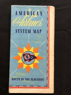
Sold2018American Airlines System Map Route Of The Flagships 194American Airlines System Map Route Of The Flagships 1946See Sold Price
2018Pair of 19th c. Railroad Maps, Routes, SchedulesIncluding: ** WEST SHORE ROUTE. NEW YORK, WEST SHORE, & BUFFALO…. March, 1885. On light pink paper, some panels faded, Very Good. ** THE NORTH-WESTERN LINE… DIRECT CONNECTION TO AND FROM ALL POINTSee Sold Price
Sold20191868 Dussieux World Map Routes of Explorers and HumanTitle/Content of Map: 1868 Dussieux World Map Routes of Explorers and Human Races -- Races Humanies Carte des Voyages et des DecouvertesÂ… Date: 1968, Paris Cartographer: L Dussieux Size: 11.5 X 17See Sold Price
Sold2020c 1920 s TRAVEL MAP ROUTES to YOSEMITE NATIONAL PARK byc 1920 s TRAVEL MAP ROUTES to YOSEMITE NATIONAL PARK by CALIFORNIA AUTO ASSOC. Vintage Circa 1920s Travel Map and Guide; "ROUTES to YOSEMITE NATIONAL PARK". Copyright by California State Automobile AsSee Sold Price
Sold20181834 Antique Map of the Falls of Ohio at LouisvilleTitle/Content of Map: 1834 Map of the Falls of Ohio at Louisville -- Plan for a Canal / Falls of Ohio (at Louisville) Date Printed: 1834, Washington DC Cartographer: American State Papers Size: 19.5 XSee Sold Price
Sold20221895 Hudson River NY - Harper & Bros Bicycle Road Map1895 Harper & Brothers advertising bicycle map. Route travels along the Hudson River, from below 181st Street to Sleepy Hollow just above Tarrytown New York. Bicycle Road Maps in Harper's Round TableSee Sold Price
Sold2020Map of NYC by H. Tanner, 1834Scarce map from "Tanner's American Traveller, or Guide Through the United States" by H. S. Tanner, circa 1834. Map is matted. Frame of map has tiny bit of light offsetting. Small chip at right edge. NSee Sold Price
Sold2022HAJJ CARAVAN ROUTES. Marrakech & Tetuan-Mecca (مكة) ‎ & Medina. MALLET 1683TITLE OF THE MAP: 'Route Maritime de Tetuan a la Mecque; Route de la Caravane de Maroc a Quibriche; Route de la Caravane de Quibriche a la Mecque' (De L'Afrique) Shows the caravan routes taken acrossSee Sold Price
Sold2022WWII 1945 87th Infantry Division Framed Battle Operations MapWWII 1945 87th Infantry Division Framed Battle Operations Map. Route of the Golden Acorn Division: France, Luxembourg, Belgium, Germany, and Czechoslovakia. Approximate size is 19 x 29 inches. NicelySee Sold Price
Sold2021North AmericaTitle: North America Artist: SDUK Medium: Engraving Dimensions: 14 1/8 x 12 1/2 Description: 1834 map of the United States by the Society for the Diffusion of Useful Knowledge Reserve: $50.00 ShippingSee Sold Price
Jun 23Schilb Antiquarian Rare Books1890 Livingstone 1ed In Darkest Africa Henry Stanley Emin Pasha Expedition MAP$26(5 bids)
Jun 20The Ross Art GroupOriginal Vintage Air France World Route Map Vickers Viscount Poster 1956 Constellation$600
Jun 29JM Hobby Supply and Railroad Artifact AuctionsFlorence & Cripple Creek RR Public Timetable-September 1894$400
2 days LeftRapid Estate Liquidators and Auction GalleryUS Post Lewis And Clark First Day Stamp Sheet Bundle$50
3 days LeftJasper521723 Dampier Map of Voyages to Brazil, Australia and Eat Indies -- Voyage du Cap. Dampier a la N.$280
Jun 07Freeman's | Hindman[MORMONS]. MILLROY & HAYES (fl. 1899). Route of the Mormon Pioneers from Nauvoo to Great Salt Lake,$300
5 days LeftThe Bidder AuctionsThe map of the railways in the Land of Israel - published by the Surveying Department of the British$30
4 days LeftJasper52Amér. Sep. Partie de l'Amérique Russe #14 Colombia profile VANDERMAELEN 1827 map$55
5 days LeftJulien's AuctionsAC/DC | Bon Scott Australian "Gold" Record Award for "Let There Be Rock"$700(1 bid)
Jun 23Schilb Antiquarian Rare Books1860 Voyages of Jonathan Carver INDIANS North America Mississippi Natchez Tours$1
3 days LeftJasper521895 AN ARTIST IN THE HIMALAYAS by A.McCORMICK illustrated antique TRAVEL$120(1 bid)
Jun 08Leon GalleryJodocus Hondius 1606 (Jodocus Hondius and Cornelis Claesz) - India Orientalis₱40,000


![Alaska Map, 1898 [155038]: 1898 Alaska route of military expedition in charge of Captain EF Glenn, from Knik Arm to Tanana River. 31x12".Date: Country (if not USA): State: AlaskaCity: Provenance:](https://p1.liveauctioneers.com/2699/258185/134287533_1_x.jpg?height=310&quality=70&version=1660347389)


![[MORMONS]. MILLROY & HAYES (fl. 1899). Route of the Mormon Pioneers from Nauvoo to Great Salt Lake, (1 of 2)](https://p1.liveauctioneers.com/197/329395/177650560_1_x.jpg?height=282&quality=70&version=1715364962)


![[The Thames] Tombleson (1 of 1)](https://p1.liveauctioneers.com/94/330664/178342457_1_x.jpg?height=282&quality=70&version=1716466933)

