Sold20171855 map of Virginia by G. W. ColtonItem: 1855 map of Virginia by G. W. Colton Description: Great hand color and clean. Virginia before West Virginia became a separate state. Insets of Richmond and Norfolk. From the 1856 edition of ColtSee Sold Price
Sold2017Map of West Virginia coal field 1867Heading: Author: Swann, John S. Title: Title Map of the Coal Field of the Great Kanawha Valley, West Virginia, United States of America Place Published: New York Publisher:G.W. Colton & C.B. Colton &See Sold Price
Sold20202 antique framed Southern maps2 antique framed maps: Map of South Carolina in German dated 1845. Map of Savannah and Charleston published by G.W and C.B Colton & Co and dated 1855. Overall size measures 25 1/2"h x 28"w and the papSee Sold Price
Sold20191856 Map of Germany No.1 Colton Germany No. 1. (with) two inset maps: Hamburg and Bremen. Published By J.H. Colton & Co. No. 172 William St. New York. Entered ... 1855 by J.H. Colton & Co. ... New York. No. 12. Author: GW ColtoSee Sold Price
Sold20191861 & 1855 Maps of Boston(1) 1861 map by W. C. Sharp, Boston. Advertising to reverse. Fold crease separations, some with tape repairs. 10 1/2" x 11 1/4" approx. (2) 1855 map engraved by G. W. Boynton. Very good condition; ageSee Sold Price
Sold20201855 Colton Map of Virginia -- VirginiaTitle/Content of Map: 1855 Colton Map of Virginia -- Virginia Cartographer: J Colton Year/Place: 1855, New York Size: 12.7 X 15.8 in. This is a very nice map of Virginia, prior to formation of West ViSee Sold Price
Sold20211855 Colton Map of Virginia -- VirginiaTitle: 1855 Colton Map of Virginia -- Virginia Cartographer: J Colton Year / Place: 1855, New York Map Dimension (in.): 11.8 X 16 in. This is a very nice map of Virginia, prior to formation of West ViSee Sold Price
Sold2021Colton Railroad and County Map United States 1878Colton, after G. W., Colton's Railroad and County Map of the United States, The Canadas, &c, 1878, antique map on paper, folded as originally issued, 33 x 42 inches, in a wood frame 36.5 x 47.5 inchesSee Sold Price
Sold20231859 Map of Florida by ColtonTitle: 1859 Map of Florida by Colton1859 Materials: Steel engraved Size: 17 1/2 x 14 1/2” Florida with Florida keys in the insert. From before the civil war. By J. H. Colton & G. W. Colton. From "GeSee Sold Price
Sold20231859 Map of Illinois, with Chicago, insert by ColtonTitle: 1859 Map of Illinois, with Chicago, insert by Colton Date/Period: 1859 Materials: Steel engraved Size: 17 1/2 x 14 1/2” Illinois with an insert of Chicago. By J. H. Colton & G. W. Colton.See Sold Price
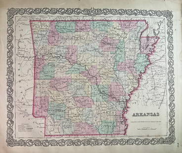
Sold20231859 Map of Arkansas by ColtonTitle: 1859 Map of Arkansas by Colton Date/Period: 1859 Materials: Steel engravedSize: 17 1/2 x 14 1/2” Arkansas. From before the civil war. By J. H. Colton & G. W. Colton. From "General Atlas".See Sold Price
Sold2023Map of 1859 Prussia and Saxony by ColtonTitle: Map of 1859 Prussia and Saxony by Colton Date/Period: 1859 Materials: Steel engraved Size: 17 1/2 x 14 1/2” Prussia and Saxony. 1859. By J. H. Colton & G. W. Colton. From "General Atlas".See Sold Price
Sold20231859 Map of England and Wales by ColtonTitle: 1859 Map of England and Wales by Colton Date/Period: 1859 Materials: Steel engraved Size: 17 1/2 x 14 1/2” England & Wales. By J. H. Colton & G. W. Colton. From "General Atlas". PublishedSee Sold Price
Sold20231859 Map of New Jersey by ColtonTitle: 1859 Map of New Jersey by Colton Date/Period: 1859 Materials: Steel engraved Size: 17 1/2 x 14 1/2” New Jersey. By J. H. Colton & G. W. Colton. From "General Atlas". Published in New YorkSee Sold Price
Sold2023Map of 1859 Switzerland by ColtonTitle: Map of 1859 Switzerland by Colton Date/Period: 1859 Materials: Steel engraved Size: 17 1/2 x 14 1/2” Switzerland. 1859. By J. H. Colton & G. W. Colton. From "General Atlas". Published inSee Sold Price
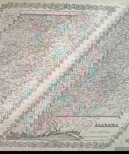
Sold20231859 Map of Alabama by ColtonTitle: 1859 Map of Alabama by Colton Date/Period: 1859 Materials: Steel engravedSize: 17 1/2 x 14 1/2” Alabama. From before the civil war. By J. H. Colton & G. W. Colton. From "General Atlas". PSee Sold Price
Sold20241859 Map of Netherlands & Belgium by ColtonTitle: 1859 Map of Netherlands & Belgium by Colton Date/Period: 1859 Materials: Steel engraved Size: 17 1/2 x 14 1/2” Netherlands & Belgium. 1859. By J. H. Colton & G. W. Colton. From "General ASee Sold Price
Sold2017Old Map of 1873 "Colton's Dakota"Old Map entitled "Colton's Dakota". Purchased by the consignor as "an original hand colored tinted map from circa 1873". Published by G.W. (and) C.B. Colton & Co. No. 172 William St. New York. At bottSee Sold Price
Sold2017Colton MAP OF THE STATE OF MISSISSIPPI 1867 EngravedDetails: COLTON, George W. (1827-1901) & Charles B. (1832-1916). Colton's Map of the State of Mississippi. New York: G.W. & C.B. Colton & Co., 1867. Engraved folding pocket map, full contemporary hanSee Sold Price
Sold2022Three Maps, Isle of Wight, East Indies, RussianComprising, Colton's East Indies, published by G.W., C.B. Colton & Co., Jeremiah Greenleaf's map of the Russian Empire, and J. Watt's map of Isle of Wight. Overall: 22-1/4"h x 25-1/2"w, 19"h x 21-3/4"See Sold Price
Sold20221890 Township Map of the State of Maine.Published by G.W. & C.B. Colton, New York, 37 x 30.5 inches, sight. Beautifully framed, 45 x 39 inches.See Sold Price
Sold2018Colton's Map of the United States of AmericaReserve Reduced! Title/Content of Map: Colton's Map of the United States of America Date: 1876 Cartographer: COLTON, G.W & C.B. Publisher: G.W. & C.B. COLTON & CO. Size: 14.5 x 26 inches Double folioSee Sold Price
Sold2023PROPOSED RICHMOND AND LOUISVILLE RAILROAD MAPPROPOSED RICHMOND AND LOUISVILLE RAILROAD MAP,laid to linen,engraved, printed, and manufactured by "G.W. & C.B. COLTON & CO. / No. 182 William St. New York".1882.55" L (rolled). Provenance: From the eSee Sold Price
Jun 13Swann Auction Galleries(NEW YORK CITY.) G.W. Colton; and J.M. Atwood. Map of the Country Thirty Three Miles Around the City$600
3 days LeftHolabird Western Americana CollectionsCalifornia Map by Colton in Frame, 1855 [180767]$150(1 bid)
4 days LeftConnoisseur AuctionsRare 19thc Colton Map, Argentine Republic, Chile, Uruguay, Pataguay$50
3 days LeftHolabird Western Americana CollectionsPyramid Lake Print Pair & 1885 NM & UT Territory Map [179398]$150
BonhamsCORRY (JOSEPH) Observations Upon the Windward Coast of Africa, the Religion, Customs, &C. of the...£400
2 days LeftFreeman's | HindmanBROWNING, Robert (1812-1889). Men and Women. London: Chapman and Hall, 1855.$200(1 bid)
BonhamsMajor G. Carmichael Smyth, A History of the Reigning Family of Lahore W. Thacker & Co., Calcutta...£1,200
3 days LeftMynt Auctions2 V 1855 LEATHER BIND BOOKS BY J. LANGHORNE & W. LANGHORNE "PLUTARCHS LIVES"$10(1 bid)
1 day LeftJasper52Africa inc. discoveries of Livingstone Barth Vogel Chadda Exp. SWANSTON 1860 map$120
354 Lots AwayMynt Auctions2 V 1855 LEATHER BIND BOOKS BY J. LANGHORNE & W. LANGHORNE "PLUTARCHS LIVES"$10(1 bid)


![California Map by Colton in Frame, 1855 [180767] (1 of 3)](https://p1.liveauctioneers.com/2699/331495/178785753_1_x.jpg?height=282&quality=70&version=1717094933)

![[The Thames] Tombleson (1 of 1)](https://p1.liveauctioneers.com/94/330664/178342457_1_x.jpg?height=282&quality=70&version=1716466933)


![Pyramid Lake Print Pair & 1885 NM & UT Territory Map [179398] (1 of 2)](https://p1.liveauctioneers.com/2699/331495/178785761_1_x.jpg?height=282&quality=70&version=1717094933)


