Sold20201888 Map of the USAuthor: Cram Title: 1888 Map of the US Materials: Ink on Paper/Glass/Wood Dimensions: 29"X22" Description: Map of the United States dated 1888. Published and engraved by George Cram in Chicago. DoubleSee Sold Price
Sold20201888 US MapTitle: 1888 US Map Author: Cram Medium: Ink on Paper Dimensions: 18"X16" Map of the US dated 1888. Map captures the territorial growth of the country between 1776 and 1886. Lower left vignette captureSee Sold Price
Sold20201888 US & Territories mapAlso includes part of the west India islands. Scale of statue miles 40-1in. Dated Dec 31 1888 by the General land office. Overall size 82" wide X 64" high. Some losses. Brittle.See Sold Price
Sold20231888 Pocket Map1888 Pocket Map, paper on cloth, "Topography New Jersey Princeton Quadrangle" U.S. geological survey, Charles and George Otis Smith, Directors, map folds into a book form. CONDITION: Separations of maSee Sold Price
Sold2017USCGS: Antique Survey Map of Longitude Stations, 1889'U.S. Coast and Geodetic survey map showing longitude stations and connections determined by means of the electric telegraph between 1846 and June 30, 1888' Date Printed: 1889 Image Size: Approx 40.0See Sold Price
Sold20221888 US Geological Survey Report1888 Powell "Seventh Annual Report of the United States Geological Survey to the Secretary of the Interior 1885-86"; Washington Government Printing Office, fold out maps and diagrams; back pocket withSee Sold Price
Sold20151845 MITCHELL'S REFERENCE & DISTANCE WALL MAP U.S.SHOWING MITCHELL'S 1845 REFERENCE AND DISTANCE WALL MAP OF THE UNITED STATES WITH GENERAL MAP OF THE US WITH CONTIGUOUS BRITISH AND MEXICAN POSSESSIONS.PHILADELPHIA : S. AUGUSTUS MITCHELL COPPER-ENGRASee Sold Price
Sold2022AJ Nystrom 2-Sided Chalkboard School Map, US & WorldLarge AJ Nystrom Roll Up 2 Sided Chalkboard Classroom Map Chart, US & World. Wonderful chart has maps of the United States and the World outlined in yellow on a black chalkboard backing. From the RoyaSee Sold Price
Sold2020AN ANTIQUE SURVEY MAP, "U.S. Coast Survey: PreliminaryAN ANTIQUE SURVEY MAP, "U.S. Coast Survey: Preliminary Sketch of Galveston Bay, Texas," SECOND EDITION, CIRCA 1852, lithograph on paper, map "I, No. 2," A.D. Bache, Superintendent, "Verified by I.I.See Sold Price
Sold20231888 US History Washington American Revolution BEAUTIFUL Leather Set1888 US History Washington American Revolution BEAUTIFUL Leather Set A rare and beautiful printing of Harpers Popular Cyclopaedia of United States History. Written by Benson John Lossing, this two-volSee Sold Price
Sold2024ASSORTED MAPS US, ARABIA, EGYPT, & ETCLarge assembled 19th hand colored maps. Various countries. 1) Early 19th century folding map titled ARABIA, EGYPT, ABYSSINIA, RED SEA & Co. Published in 1817. Large map of Arabia andadjacent countriesSee Sold Price
Sold2023Limoges World Map, US Navy Plane, & Bon Voyage Cruise Ship Set of Miniature Porcelain CollectablesA delightful set of miniature porcelain collectable boxes by Limoges - featuring a world map, a US Navy plane, and a bon voyage cruise ship with a bottle of champagne inside. Each one is artfully handSee Sold Price
Sold20191899 Jones Map U.S. Indian Reservations"Map showing Indian Reservations within the limits of the United States compiled under the direction of the Hon. W. A. Jones Commissioner of Indian Affairs 1899". Includes inset maps of Alaska, CalifoSee Sold Price
Sold2023Rare 19thc Census Map, U.S. Agricultural ProductionExtremely rare, original 1876 atlas map of the United States Agriculture Production - five agricultural maps (in inset form) of the production of wheat, hay, corn, cotton and tobacco. Each map distingSee Sold Price
Sold20161888 US Silver Dollar Mounted Sterling Bowl2.8 troy ounces. Diameter - 4 inches.See Sold Price
Sold2022Three Antique Hawaiian Maps, US Government3 1920s Hawaiian Maps. Island Of Oahu Map Approximately 47.1875 x 36.5 in. Hawaiian Islands Approximately 45.875 x 35.125 in. Hawaii To Oahu Approximately 46.4375 x 35.5625 in.See Sold Price
Sold20235 Uncut World War II Map US Postal StampsThis lot contains 5 uncut sheets of 20 29-cent stamps that are part of the "50th Anniversary WWII" stamps that were released from 1991 to 1995. Each stamp has a different image of key events that happSee Sold Price
Sold20201888 Map of ParisAuthor: Cram Title: 1888 Map of Paris Medium: Ink on Paper Dimensions: 22"X14.5" Double folio Map of Paris dated 1888. Engraved and published by George Cram in Chicago. Cram is considered one of the bSee Sold Price
Sold20201888 Map of the Indian NationsAuthor: Clare Title: 1888 Map of the Indian Nations Medium: Ink on Paper Dimensions: 14.5"X11.5" Map dated 1888 part of Watson's General Atlas. Engraved by I.S. Clare it captures the Indian Nations teSee Sold Price
Sold20221888 US Morgan Silver Dollar Clip & Buffalo Round1888 US Morgan Silver Dollar insetred into Money Clip and Uncirculated 1 troy oz. .999 Silver Buffalo Round by Golden State Mint.See Sold Price
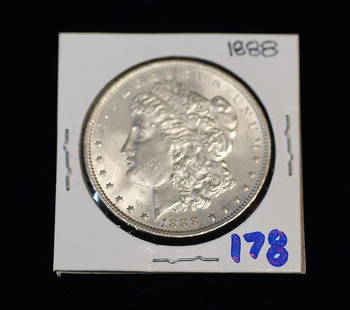
Sold20181888 US Silver Morgan Dollar(If you are bidding on coins, credit card payments are not accepted. Cashier’s checks, MO, cash, wire-transfers only.)See Sold Price
7 days LeftJasper521880 Map of US Wheat Farming -- Map of the United States Showing the Distribution of Production of$45
7 days LeftJasper521880 Map of US Tobacco Production by Type of Tobacco -- Map of the United States Showing the Regions$45
Jun 12Richard L. Edwards AuctioneeringWhitman Statehood Quarters Map w/ D.C & U.S. Territories- 55 Coins$1
Jun 23East Coast Fine Arts LLC1777 US Revolutionary War Map French Brion de la Tour Theatre de Guerre$1,000


![Western US Map, 1857 [181625] (1 of 3)](https://p1.liveauctioneers.com/2699/331495/178785798_1_x.jpg?height=282&quality=70&version=1717094933)


![[3] [1888, 1943-S, 1945-S] Varied US Coinage (1 of 2)](https://p1.liveauctioneers.com/7261/327268/178018408_1_x.jpg?height=282&quality=70&version=1717183570)


![1885 Cram Map of New Mexico [verso] Arizona -- New Mexico [verso] Arizona (1 of 2)](https://p1.liveauctioneers.com/5584/331526/178834526_1_x.jpg?height=282&quality=70&version=1717530687)


