Sold20231889 Cram Map of Pennsylvania -- PennsylvaniaTitle: 1889 Cram Map of Pennsylvania -- Pennsylvania Cartographer: G Cram Year / Place: 1889 c., Chicago Map Dimension (in.): 16.2 X 22.4 in. This is a very nice double-page map of Pennsylvania. PlentSee Sold Price
Sold2017Cram's Map of Pennsylvania, 1883Map: Pennsylvania Maker: George F. Cram Date: 1883 21.75 x 14.5 in Please note that this lot has a confidential reserve. When you leave a bid in advance of the auction, submit your maximum. Jasper52 wSee Sold Price
Sold2024George F. Cram - Historical Map of Pittsburgh Allegheny PennsylvaniaHistorical Map of Pittsburgh Allegheny Pennsylvania - Cram 1892.Size: 54 cm x 33 cmSee Sold Price
Sold2024Crams Township and Railroad Map of Pennsylvania-1898This is a Crams Township and Railroad Map of Pennsylvania dated 1898. Booklet contains an excellent multi-paneled fold-out map of the state of Pennsylvania that shows and lists all railroads in the stSee Sold Price
Sold20161930s Crams Superior Pennsylvania School Wall MapDESCRIPTION: George Cram Markable-Washable Superior Pennsylvania school wall map. With census, regions, and population information at bottom. Printed by George Cram Co. Indianapolis, Indiana. MEASUREMSee Sold Price
Sold2023(48) Geological Survey Topographic Maps of Pennsylvania(48) Geological Survey Topographic Maps of Pennsylvania Each is 22îL x 37îH.See Sold Price
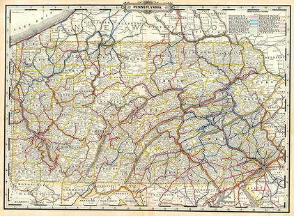
Sold2020Large Map of PennsylvaniaMap of Pennsylvania With map of New Jersey [and] Maryland Delaware and Baltimore County on versos Cartographer: George Franklin Cram Dated: Circa 1900See Sold Price
Sold2018DESCRIPTIVE REVIEW SHOWING DEVELOPMENT OF THE STATE OFDESCRIPTIVE REVIEW SHOWING DEVELOPMENT OF THE STATE OF PENNSYLVANIA c1914 Oversized Folio Color Maps George F Cram Keystone State Index Populations Historical Industrial Commercial Agricultural ReviewSee Sold Price
Sold20239 1889 Franklin & Roe Harrisburg BlueprintsBlueprints includes (1) Map of 7th & 8th wards. Includes Sunshine Park & Allison Hill areas; Harrisburg Cemetery; Pennsylvania State Arsenal; and more. Streets include Reily St.; Walnut St.; PennsylvaSee Sold Price
Sold2023Pennsylvania.Publication Date: 1889 Title: Pennsylvania. Cartographer: CRAM, GEORGE F. Publisher: GEO. F. CRAM Height: 16 Width: 22.30 Detailed map with railroad routes in colors. Letterpress on reverse. OrnamentaSee Sold Price
Sold20211889 Cram Map of Ohio -- Railroad and County Map ofTitle: 1889 Cram Map of Ohio -- Railroad and County Map of Ohio Cartographer: G Cram Year / Place: 1889 c., Chicago Map Dimension (in.): 16.2 X 22.2 in. This is a very nice double-page map of Ohio. ThSee Sold Price
Sold20191889 Cram Map of New Orleans and Atlanta -- New OrleansReserve Reduced! Title/Content of Map: 1889 Cram Map of New Orleans and Atlanta -- New Orleans [verso] Atlanta Date: 1889, Cicago Cartographer: G Cram Size: 11.2 x 9.3 in. A very nice and detailed mapSee Sold Price
Sold2017Cram: Antique Map of New Orleans, 1889Map: 1889 Cram's Map of New Orleans verso Map of San Francisco -- New Orleans verso San Francisco Cartographer: G Cram / People's Publishing Co. Year / Place: 1889, New York Map Dimensions: 11.3 X 9.4See Sold Price
Sold20231855 Colton Map of Pennsylvania -- PennsylvaniaTitle: 1855 Colton Map of Pennsylvania -- Pennsylvania Cartographer: J Colton Year / Place: 1855, New York Map Dimension (in.): 11.8 X 15.1 in. This is a very nice map of Pennsylvania. Great deal of dSee Sold Price
Sold20201855 Colton Map of Pennsylvania -- PennsylvaniaTitle: 1855 Colton Map of Pennsylvania -- Pennsylvania Date: 1855, New York Cartographer: J Colton Size: 11.8 X 15.1 in. Additional Information: This is a very nice map of Pennsylvania. Great deal ofSee Sold Price
Sold20221918 Road Map of Pennsylvania -- PennsylvaniaTitle: 1918 Road Map of Pennsylvania -- Pennsylvania Cartographer: Geographical Publishing Co. Date/Place: 1918, Chicago Dimensions: 16.6 X 26.9 in. Description: This is an excellent early road focuseSee Sold Price
Sold20221883 Hardesty Map of Pennsylvania -- Map of PennsylvaniaTitle: 1883 Hardesty Map of Pennsylvania -- Map of Pennsylvania Cartographer: H Hardesty Year / Place: 1883, Chicago Map Dimension (in.): 12.8 X 19.4 in. This is an excellent map of Pennsylvania. GreaSee Sold Price
Sold2022PRINT OF ANTIQUE MAP OF PENNSYLVANIAPRINT OF ANTIQUE MAP OF PENNSYLVANIA See how Pennsylvania and its cities, counties, townships have evolved since this map was created. 25 1/2" X 21&quSee Sold Price
Sold2017Cram: Map of Detroit, 1889Map of Detroit. Cram, George Franklin. Cram's Unrivaled Atlas of the World. This plate: Detroit, with Toledo on the verso. Chicago, 1889. Original lithograph printed in color. Sheet size: 11 x 14 1/2See Sold Price
Sold2017Cram: Map of Indian Territory, 1889An original map published in 1889 depicting the Indian Reservations in what is now the state of Oklahoma. 9.5 x 12" Please note that this lot has a reserve. When you leave a bid in advance of the auctSee Sold Price
Sold20181864 Johnson Map of Pennsylvania and New Jersey --Title/Content of Map: 1864 Johnson Map of Pennsylvania and New Jersey -- Johnson's Pennsylvania and New Jersey Date: 1864, New York Cartographer: Johnson & Ward Size: 17.1 x 23.2 in. A nice, double paSee Sold Price
Sold2021Pair of 19th century maps of PennsylvaniaPair of 19th century maps of Pennsylvania: North America Sheet VII, Pennsylvania, New Jersey... And Part of Virginia, c.1833, hand colored, 16 x 14 inches //AND// Map of Pennsylvania Prepared ExpresslSee Sold Price
Sold20241875 Walling and Gray Pennsylvania County Maps -- Atlas of Pennsylvania Counties of Chester,Title: 1875 Walling and Gray Pennsylvania County Maps -- Atlas of Pennsylvania Counties of Chester, Dauphin, Berks, Lebanon, York and Lancaster [with] Cumberland Fraklin and Adams Cartographer: WallinSee Sold Price
Sold20171855 Barnes's Map of Pennsylvania. A new county m1855 Barnes's Map of Pennsylvania. A new county map of Pennsylvania and adjoining states. Showing Central and other railroads.-- Dimensions: H: 26 inches: W: 37.5 inches ---See Sold Price
Jun 08Early American History Auctions1891 TEN-Letter Archive Regarding James T. Mitchell's Collection of Rare George Washington Portraits$500
Featured10 hrs LeftJasper521867 Beers Map of New York City Area -- Map of New York and Vicinity Accompanying "Atlas of New York$200
Jun 08Simpson Galleries, LLC.J.H. Young (1792-1870) AN AMERICAN FEDERAL PERIOD MAP, "Mitchell's Travellers Guide Through the$500
9 hrs LeftJasper521822 MAP of BRAZIL GEOGRAPHICAL STATISTICAL HISTORICAL # 48 antique 17.5 x 21.5"$75
9 hrs LeftJasper521823 MAP of WINDWARD ISLAND GEOGRAPHICAL STATISTICAL HISTORICAL antique 17.5x 22$75
Featured5 days LeftGold Coast AuctioneersFranklin B. De Haven ( America 1856-1934) Tonalist Landscape Oil$175(3 bids)
1 day LeftJasper52SOUTHERN MEXICO & CENTRAL AMERICA. Lighthouses. Key West Yucatan. LETTS 1889 map$10


![Large Map of Pennsylvania: Map of Pennsylvania With map of New Jersey [and] Maryland Delaware and Baltimore County on versos Cartographer: George Franklin Cram Dated: Circa 1900](https://p1.liveauctioneers.com/5614/183569/92295179_1_x.jpg?height=310&quality=70&version=1603822607)


![1889 Cram Map of New Orleans and Atlanta -- New Orleans: Reserve Reduced! Title/Content of Map: 1889 Cram Map of New Orleans and Atlanta -- New Orleans [verso] Atlanta Date: 1889, Cicago Cartographer: G Cram Size: 11.2 x 9.3 in. A very nice and detailed map](https://p1.liveauctioneers.com/5584/136495/69275192_1_x.jpg?height=310&quality=70&version=1550614831)


![1875 Walling and Gray Pennsylvania County Maps -- Atlas of Pennsylvania Counties of Chester,: Title: 1875 Walling and Gray Pennsylvania County Maps -- Atlas of Pennsylvania Counties of Chester, Dauphin, Berks, Lebanon, York and Lancaster [with] Cumberland Fraklin and Adams Cartographer: Wallin](https://p1.liveauctioneers.com/5584/319185/171438575_1_x.jpg?height=310&quality=70&version=1707858212)


