Sold2019(2) 18TH C. MAPSNetherlands. Dimensions: (Frame) H 32.25" x W 36", (Sight) H 22.5" x W 27" Condition: Wear consistent with age and handling. Toning, marks, and creases.See Sold Price
Sold20242 18th C. Road Maps: London to Carlisle (14 1/2" x 17 1/2") & Bristol to Exeter, 6 1/2"2 18th C. Road Maps: London to Carlisle (14 1/2" x 17 1/2") & Bristol to Exeter, 6 1/2"See Sold Price
Sold2022(2) 18th c. road maps, London-Norwich, etc.Two hand colored maps of roads from London to Norwich, England, and from Shrewsbury to Holywell, England. A printed description in an attached envelope on the back of one states that they were made bySee Sold Price
Sold20222 Framed 18th C. Faden Maps - Greece & Denmark**Originally Listed At $200** Cartographer: William Faden (British, 1749-1836). Engraver: William Palmer (British, 1735-1812). "Graecie Antiquae et Aegaei Maris Tabula" Published by William Faden JanuSee Sold Price
Sold2024Two (2) Antique 18th C. Copper Engraved Framed Maps - America & EuropeTwo (2) antique 18th C. copper engraved framed maps. One of Amerique and other titled Carte d'Europe. Both framed under glass. Frame Size: 13.5H x 14.5W (each)See Sold Price
Sold202218th C. MAPS OF NORTH AMERICA & CARIBBEAN (2 MAPS)Includes: Brian de la Tour, Louis. L'AMERIQUE DRESSEE POUR L'ETUDE DE LA GEOGRAPHIE (Paris, 1764).Copperplate engraved map of North and South America. Hand colored. Matted and framed. H. 11", W. 12" BSee Sold Price
Sold2021Authentic Early / 18th C Maps(1) South America Bolivia and Peru Sheet VI Engraved by J. and C. Walker; (2) Rand McNally and Co Atlas of the World Map of Bolivia, Ecuador and Peru page 173; (3) Andre Sculpt's Imperii Romani DistraSee Sold Price
Sold20201761 MAP OF NORTH AMERICA BY ROCQUE18th century map GENERAL MAP OF NORTH AMERICA 1754-1761 by John Rocque, London by A. Drury, 2 part map, 35.5 x 36 inches, good condition.See Sold Price
Sold2023Four 18th Century Celestial MapsAn assembled collection of four antique Celestial maps to include 1) "Theoria Cometarum, in qua Praecipua Eorum Phaenomena", Atlas Coelestis 1742, sight size 19.5" x 22.5". Note staining, toning. 2) "See Sold Price
Sold202216th / 18th C. European Maps of New Spain (2)**Originally Listed At $300** Cartographer: Gerard Mercator. "Hispaniae Novae Nova Descriptio" Published by I.E. Cloppenburgh, Amsterdam, 1632. AND Stieler's "Mexico Und Centro-America …" Gotha, 182See Sold Price
Sold202218th & 19th C. MAPS OF ASIA (3 MAPS)Includes: 2 maps by John Tallis & Co. London / New York, ca. 1850, both matted and framed, including: (1) MAP OF ASIA. Hand colored engraved map. 5 hand colored vignettes. H. 10.25", W. 12.75"; (2) MASee Sold Price
Sold202118TH C. (1755) MAP OF N.Y. , PENSYLVANIA & NEW ENGLANDFRAMED 18TH C. (DATED 1755) 2 PART MAP "A MAP OF THE PROVINCE OF NEW YORK, WITH PART OF PENSILVANIA AND NEW ENGLAND / FROM AN ACTUAL SURVEY BY CAPTAIN MONTRESOR, ENGINEER 1755" - FRAME 59 1/4" X 39",See Sold Price
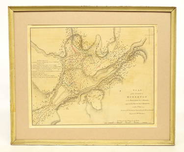
Sold202018th c. Battle Map18th c. Battle map "PLAN / of the ACTION of / HUBERTON...July 1777". Sight 11" x 13 1/2".See Sold Price
Sold2022Three 18th Century North Carolina Mapsengravings on laid paper, all unframed, including: John Reid, The State of North Carolina From the Best Authorities, engraver Benjamin Tanner, New York, circa 1796, sheet 16-1/2 x 19 in.; Matthew CareSee Sold Price
Sold2016Prints, (2) Augsburg & Munich, 18th CThese two prints depict city-view maps that highlight and label important landmarks. Each important location has been assigned a number or letter that explains what it is and where it is in relation tSee Sold Price
Sold2017English 18th C. Petit Point Map of England & WalesDated May 8th 1787 or 1788. Framed and under glass. Sight: 21 x 18. Frame: 25 1/4 x 22 1/2 inches. Shipping weight: 5 lbs.See Sold Price
Sold2023"Regni Daniae" Antique 18thC Hand Colored Map of Denmark by Johann Baptiste Homann"Regni Daniae" Antique 18thC Hand Colored Map of Denmark by Johann Baptiste Homann. Frame Size: 21 3/4" H x 25 1/4" W x .75" D. Sight Size: 20" H x 23 1/2" W.See Sold Price
Sold2023Antique Map of HispaniolaAntique Map of Hispaniola, "Hispaniolae, Cubae...", Ortelius, late 17th/early 18th c., hand-colored engraved map, sight 15 in. x 21 1/2 in., framedSee Sold Price
Sold2016*ZATTA, ANTONIO(18th C. Italian) Handcolored engraved map illustrating Maryland, Jersey, Delaware, Virginia and Carolina settlements, approximate plate size 13 1/4" x 17 1/2", frame 16" x 22 1/2".See Sold Price
Sold2017EARLY NEW YORK STATE ACTUAL SURVEY MAPEARLY NEW YORK STATE ACTUAL SURVEY MAP FOR COUNTIES ALONG SUSQUAHANNAH RIVER, INCL. CLINTON, CHENANGO, GREEN, ETC. 18TH C. 15 1/2" X 21"See Sold Price
Sold202018th century Navigation.- Navigation, manuscript, 218th century Navigation.- Navigation, manuscript, 174pp., partially ruled in red, 2 folding pen and ink maps hand-coloured in outline, numerous pen and ink diagrams, slightly browned, new endpapers, mSee Sold Price
Sold2019Unknown, "An Accurate Map of North America," 18th c.,Unknown, "An Accurate Map of North America," 18th c., mounted and matted, H. -8 1/2 in., W. - 14 in.See Sold Price
Sold202418th century cherry Queen Anne 2-pc highboy18th century cherry Queen Anne 2-pc highboy with inlay and carved shell, not a marriage, has a secret map drawer at top (part of the crown molding), dovetailed case and drawers, 69.25"T x 39.25"W x 20See Sold Price
Jun 19Flanders AuctionsAn antique map of Ingelumunster and two 'Heerlijkheden van Picquenij', 18th C. (W:42 x H:33 cm)€160
3 days LeftSwann Auction Galleries(COLONIAL NORTH AMERICA.) Herman Moll. [The Codfish Map]. To the Right Honourable John Lord Sommers.$1,500
Jun 27NY Elizabeth ANTIQUE ROMAN ARMORIAL VELLUM BINDING, 1744, ILLUSTRATED WITH AN ANTIQUE MAP BY FLORUS$100
Jun 27NY Elizabeth 1709 SEPTUAGINT GREEK BIBLE ILLUSTRATED WITH MAPS, VINTAGE VELLUM BOUND VERSION$100
4 days LeftDuMouchellesEuropean Etchings on Paper, Georg Friedrich Schmidt, John Dawson Watson, 18th And 19th C., 2 pcs$100
6 days LeftPalmyra Heritage GalleryAntique India, Stone Buddha Torso c.18th century or earlier.$10(1 bid)
2 days LeftNoble House Collection GalleryOUTSTANDING ANTIQUE FINE CHINESE PEKING GLASS SNUFF BOTTLE 18TH C YANGZHOU$750(1 bid)
5 days LeftHunt and Gather Vintage Market LLCGEORGE III TALL CHEST OF DRAWERS 18th C MAHOGANY$360(3 bids)
Jun 23East Coast Fine Arts LLCAttrib Gerritt Dou Dutch School 18th C Woman Carving by Firelight$3,000
14 hrs LeftChiswick AuctionsAn 18th century Spanish colonial silver twin handled bowl, Guatemala circa 1770£1,000(1 bid)
7 days LeftInternational Auction GalleryChinese 18th c. porcelain brush wash, Qianlong period$50(1 bid)


![(COLONIAL NORTH AMERICA.) Herman Moll. [The Codfish Map]. To the Right Honourable John Lord Sommers. (1 of 1)](https://p1.liveauctioneers.com/199/332329/179231618_1_x.jpg?height=282&quality=70&version=1717450360)


