Sold2021Framed Map of the Dongjing Bay Beibu Wan c1760Framed Map of the Dongjing Bay Beibu Wan 北部湾,c1760 Published by French Cartographer Nicholas Bellin, this pictre has been framed in accordance with museum standards, Frame size H:See Sold Price
Sold2023MAPS CARTOGRAPHY ITEMS WITH 2 HAND DRAWINGSThe lot includes a framed mid century American map Penobscot Bay And Approaches, United States - East Coast - Maine, Scale 1:80 000; Raritan River From Raritan Bay to New Brunswick New Jersey, Scale 2See Sold Price
Sold2022MAPS CARTOGRAPHY ITEMS WITH 2 HAND DRAWN PIECESThe lot includes a framed mid century American map Penobscot Bay And Approaches, United States - East Coast - Maine, Scale 1:80 000; Raritan River From Raritan Bay to New Brunswick New Jersey, Scale 2See Sold Price
Sold2017Revolutionary War era chart of Delaware Bay and RiverTitle/Content of Map: Revolutionary War era chart of Delaware Bay and River Date Printed: 1779 Cartographer: Gentlemans Magazine Size (in): 9 x 7 Small antique chart of Delaware Bay and River. DerivedSee Sold Price
Sold20231795 Joseph Scott Map Of DelawareScarce early 1795 Scott's Map Of Delaware from his The United States Gazetteer. Measures 7 1/2 x 6 inches in matt. Framed.See Sold Price
Sold2021Collection of Antique Maps of North AmericaA framed collection of nine small maps including "The English Empire in America, Newfound-Land, Canada, Hudsons Bay &c. in Plano" by Herman Moll circa 1709 and "North America from the Best AuthoritiesSee Sold Price
Sold2018Ledger Art Assemblage, Northwest Coast, NorwegianFramed contemporary Ledger Art assemblage, Pacific Northwest Coast. The assemblage depicts an antique note card: Neah Bay, 1879, over a vintage Norwegian map of Alaska and Canada. Housed under plexiglSee Sold Price
Sold20231778 J. Lodge Exact Map of the Five Great Lakes1778 Lodge Exact Map of the Five Great Lakes with Part of Pensilvania New York, Canada and Hudson's Bay Territories from the best Surveys. Hand colored, fine framed acid free mount example. 8 1/2 by 1See Sold Price
Sold2021Antique Framed Map. Virginia Marylandia et Carolina. JoAntique Framed Map. Virginia Marylandia et Carolina. Johannes Baptisa Homann-- Dimensions: Image Size: H: 21 inches: W: 24.5 inches -- FRAME SIZE: Frame Height 25 inches - Frame Width 28.5 inches ---See Sold Price
Sold2016Antique Framed Map of Israel, C. 1748.Ivdaea Sev Palaestina, ... Terra Sancta. By Johann Baptist Homann. Framed, 18.5" x 21.5" sight size. Visible foxing. From a Larchmont NY estate. Dimensions: 23" w x 20" h framed. Condition: Foxing, noSee Sold Price
Sold2023Antique Framed Map of CubaAntique Framed Map of Cuba. Framed measures 15 inches x 20 inchesSee Sold Price
Sold2021Antique Framed Map Livingston,Germantown,Claremont NYAntique Framed Map of Livingston, Germantown and Claremont, Columbia County, NY. Dated 1850. Engraved by R.H.Pease, Albany, NY. Lovely early map is nicely framed in dark brown wood, and wired on the bSee Sold Price
Sold2017Antique framed map of Indian Ocean, Asia, AustraliaTitle/Content of Map: Antique framed map of Indian Ocean, Asia, Australia Date Printed: 1713 Cartographer: Aa, Pieter van der Size (in): 11 x 8 Very attractive framed copper-engraved antique map by PiSee Sold Price
Sold2021Antique Framed Map of Columbia County, NY 1829Antique Framed Map of Columbia County, NY, dated 1829. Engraved by Rawdon Clark & Co, Albany, NY. Also marked Rawdon Wright, New York. Map includes locations of mills, churches and stage roads. NicelySee Sold Price
Sold2019Antique Framed Map Showing Estonia Coast & RussiaAntique Framed Map Showing Estonia Coast & Russia. Professionally framed and matted. Showing the current coast and islands of Estonia as well as a portion of Russia. Measures 26 x 31 inches.See Sold Price
Sold2023Antique Framed Map of Greece by Nicolaum VisscherAntique Framed Map of Greece by Nicolaum Visscher. 21 inches x 25 inches.See Sold Price
Sold2021Antique Framed Map of Europe, Europa Guilielmo BlaeuwAntique Color Map of Europe, Dutch Cartography. "Europa Recens Descripta" by Guilielmo Blaeuw, a cartographer for the Dutch East India Company. Lots of colorful detail of different nationalitiSee Sold Price
Sold2021Antique Framed Map of Germany by A Christophoro HurteroAntique Framed Map of Germany by A Christophoro Hurtero. Full title: Alemannia Sive Svevia Superior. Date of printing is somewhere in 1640's, and possibly engraved. Golden painted inner frame. DimSee Sold Price
Sold2021(2) ANTIQUE FRAMED MAPSAntique world map approximately 16" x 9.75" w/ frame and Asia minor 11.75" x 9.25" w/ frame.See Sold Price
Sold20242 ANTIQUE FRAMED MAPSMAP OF FRANCE, DATED 1850, BY THOMAS COWPERTHWAIT AND ONE OF ENGLAND. FRAMED 21"X 24"See Sold Price
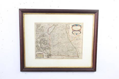
Sold2021Antique Framed Map of East HamptonAntique map of East Hampton, Long Island, NY, framed under glass. [Sight: 10" H x 14 1/2" W; Frame: 17 1/2" H x 21" W]. Minor creases.See Sold Price
Sold2021Antique Framed Map of Livingston Manor, NY, dated 1714Antique Framed Map of Livingston Manor, NY, dated 1714. Engraved by J.E. Gavit, Albany, NY. Lovely early map is nicely framed in dark brown wood, matted in white, and wired on the back and ready to haSee Sold Price
Sold2021Antique Framed Map of Russian Empire "Improved to 1321"Antique Framed Map of Russian Empire "Improved to 1321." Geographical and statistical map, with full color and cultural information. This includes natural history, national character, manners,See Sold Price
5 days LeftArarity AuctionsC. G. Reichard "Charte des Osmanische Reichs in Asien" 1804 Antique Hand Colored Framed Map$50
1 day LeftJasper52Chinese Japanese Korean Ports sea chart. lighthouses mail routes. LARGE 1927 map$40
5 days LeftArarity AuctionsThomson's 1817 Hand Colored Map Comparative Heights of the World's Great Mountains$50


![Antique Framed Map of East Hampton: Antique map of East Hampton, Long Island, NY, framed under glass. [Sight: 10" H x 14 1/2" W; Frame: 17 1/2" H x 21" W]. Minor creases.](https://p1.liveauctioneers.com/1221/225810/117094074_1_x.jpg?height=310&quality=70&version=1637685024)


