Sold2018GREAT LAKES. Upper Canada districts <1849 Lake HuronTITLE/CONTENT OF MAP: 'NORTH AMERICA, SHEET III., Upper Canada and New Brunswick with parts of New York, Pennsylvania and Michigan' The map shows the historic districts of Upper Canada (Ontario) as thSee Sold Price
Sold2018Ettling: Antique Map of Upper Canada, 1863TITLE/CONTENT OF MAP: 'Upper Canada' Lakes Huron, Erie & ONTARIO. Counties. Railways. DATE PRINTED: 1863 IMAGE SIZE: Approx 32.0 x 44.5cm, 12.5 x 17.5 inches (Large) TYPE: Antique map with original ouSee Sold Price
Sold20181683 Sanson Map of the Great Lakes and the Upper EastTitle/Content of Map: 1683 Sanson Map of the Great Lakes and the Upper East Coast -- Le Canada, ou Nouvelle France, &c. Tiree de diverses Relations des Francois, Anglois, Hollandois, &c. Date: 1683, PSee Sold Price
Sold20181683 Sanson Map of the Great Lakes and the Upper EastTitle/Content of Map: 1683 Sanson Map of the Great Lakes and the Upper East Coast -- Le Canada, ou Nouvelle France, &c. Tiree de diverses Relations des Francois, Anglois, Hollandois, &c. Date Printed:See Sold Price
Sold20211849 Geological Map of the Upper Peninsula of Michigan,Title: 1849 Geological Map of the Upper Peninsula of Michigan, in Part -- Geological Map of the District between Portage Lake and Montreal River, Lake Superior, Michigan Cartographer: Foster/Whitney/USee Sold Price
Sold2022Great Lakes Canada Goose DecoyA mid 20th century Great Lakes area Canada goose decoy. Laminated body with original paint. Moderate wear to paint, chips at body and tail. 22" long. ESTIMATE $200-400See Sold Price
Sold2019Partie Occidentale du Canada Great Lakes Midwest.Reserve Reduced! TITLE/CONTENT OF MAP: 'Partie Occidentale du Canada et Septentrionale de la Louisiane avec une Partie de la Pensilvanie par le Sr. d'Anville de l'Academie Rle. des Inscriptions et BelSee Sold Price
Sold20211783 Delisle/Dezauche Map of Great Lakes and Canada --Title: 1783 Delisle/Dezauche Map of Great Lakes and Canada -- Carte du Canada qui Comprend la Partie Septentrionale des Etars Unis d'Amerique… Cartographer: Delisle/Dezauche Year/Place: 1783, PaSee Sold Price
Sold2023COLLECTION OF VINTAGE POSTCARDS AND PICTURES GREAT LAKES MICHIGAN CANADACOLLECTION OF VINTAGE POSTCARDS AND PICTURES GREATSee Sold Price
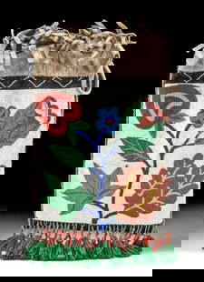
Sold2023Early Winnebago / Ojibwe Beaded Leather PouchNative American / First Nations, Northern United States / Canada, Great Lakes Region & Midwest, Winnebago / Ojibwe, ca. early 20th century CE. A hide bag with beadwork across both sides, the front panSee Sold Price
Sold20241920s Native American Chippewa Beaded Leather Bag**Originally Listed At $300** First Nations / Native American, Midwestern United States / Canada, Great Lakes Region & Midwest, Chippewa / Ojibwe, ca. 1920s to 1930s CE. A fringed hide drawstring bagSee Sold Price
Sold2019Two Maps by Jacques Nicolas Bellin (1703-1772), "PartieTwo Maps by Jacques Nicolas Bellin (1703-1772), "Partie Occidental de la Nouvelle France du Canada (Great Lakes)," 1755; together with "Carte de la Louisiana et Pays Voisins," 1757, both hand colored,See Sold Price
Sold20161 3/8" Historic Brass Pipe. Iroquois. Upper Great1 3/8" Historic Brass Pipe. Iroquois. Upper Great Lakes region. Shows good age, in very good conditionSee Sold Price
Sold20218 Native Research BooksLot to include 8 books, The stuff of dreams - Pueblo Stories and Storytellers - Crooked Beak of Heaven - White Metal Universe - Yazz Navajo Painter - Beads; Their Use by Upper Great Lakes Indians - BlSee Sold Price
Sold20197 Collectible Maps - Lake Huron - Georgian BayLake Huron Canada. Georgian Bay. French / English. [LA 4529]See Sold Price
20181719 Chatelain Map of Eastern Canada and Great LakesTitle/Content of Map: 1719 Chatelain Map of Eastern Canada and Great Lakes Region -- Carte du Canada ou de la Nouvelle France & Des Decouvertes qui y ont ete Faites, Dresse sur les observations les plSee Sold Price
Sold20191719 Chatelain Map of Eastern Canada and Great LakesTitle/Content of Map: 1719 Chatelain Map of Eastern Canada and Great Lakes Region -- Carte du Canada ou de la Nouvelle France & Des Decouvertes qui y ont ete Faites, Dresse sur les observations les plSee Sold Price
Sold2023Cartes des Lac du Canada'. The Great Lakes of North America. BELLIN 1757 mapDescriptionCAPTION PRINTED BELOW PICTURE: Cartes des Lac du Canada [Map of the Great Lakes of North America]DATE PRINTED: 1757IMAGE SIZE: Approx 20.5 x 30.0cm, 8 x 11.75 inches (Medium); Please note tSee Sold Price
Sold2017US Canada Atlantic & Great Lakes Ports Sea Chart, 1914Title/Content of Map: 'American Atlantic Ports - North Sheet; Inset Chicaco; Boston Harbour; Soo Canals; New York Horbour; Ontario; The Coast from New York to Boston; Buffalo; Montreal; Halifax; NewfoSee Sold Price
Sold2016Map of Canada Framed Vintage 40s Print After 1720Map of Canada Framed Vintage 40-s Print After 1720 Guillaume De L'Isle Carte Du Canada Qui Comprend la Partie Septentrionale Des Etats Unis D'Amerique Canada and Great Lakes Map Approximately 21 5/8"See Sold Price
Sold2017BRIGHAM YOUNG Signed 1849 G.S.L.C Mormon $1 NoteAutographs Outstanding Brigham Young Signed 1849 Great Salt Lake City $1 Mormon Currency Note PCGS Certified Very Choice New-64 Premium Paper Quality BRIGHAM YOUNG (1801-1877). Mormon Leader, PresidenSee Sold Price
Sold2023Great Lakes Series First Editions "Huron, Superior and Michigan"Great Lakes Series First Editions "Huron, Superior and Michigan": Lake Huron by Fred Landon, Lake Superior Grace Lee Nute, Lake Michigan Milo Quaife. Books from a personal library with such markings.See Sold Price
Sold20241775-1780 Upper Midwest and Great Lakes region. By Bonne & RaynalTitle: 1775-1780 Upper Midwest and Great Lakes region. By Bonne & Raynal Date/Period: 1775-1780 Materials: Copperplate engraved Size: 14 1/2” x 9 1/2 “ This vintage map, created by R. BonnSee Sold Price
Sold20211683 Sanson Map Great Lakes to Newfoundland -- LeTitle: 1683 Sanson Map Great Lakes to Newfoundland -- Le Canada, ou Nouvelle France, &c. Tiree de diverses Relations des Francois, Anglois, Hollandois, &c. Cartographer: N Sanson Year / Place: 1683 c.See Sold Price
6 days LeftSwann Auction Galleries(GREAT LAKES/CANADA.) Gilles and Didier Robert de Vaugondy. Partie de l'Amerique Septent qui$450(1 bid)
6 days LeftSwann Auction Galleries(AMERICAS.) John Senex. A New Map of America From the latest Observations.$450
5 days LeftJasper52North America Sheet III West Canada With Parts of New York, Pennsylvania and Michigan$30
6 hrs LeftHolabird Western Americana CollectionsSalt Lake Route RR Co. passes, 1913-17 [176592]$50(1 bid)
6 hrs LeftHolabird Western Americana CollectionsSeneca Lake Steam Navigation Co Pass, 1888 [182704]$150
Jun 30JM Hobby Supply and Railroad Artifact AuctionsThe Michigan RR Collection-52 High Grade Michigan Railroad Freight Cars$50(1 bid)
3 days LeftTigerlily Arts & Antiques CoReplica of the Great Lake Freighter, Edmund Fitzgerald in Plexiglass Case$550
6 days LeftSwann Auction Galleries(NEW YORK -- ADIRONDACK MOUNTAINS.) Seneca Ray Stoddard. Map of the Adirondack Wilderness.$375
6 days LeftJasper52OS #98 Lake District South & Cumbria Fells. Ambleside Windermere Kendal 1883 map$260
BonhamsFIELDING (THEODORE HENRY) Cumberland, Westmoreland, and Lancashire Illustrated, in a Series of F...£600
6 hrs LeftHolabird Western Americana CollectionsCalifornia Map by Colton in Frame, 1855 [180767]$150(1 bid)
1 day LeftTony Putty Artifacts25 1/2" Northern Great Lakes Indian Ball Club with Spike. Pictured. Ex Joe Kinker.$155(2 bids)


![7 Collectible Maps - Lake Huron - Georgian Bay: Lake Huron Canada. Georgian Bay. French / English. [LA 4529]](https://p1.liveauctioneers.com/6288/141133/71496657_1_x.jpg?height=310&quality=70&version=1556635288)


![Cartes des Lac du Canada'. The Great Lakes of North America. BELLIN 1757 map: DescriptionCAPTION PRINTED BELOW PICTURE: Cartes des Lac du Canada [Map of the Great Lakes of North America]DATE PRINTED: 1757IMAGE SIZE: Approx 20.5 x 30.0cm, 8 x 11.75 inches (Medium); Please note t](https://p1.liveauctioneers.com/5584/311630/167410814_1_x.jpg?height=310&quality=70&version=1701439692)


![Early French Map of Great Lakes [179300] (1 of 1)](https://p1.liveauctioneers.com/2699/331495/178785744_1_x.jpg?height=282&quality=70&version=1717094933)


![Great Northern RY passes, 1913-16 [172080] (1 of 2)](https://p1.liveauctioneers.com/2699/331495/178785963_1_x.jpg?height=282&quality=70&version=1717094933)
![French Map of America Southeast [179304] (1 of 1)](https://p1.liveauctioneers.com/2699/331495/178785746_1_x.jpg?height=282&quality=70&version=1717094933)

![Salt Lake Route RR Co. passes, 1913-17 [176592] (1 of 2)](https://p1.liveauctioneers.com/2699/331495/178786142_1_x.jpg?height=282&quality=70&version=1717094933)
![Seneca Lake Steam Navigation Co Pass, 1888 [182704] (1 of 2)](https://p1.liveauctioneers.com/2699/331495/178786269_1_x.jpg?height=282&quality=70&version=1717094933)


![[Fore-edge Painting] Wordsworth, William: The Poetical Works (1 of 10)](https://p1.liveauctioneers.com/65/332523/179335109_1_x.jpg?height=282&quality=70&version=1717709445)

![California Map by Colton in Frame, 1855 [180767] (1 of 3)](https://p1.liveauctioneers.com/2699/331495/178785753_1_x.jpg?height=282&quality=70&version=1717094933)
