Sold2021Litchfield County Map Hopkins and Clark 1869Litchfield County Map Hopkins and Clark 1869 54.5"x64"hSee Sold Price
Sold20241859 Clark & Hopkins Wall Map Litchfield County CTAntique 1859 Clark & Hopkins Topographical Wall Map of Litchfield County Connecticut, Coated Fabric Backed Paper with Original Rollers. Measures 55 inches x 51 inches. Please note condition issues notSee Sold Price
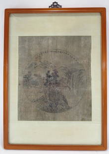
Sold202319th Cent. Clark Litchfield County Map Dated 185919th Cent. Clark Litchfield County Map Dated 1859 40" x 56" including the frame, appears to be trimmedSee Sold Price
Sold2022Map of the Town of Cornwall, Connecticut, Circa 1854Map of the Town of Cornwall, Connecticutcirca 1854marked "Map of the Town of Cornwall, Litchfield County, Connecticut, Surveyed & Drawn by L. Fagan, Published by Richard Clark, 42, Moyamensing RoSee Sold Price
2018SUSSEX COUNTY NEW JERSEY MAP, HOPKINS 1860SUSSEX COUNTY NEW JERSEY MAP, HOPKINS 1860 57" X 53"See Sold Price
Sold20171829 David Burr Clinton County, NY map1829 David Burr Clinton County, NY map, Rawdon Clark & Co., Albany & Rawdon Wright & Co., NY hand colored, earliest known printed map of Clinton County, plate size 17 3/4" x 20", sheet size 24" x 21 1See Sold Price
Sold20171873 Atlas of Late Township of Greenville and the1873 Atlas of Late Township of Greenville and the State of New Jersey. G.M. Hopkins. County Maps Atlantic, Bergen, Camden, etc. Approx 31 Maps. --- This is just one of hundreds of antique books beingSee Sold Price
Sold20231856 Richard Clark Map of Fairfield CountyDescription: This lot includes an original 1856 map of Fairfield Country by Richard Clark. The lamp is still on it's original wood poles and has been rolled up for decades. Condition: The map is in faSee Sold Price
Sold20221859 Hopkins Clarke Litchfield City Map 54"x64"1859 Hopkins Clarke Litchfield City Map 54"x64"See Sold Price
Sold20234 color Ohio wool coverlet4 color wool coverlet signed Made by S. Riegel, Germin Township, For Mary Detrick, 1869, Simon Riegel was from Clark County, Ohio, fringe pretty well intact, bird and tree border, 78" x 87"See Sold Price
Sold20181869 Mitchell Map of CaliforniaTitle/Content of Map: 1869 Mitchell Map of California -- County Map of the State of California Date Printed: 1869, Philadelphia Cartographer: S. Mitchell Size: 21.2 x 14.6 in. An excellent large map oSee Sold Price
Sold2024Georges Meunier - Bec Auer - PosterGeorges Meunier, French, 1869-1942, Bec Auer, c.1895, Imp. Chaix (Ateliers Cheret) Rue Bergere, 20, Paris, lithograph poster Framed 69 1/2" x 50" From a Litchfield County Connecticut CollectorSee Sold Price
Sold2017Mitchell: Antique Map of Ontario in Counties, 1869Map: Ontario in counties Date Printed: 1869 Cartographer: Augustus S. Mitchell Material/Medium: Paper Size: 15 1/4" x 12 1/4" Hand colored engraved map. Printed in Philadelphia. From his 'Mitchell's NSee Sold Price
Sold2016Atlas Of Hartford City And County, With a Map ofAtlas Of Hartford City And County, With a Map of Connecticut, Published by Baker & Tilden, Hartford, Conn., 1869, 15" x 18", having brown textured cloth boards with title on font cover. Note: Atlas apSee Sold Price
Sold20211839 MAP OF ULSTER COUNTY, NEW YORK, BY DAVID H. BURR,1839 MAP OF ULSTER COUNTY, NEW YORK, BY DAVID H. BURR, STONE & CLARK PUBLISHERS, ITHICA, N.Y. NICELY FRAMED, FROM PROMINENT ELLENVILLE, N.Y. ATTORNEYS OFFICE. MAP MEASURES 22" X 23", NICELY FRAMED, ANSee Sold Price
Sold2021Antique Framed Map of Columbia County, NY 1829Antique Framed Map of Columbia County, NY, dated 1829. Engraved by Rawdon Clark & Co, Albany, NY. Also marked Rawdon Wright, New York. Map includes locations of mills, churches and stage roads. NicelySee Sold Price
Sold2018Antique Clark & Tackabury Connecticut Map,1859Antique Clark & Tackabury's, 1859, "New Topographical Map of the State of Connecticut", attached to wooden rod with acorn finials. Note: Complete and very informative colored wall map of Connecticut,See Sold Price
Sold2019MAP - Indiana. MendenhallIndiana. Edward Mendenhall, A New Map of Indiana Exhibiting the Counties, Townships, Cities, Villages, and Post Offices. Rail Roads, Canals, and Common Roads, 1869 (dated). Hand Color. An attractive,See Sold Price
Sold2022Map of San Francisco Tidelands for sale, 1869Heading: -1869 Author: Allardt, Geo. F., Surveyor Title: Map No. 3 of Salt Marsh and Tide Lands Situate in the City & County of San Francisco. To be sold at Public Auction, by order of the Boards of TSee Sold Price
Sold2021Henri Dupre & Carol Hopkins - Women & Beach O/CHenri Dupre & Carol Hopkins, 2 Oil on Canvas, "A Day at the Beach" and "Woman with Parasol", signedProperty from the estate collection of lifelong gallery owners, Essex County, New Jersey.Dimensions:See Sold Price
Sold20201749 Land Grant & Kearns Golden's Bridge MapsHenry Brown, Patent to 790 Acres of Land in Surry, (Sussex?) County 1749. Together with 8 renditions, 6 Edward J Kearns 1976 Map of Golden's Bridge. All numbered from the edition of 300, one signed inSee Sold Price
Sold2022Topographical Atlas of Bergen County NJ (US) 1876Topographical Illustrated, Historical Descriptive, A.H. Walker, Published by C.C. Pease, Successor to A.H. Walker. Color maps, home sites, business locations in fold-out pages. Cover in green with blaSee Sold Price
Sold20231869 Beers Atlas of Clinton County, New York1869 Beers, Ellis and Soule Atlas of Clinton County, New York, leather spine split, otherwise fair condition, fold out map of Plattsburgh loose and mended with old cloth tape. 16" x 13"See Sold Price
Sold2017Yi In-mun,Korean,Scholars Conversing,ink on paperYi In-mun(Yuchun),Korean, 1745-1821, Scholars Conversing within Landscape, ink and light color on paper,bears artists seal (JTIS2149){MM} Property Title / Biography: Litchfield County Auctions is pleaSee Sold Price
Featured1 day LeftJasper521878 Mitchell Map of Virginia and West Virginia [verso] New Jersey, Maryland and Delaware -- County$45
Jun 08Potter & Potter AuctionsHOPKINS, Albert (1869 – 1939). Magic. Stage Illusions and S...$125
4 days LeftMeander Auctions by Andrew Richmond and Hollie DavisOHIO ORANGE BLOSSOM PIECED QUILT$55(2 bids)
Jun 08Early American History Auctions1753 Map of the County of Lancaster Divided into its Hundreds, by Royal Mapmaker Emanuel Bowen$280
Swann Auction GalleriesSwisshelm, Jane Grey Cannon (1815-1884) Autograph Letter Signed, Zozonia, [Indiana County, Pennsylva$175
Jun 08Early American History Auctions1720 Colonial Northumberland County Virginia Manuscript Deed and Map Plot$400
2 days LeftThomaston Place Auction GalleriesEARLY 17TH C. ELIZABETHAN ENGRAVED MAP OF CORNWALL BY WILLIAM KIP AFTER WILLIAM SAXTON$150


![1878 Mitchell Map of Virginia and West Virginia [verso] New Jersey, Maryland and Delaware -- County (1 of 2)](https://p1.liveauctioneers.com/5584/329422/177662152_1_x.jpg?height=282&quality=70&version=1715717898)


