Sold2019Ogilby's road through Wales 1675Heading: (Maps) Author: Ogilby, John Title: The Road From St Davids com Pembroke to Holywell com Flint Place Published: Publisher: Date Published: Description: Copper-engrSee Sold Price
Sold2022England.- Ogilby (John) Ogilby's Road Maps of England and Wales from Ogilby's 'Britannia', 1675,NO RESERVE England.- Ogilby (John) Ogilby's Road Maps of England and Wales from Ogilby's 'Britannia', 1675, double- and whole-page maps, original cloth, Osprey, [1971]; and 16 others British TopographSee Sold Price
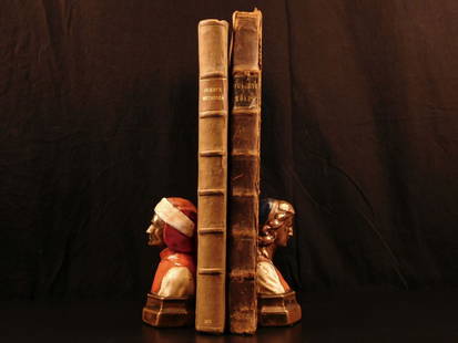
Sold20181675 John Ogilby Britannia Atlas England HUGE FOLIOS1675 John Ogilby Britannia Atlas England HUGE FOLIOS Roads Scotland Wales 2v In 1675, John Ogilby, a famed Scottish cartographer, began working on his famous road atlas known as ‘The Britannia.’ BSee Sold Price
Sold20221675 Ogilby Road Map from London to Flambourough HeadTitle: 1675 Ogilby Road Map from London to Flambourough Head -- The Road from London to Flambourough Head in Com Ebor… Cartographer: J Ogilby Year / Place: 1675, London Map Dimension (in.): 13.4 X 1See Sold Price
Sold20221675 Ogilby Strip road Map of York to Scarborough -- The Roads from York to Whitby and ScarboroughTitle: 1675 Ogilby Strip road Map of York to Scarborough -- The Roads from York to Whitby and Scarborough in Yorkshi:… Cartographer: J Ogilby Year / Place: 1675, London Map Dimension (in.): 12.8See Sold Price
Sold2022London to Bristol road map by OgilbyTitle: London to Bristol road map by Ogilby Date/Period: 1675 Materials: Copperplate engraved Size: 18 1/2” x 14” London to Bristol road map. 1675. By John Ogilby. Published in ‘AtlaSee Sold Price
Sold2017Road Map from London to Oxford by John Ogilby Road MapRoad Map from London to Oxford by John Ogilby, 1675, reproduced from the original in the Rand McNally & Company collection, roads in ribbon design, professionally framed and matted, gold painted woodSee Sold Price
Sold2017Road Map from London to Oxford by John Ogilby Road MapRoad Map from London to Oxford by John Ogilby, 1675, reproduced from the original in the Rand McNally & Company collection, roads in ribbon design, professionally framed and matted, gold painted woodSee Sold Price
Sold2019Senex & Ogilby 1719 Road Map. London to Montgomery"The Road from London to Montgomery in North Wales" Copper Engraved Map Published 1719, London for "An Actual Survey of all the Principal Roads of England and Wales" by John Ogilby and John Senex. PapSee Sold Price
Sold2020Senex & Ogilby 1719 Road Map. London to Montgomery"The Road from London to Montgomery in North Wales" Copper Engraved Map Published 1719, London for "An Actual Survey of all the Principal Roads of England and Wales" by John Ogilby and John Senex. PapSee Sold Price
2019Early English road map by John OgilbyHeading: (Maps) Author: Ogilby, John Title: The Road from London to St. Neotts in Com. Hunt. Continued to Oakeham in Com Rutland Place Published: London Publisher: Date Published: 1675See Sold Price
Sold2022[ANTIQUE MAPS] OGILBY--YORK TO WHITBY, SCARBORO 1675[ANTIQUE MAPS] OGILBY, John "YORK TO WHITBY, SCARBORO" London, UK 1675. 50X36cm. Scrolled road map. Framed. Hand-coloured. The complete route, with a spur from New Malton to Scarborough. Frame not incSee Sold Price
Sold20241645 Road Map by John Ogilby Buckingham to Bridgnorth Plate 23An antique road map showing the first accurate survey of the roads of England and Wales. This map shows the continuation of the extended road from Buckingham to Bridgnorth. 1 of over 100 maps publisheSee Sold Price
Sold2017[Maps] Britannia Depicta, 1720Bowen, Emanuel. BRITANNIA DEPICTA OR OGILBY IMPROV'D; BEING A CORRECT COPPY OF MR. OGILBY'S ACTUAL SURVEY OF ALL YE DIRECT & PRINCIPAL CROSS ROADS IN ENGLAND AND WALES. London: Tho. Bowles, 1720. 8vo.See Sold Price
Sold2020Ogilby, John 1939 Facsimile Atlas. Road Maps, UK"Britannia, Volume the First..." Facsimile Edition of the 1675 Edition by John Ogilyby & Alexander Duckham, 1939. Oblong 4to (315 x 250mm) 100 Maps printed both sides on 50 sheets. Cloth bound, a littSee Sold Price
Sold2021London to Bath & Wells by Ogilby, 1675 LondonTitle:London to Bath & Wells by Ogilby, 1675 London Date/Period:1675 Medium:Hand colored copper plate engraved Dimensions:18 1/2” x 14” Description:London to Bristol road map. By John OgilSee Sold Price
Sold2020Ogilby, John 1939 Lot of 375 Facsimile Road Maps, UK375 Sheets of Maps, printed both sides. Some duplication. Lithographs Published for 1939, London for "Britannia, Volume the First..." Facsimile Edition of the 1675 Edition by John Ogilyby & AlexanderSee Sold Price
Sold2017Road Map from London to Oxford by John OgilbyRoad Map from London to Oxford by John Ogilby, 1675, reproduced from the original in the Rand McNally & Company collection, roads in ribbon design, professionally framed and matted, gold painted woodSee Sold Price
Sold202118th c. Print England and Wales Road Map by Condor"A New Most Accurate & Complete Map of all the Direct and the Principal Cross Roads in England and Wales". Original detailed map shows distances of major roadways across England and Wales, measured inSee Sold Price
Sold2022John Ogilby, three road maps, including London to Norwich, hand coloured engravings, late 17thJohn Ogilby, three road maps, including London to Norwich, hand coloured engravings, late 17th century, 35 x 45cmSee Sold Price
Sold2022Postcards, Photo Books,Maps and Guide Books.Postcards, Photo Books,Maps and Guide Books. Pompeii, France, North Wales, London, Paris, Arundel and Windsor Castle, Imperial War Museum, Pratts England and Wales Road Atlas etc. (39 items)See Sold Price
Sold2022British road maps.- Ogilby (John) The Roads fromNO RESERVE British road maps.- Ogilby (John) The Roads from Chelmsford in Essex to St. Edmonds-Bury in Suffolk & Saffron-Walden in Essex, strip road map, engraving with hand-colouring, on thin laid paSee Sold Price
Sold2023John Ogilby, Three Engraved Road Maps on laid paperJOHN OGILBY (Scottish, 1600-1676), Three Double Paged Hand Colored Engraved Road Maps on laid paper, including "The Road from London to St. Davids in Com. Pembroke," "The Road from London to St. NeottSee Sold Price
Sold2019OGILBY, John (1600-1676). The Road from CambridgOGILBY, John (1600-1676). The Road from Cambridg to Coventry. [London, ca 1570s]. Engraved scroll map hand-colored in wash and outline, visible area 17 1/4 x 14 1/14 in. (444 x 360 mm). DecoSee Sold Price
Jun 28Rail & Road AuctionsPennsylvania Railroad Lunkenheimer Three Chime Whistle - East Altoona Roundhouse & Nickel Plate$2,000
Jun 28Rail & Road Auctions48 Mower Lumber Company Logging Railroad Black and White Photographic Negatives$50
Jun 28Rail & Road AuctionsAdams & Westlake Restored Railroad Right Marker Lamp w/ Brass Tag, Bell Bottom$40(1 bid)
Jun 28Rail & Road AuctionsNorthern Pacific Railway Advertisement - Thomas Moran Color Grand Canyon Yellowstone Park$30
Jun 28Rail & Road AuctionsEleven Railroad China Butter Pats - Fred Harvey, John H. Murphy, Seaboard Air Line, Florida East$40
Jun 28Rail & Road AuctionsFive New York Central Lines Railroad Advertising Poster Prints By Walter Greene$70
Jun 28Rail & Road AuctionsBaltimore & Ohio Railroad Dining Car Department Wooden Crate For Glassware$70
Jun 28Rail & Road AuctionsThree Signed Lionel Trains "Controlling the Magic" Prints - Musician Neil Young, Richard Kughn,$30(1 bid)
Jun 27Rail & Road AuctionsMixed Group of Southeastern Railroad Items - Switch Key, Locks, Lantern Globe, Timetables, and More$30


![England.- Ogilby (John) Ogilby's Road Maps of England and Wales from Ogilby's 'Britannia', 1675,: NO RESERVE England.- Ogilby (John) Ogilby's Road Maps of England and Wales from Ogilby's 'Britannia', 1675, double- and whole-page maps, original cloth, Osprey, [1971]; and 16 others British Topograph](https://p1.liveauctioneers.com/5458/257239/133765092_1_x.jpg?height=310&quality=70&version=1659622051)


![[ANTIQUE MAPS] OGILBY--YORK TO WHITBY, SCARBORO 1675: [ANTIQUE MAPS] OGILBY, John "YORK TO WHITBY, SCARBORO" London, UK 1675. 50X36cm. Scrolled road map. Framed. Hand-coloured. The complete route, with a spur from New Malton to Scarborough. Frame not inc](https://p1.liveauctioneers.com/8321/253807/131946541_1_x.jpg?height=310&quality=70&version=1657215628)

![[Maps] Britannia Depicta, 1720: Bowen, Emanuel. BRITANNIA DEPICTA OR OGILBY IMPROV'D; BEING A CORRECT COPPY OF MR. OGILBY'S ACTUAL SURVEY OF ALL YE DIRECT & PRINCIPAL CROSS ROADS IN ENGLAND AND WALES. London: Tho. Bowles, 1720. 8vo.](https://p1.liveauctioneers.com/3532/111460/57224161_1_x.jpg?height=310&quality=70&version=1509131847)


![OGILBY, John (1600-1676). The Road from Cambridg: OGILBY, John (1600-1676). The Road from Cambridg to Coventry. [London, ca 1570s]. Engraved scroll map hand-colored in wash and outline, visible area 17 1/4 x 14 1/14 in. (444 x 360 mm). Deco](https://p1.liveauctioneers.com/197/151909/76680351_1_x.jpg?height=310&quality=70&version=1570472488)


