NEW YORK — Embark on a visual odyssey through England of the 19th and 20th century with Jasper52‘s Charting the Past: Exclusive Antique Maps sale taking place Wednesday, April 24 at 8 pm Eastern time, exclusively at LiveAuctioneers.
Created and printed by David Burley in 1950, this map of East Kent pub ‘inn-signias’ charts dozens of heralds adorning popular drinking establishments. Inn-Signia of Whitbread Houses in East Kent measures 22.25 by 32.25in and carries a $2,000-$2,500 estimate.
London and its environs – levels taken by order of the Commissioners of Sewers is a circa-1850 map charting the greater London area for use by the Metropolitan Commission of Sewers, which had been formed in 1848. The map shows both Battersea Park and Waterloo Station, which both date to that year. The 42.25 by 51.5in map is estimated at $5,000-$6,000.
Dating to 1933, London Passenger Transport Board – Underground Railways of London charts the extensive London Underground subway system at the time of its printing. Measuring 5.5 by 7.75in, the map is estimated at $2,000-$2,500.
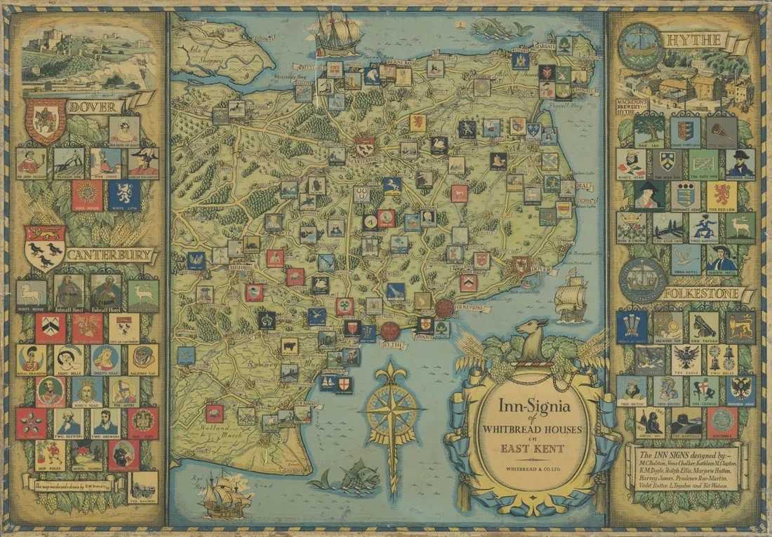
Inn-Signia of Whitbread Houses in East Kent, estimated at $2,000-$2,500 at Jasper52.
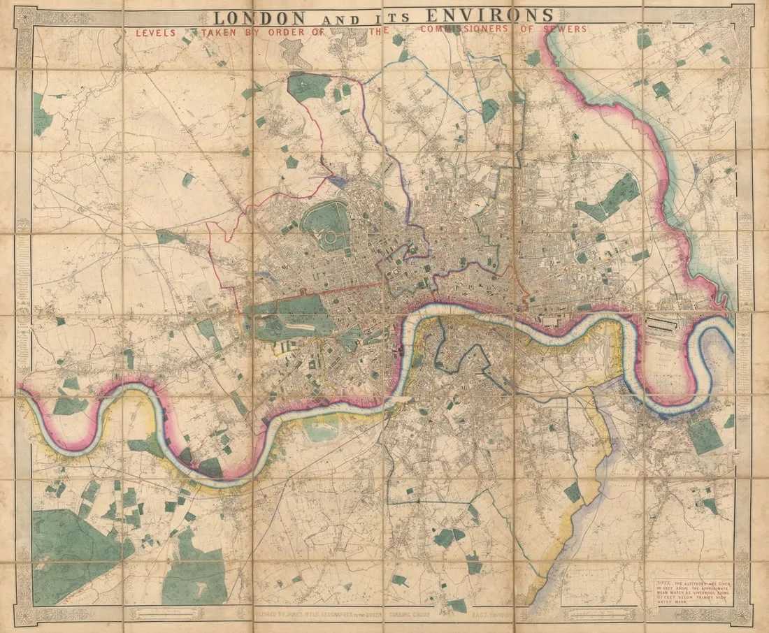
London and its environs - levels taken by order of the Commissioners of Sewers, estimated at $6,000-$6,000 at Jasper52.
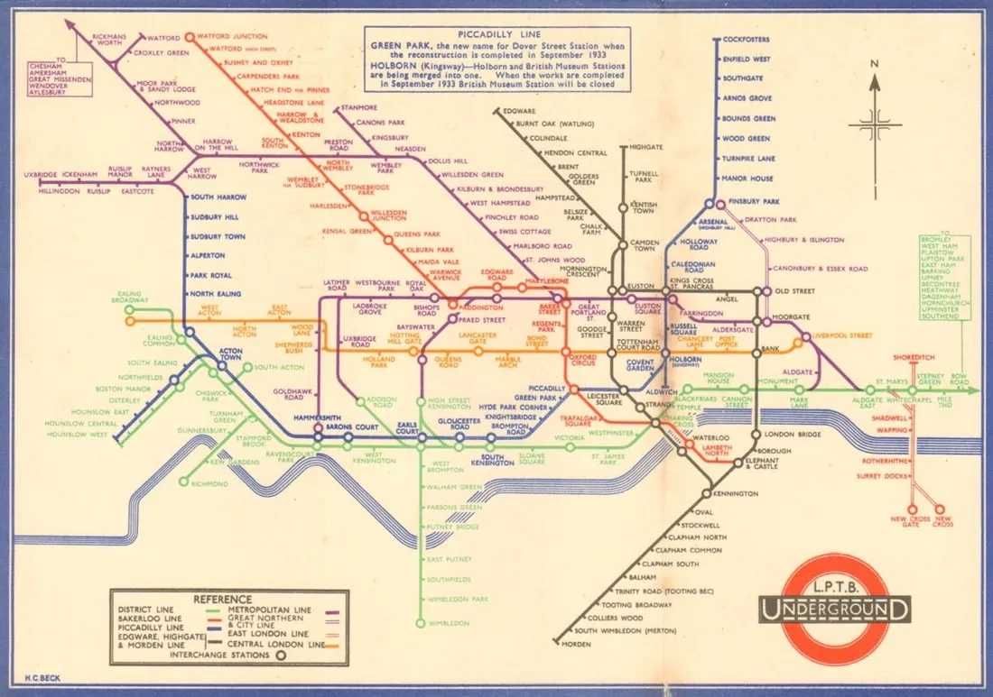
London Passenger Transport Board - Underground Railways of London, estimated at $2,000-$2,500 at Jasper52.