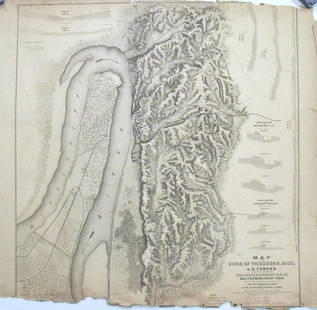
17th-20th Century Antiquarian Map Auction 2017-01-14 Auction - 74 Price Results - Jasper52 in NY
LiveAuctioneers Logo

van der Aa: T Noorder deel Vaa Amerika, 1707Coronelli: Mare Del Nord Auttore, 1690Chatelain: Nouvelle Carte D'Angleterre, 1719
Done
New York, NY, United States
Auction Details

17th-20th Century Antiquarian Map Auction

Jasper52

Jasper52

badge TOP RATED
Explore both land and sea with this array of maps, which preserves the geography of nearly every region imaginable. Unlike modern maps, these original engravings trace borders as they evolved throughout history. Discover lost American highways or the 17th century understanding of the Mediterranean Sea. Not only will these maps serve as decorative pieces, but they also will reveal innumerable ways to view our world.
Lot Number: Lowest
24
Sold
J. Arrowsmith British North America Map: Map: British North America MapMaker: J. ArrowsmithIt is printed on high-quality paperSize: approximately 24 inches high x 18inches wide. Reproduction of an antique map entitled “British North
0001: J. Arrowsmith British North America MapEst. $40-$80
See Sold Price
Sold
Framed Poster Map of New York, 1867: Map: Framed Poster Map of New YorkDate: 1867Size: 20 inches wide x 24 inches wide Framed and well preserved. Please note that this lot has a reserve. When you leave a bid in advance of the auction,
0002: Framed Poster Map of New York, 1867Est. $50-$150
See Sold Price
Sold
Map Caart van de Rivieren Coretyn 1770: Map: Caart Van de Rivieren Coretyn, Copename en SaramecaMaker: Jacobus van der SchleyTechnique: Hand coloredDate: ca. 1770Size: 10 x 18 inches Jakob van der Schley, or Jakob van Schley, (1715 -
0005: Map Caart van de Rivieren Coretyn 1770Est. $100-$200
See Sold Price
Bradford: South Carolina, 1838: Map: Map of South CarolinaMaker: T.G. BradfordDate: 1838From one of the finest atlases published in the United States, engraved and printed on the highest quality paper with expert original hand
0007: Bradford: South Carolina, 1838Est. $165-$275Lot Passed
Sold
Dower: Mexico & Guatimala, c.1835: Map: Map of Mexico and Guatimala (Guatamala)Maker: J. DowerDate: Circa 1835Description: Mexico before the separation of Texas and California. Texas is shown in a small configuration as a province of
0010: Dower: Mexico & Guatimala, c.1835Est. $150-$225
See Sold Price
Sold
Rapkin/Tallis: United States, 1851: Map: Map of United StatesMaker: John RapkinPublisher: John TallisDate: 1851Published after Texas became a state but giving it an odd configuration with the panhandle chopped off. Includes western
0011: Rapkin/Tallis: United States, 1851Est. $165-$250
See Sold Price
19th C Map of Hindoostan: Map: Hindoostan (India)Date: 19th centuryMap Size: 10 x 12 inchesFrame Size: 18 x 20 inches Hindoostan (or Hindustan) is a common geographic term for the northern/northwestern Indian subcontinent.
0013: 19th C Map of HindoostanEst. $100-$150Lot Passed
Sold
Afrique Ancienne, 1812: Map: Afrique AncienneFrom Malte-Brun's Atlas CompletAn excellent map of North Africa from approximately Biblical times. It shows the extend of the Sahara. A few of the very early cross-Sahara,
0014: Afrique Ancienne, 1812Est. $100-$200
See Sold Price
H. Tanner: Switzerland Map: Map: SwitzerlandDescription: Switzerland / Helvetia. Details are shown of towns, rivers, lakes, and importantly the mountains, etc. Lombardy, part of today's Italy is still Austrian controlled.
0018A: H. Tanner: Switzerland MapEst. $150-$200Lot Passed
Sold
W & A Johnston: Russia in Europe: Map: Russia in EuropeDescription: This highly detailed map of European Russia highlights the imperial wishes of the Czars, with Russia's expansion and control of Finland, the Baltics, parts of
0018B: W & A Johnston: Russia in EuropeEst. $150-$200
See Sold Price
Sold
Johnson's Delaware and Maryland: Map: Johnson's Delaware and MarylandDescription: A map of these two mid-Atlantic states with plenty of topographical and settlement details as well as showing roads and railroads. Counties are color
0018C: Johnson's Delaware and MarylandEst. $150-$200
See Sold Price
Sold
Tibet, Mongolia, and Manchuri: Map: Tibet, Mongolia, and ManchuriDescription: This is an ornate and highly decorative map of Tibet, Mongolia, and Mandchouria – modern day China including Tibet and Mongolia. The map features six
0019B: Tibet, Mongolia, and ManchuriEst. $150-$200
See Sold Price
View:
24
TOP