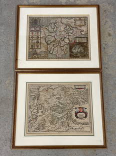
Early Framed Map Of Troy, Ny 1802 15"x18" - Jun 05, 2022 | State Line Auctions & Estate Services In Ct
LiveAuctioneers Logo

lots of lots

Early Framed Map of Troy, NY 1802 15"x18"

Sold
Early Framed Map: Early framed map "MAP OF THE / OLD RELIABLE / HANNIBAL / AND ST. JOSEPH / SHORT LINE". Sight 23" x 21 1/2".
2020Early Framed MapSee Sold Price
Sold
EARLY FRAMED MAP OF HOLLANDIA: ~
2023EARLY FRAMED MAP OF HOLLANDIASee Sold Price
Sold
Early Framed Map: Early framed map "Various PLAINS and DRAOUGHTS of CITIES, TOWNS, HARBOURS....". Sight 12" x 8 1/2".
2020Early Framed MapSee Sold Price
Sold
2 EARLY FRAMED MAPS: ~
20232 EARLY FRAMED MAPSSee Sold Price
Sold
Early Map: Early framed map "An / Accurate MAP . of / ENGLAND and WALES / with / The Principal Roads from the beft / AUTHORITIES". Engraving on rag paper, plated #7 for Carey's American Edition Guthries Improved
2020Early MapSee Sold Price
Sold
Two Early Framed Engraved Maps: A lot of two early hand-colored engraved maps to include a W. J. Bleau map of Amsterdam, ca. 1634-1635, "Sabaudia Ducatus Savoye", together with a John Speed map of Britain, ca. 1611-1614, "Devonshire
2021Two Early Framed Engraved MapsSee Sold Price
Sold
Early Map: Early Continental framed map. Sight 14 1/2" x 21", frame overall 17" x 23 1/2".
2021Early MapSee Sold Price
Sold
Early Map: Early Continental framed map. Sight 15 1/2" x 20".
2018Early MapSee Sold Price
Sold
Group of 4 Early European Maps: Group of 4 early framed European maps, including; 'De L'Europe, figure III., Isle D'Albion", 'Westmorland', 'Wien in Oesterreich' and 'Milan'. Measures: 12" x 15 1/2" overall, largest.
2023Group of 4 Early European MapsSee Sold Price
Sold
Two Small Framed Early Maps: including Connecticut and Virginia. Not examined out of frames. Largest frame size: 11 1/3" high, 13 3/4" wide. Stains, toning, creases. Provenance: Property of a Madison, CT Collector. Vir
2020Two Small Framed Early MapsSee Sold Price
Sold
17th Century Map: Comittus Tirolean framed early map, size is 19 x 23 book leaf, double sided
201817th Century MapSee Sold Price
Sold
Map Lot: Lot early framed and loose maps.
2019Map LotSee Sold Price
Sold
2 PC. FRAMED EARLY ENGLISH MAPS: 2 PC. FRAMED EARLY ENGLISH MAPS: Comprising; 1- Hand-colored Oxford Shire map, by Robert Morden. 1- An accurate map of the county of Bedford divided into its hundreds. Drawn from a late survey, & illu
20222 PC. FRAMED EARLY ENGLISH MAPSSee Sold Price

Related Maps & Atlases

More Items in Maps & Atlases

View More

Recommended Transportation & Travel Collectibles

View More
item-129742846=1
item-129742846=2
item-129742846=3
item-129742846=4
item-129742846=5
item-129742846=6
item-129742846=7
item-129742846=8
item-129742846=9
item-129742846=10
item-129742846=11
item-129742846=12
Early Framed Map of Troy, NY 1802 15"x18"
Item Details
Description
Early Framed Map of Troy, NY 1802 15"x18"
Buyer's Premium
  • 23%

Early Framed Map of Troy, NY 1802 15"x18"

Estimate $100 - $200
See Sold Price
Starting Price $50
10 bidders are watching this item.

Shipping & Pickup Options
Item located in Canaan, CT, us
See Policy for Shipping
Local Pickup Available

Payment
Accepts seamless payments through LiveAuctioneers

State Line Auctions & Estate Services

State Line Auctions & Estate Services

badge TOP RATED
Canaan, CT, United States4,730 Followers
TOP