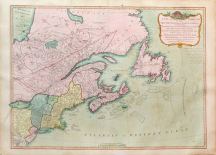
Manuscript Map of Givet, France on the Belgian Border
Similar Sale History
View More Items in Maps & AtlasesRelated Maps & Atlases
More Items in French Maps & Atlases
View MoreRecommended Transportation & Travel Collectibles
View More


Item Details
Description
[Givet, France].
"Charlemont les deux Givets et la Couronne d'Haurs Pour servir au Projet de mil Sept cent trente sept"
Fine manuscript plan in ink and colours on paper (no visible watermark), scale approximately 1:1000).
[France, 1737].
22 1/4" x 35 1/4" sheet.
Givet, on the Meuse near the Belgian frontier, is divided into three: the citadel of Charlemont, Grand Givet and Petit Givet. The fortress was erected by Charles V in the sixteenth century and extended by Vauban in the late seventeenth. Much of the fortifications around Givet were demolished in 1892.
Condition: Traces of folds and repairs at fold junctions.
Buyer's Premium
- 25%
Manuscript Map of Givet, France on the Belgian Border
Estimate $1,500 - $3,000
1 bidder is watching this item.
Shipping & Pickup Options
Item located in New York, NY, usOffers In-House Shipping
Local Pickup Available
Payment

Related Searches
TOP


![French Manuscript Map of the Meuse Valley: [Europe, France] [French & Belgium Border, Meuse Valley] Carte de Givet A'Dinant. Manuscript map in ink and watercolors on paper. France, c.1750. 20" x 56 1/2" sheet. Carte de Givet [France] a Dinant](https://p1.liveauctioneers.com/1968/216191/110783526_1_x.jpg?height=310&quality=70&version=1629990486)
![Manuscript Map of Antibes [Near Canne], France including Fort Le Carre: [Antibes, France near Canne]. Plan de la Ville et Fort Quarre d'Antibe. Manuscript map in ink and colors on paper. France, 18th century. 18 1/4" x 34 1/2" sheet. French manuscript map of historic Anti](https://p1.liveauctioneers.com/1968/273926/143704770_1_x.jpg?height=310&quality=70&version=1672435208)
![Manuscript Map of French & Belgium Border, Meuse Valley: [French & Belgium Border, Meuse Valley] Carte de Givet A'Dinant. Manuscript map in ink and watercolors on paper. France, c. 1750. 20" x 56 1/2" sheet. Carte de Givet [France] a Dinant [Belgium], manus](https://p1.liveauctioneers.com/1968/314554/168606379_1_x.jpg?height=310&quality=70&version=1704142666)
![Manuscript Map of Ham, France from the Early 18th Century: [HAM, FRANCE]. Plan de Ham Relatif au projet de 1728. Manuscript plan of the town and castle on the Somme, in ink and colours on paper (watermark 'Biberolle,) scale approximately 1:5000. [France, c.17](https://p1.liveauctioneers.com/1968/273926/143704767_1_x.jpg?height=310&quality=70&version=1672435208)
![Freminville Manuscript Map of Brittany France: FREMINVILLE, Christophe-Paulin de La Poix, chevalier de (1787-1848). [Europe, France] Plan de la Riviere de Pontrieux... Manuscript Map with original hand color in full. c. 1831 or later. 15 3/4" x 65](https://p1.liveauctioneers.com/1968/314554/168606380_1_x.jpg?height=310&quality=70&version=1704142666)

![Important French Navy Manuscript Map of the St.: ANONYMOUS, Manuscript Map. [Echelle de la Lieux Marine de France]. Pen and ink on paper. c. Early-Mid 18th Century. 19 3/4 x 28 inches sheet, 29 x 37 inches framed. AN IMPORTANT FRENCH NAVY MANUSCRIPT](https://p1.liveauctioneers.com/1968/232715/120470655_1_x.jpg?height=310&quality=70&version=1641404127)
![French Manuscript Map of the River Triuex by: [Europe, France] FREMINVILLE, Christophe-Paulin de La Poix, chevalier de (1787-1848). Plan de la Riviere de Pontrieux... Manuscript Map with original hand color in full. c. 1831 or later. 15 3/4" x 65](https://p1.liveauctioneers.com/1968/216191/110783527_1_x.jpg?height=310&quality=70&version=1629990486)


