An Early 19th Century English Map of the Carolinas
Similar Sale History
View More Items in Maps & AtlasesRelated Maps & Atlases
More Items in Maps & Atlases
View MoreRecommended Transportation & Travel Collectibles
View More


Item Details
Description
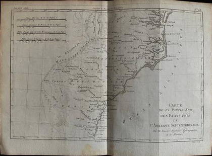
An Early 19th Century English Map of the Carolinas
(London: Baldwin & Cradock,1833), being North America Sheet XI Parts of North and South Carolina for the Society for the Diffusion of Useful Knowledge. Presented in a wooden frame.
Overall dimensions 21-1/2 x 19 in.
Additional high-resolution photos are available at www.lelandlittle.com
(London: Baldwin & Cradock,1833), being North America Sheet XI Parts of North and South Carolina for the Society for the Diffusion of Useful Knowledge. Presented in a wooden frame.
Overall dimensions 21-1/2 x 19 in.
Additional high-resolution photos are available at www.lelandlittle.com
Condition
Minor stains, else good estate condition.
Buyer's Premium
- 25%
An Early 19th Century English Map of the Carolinas
Estimate $50 - $25,000
20 bidders are watching this item.
Shipping & Pickup Options
Item located in Hillsborough, NC, usSee Policy for Shipping
Payment

Related Searches
TOP


![[MAP]. TODESCHI, Pietro. [Nova et Acurata Totius Americae Tabula auct. G.I. Blaeu] America quarta: [MAP]. TODESCHI, Pietro. [Nova et Acurata Totius Americae Tabula auct. G.I. Blaeu] America quarta pars orbis quam plerunq, nuvum orbem appellitant primo detecta est anno 1492 a Christophoro Columbo...](https://p1.liveauctioneers.com/197/329395/177650542_1_x.jpg?height=310&quality=70&version=1715364962)


![[MAPS]. HOMANN, Johann Baptist, HOMANN HEIRS, and Georg Matthäus SEUTTER. [Composite Atlas].: [MAPS]. HOMANN, Johann Baptist (1663-1724), HOMANN HEIRS, and Georg Matthäus SEUTTER (1678-1757). [Composite Atlas]. [Nuremberg, Augsburg, and others: Homann Heirs and others, maps dated between](https://p1.liveauctioneers.com/197/329395/177650530_1_x.jpg?height=310&quality=70&version=1715364962)


