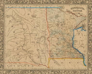
MATHEW CAREY (IRISH-AMERICAN, 1760-1839) MAP OF MARYLAND
Similar Sale History
View More Items in Maps & AtlasesRelated Maps & Atlases
More Items in Maps & Atlases
View MoreRecommended Transportation & Travel Collectibles
View More


Item Details
Description
MATHEW CAREY (IRISH-AMERICAN, 1760-1839) MAP OF MARYLAND, hand-colored engraving on paper, titled "MARYLAND" in a scrolling cartouche in lower left corner, from Carey's General Atlas, published in 1814 in Philadelphia, which was the first American atlas to be offered with hand coloring on the maps, featuring the counties outlined in color, bordered by Pennsylvania and nondescript depictions of Delaware and Virginia, large inset of "WESTERN PART / OF / MARYLAND" in the left side, upper right corner with "16" in margin. Housed under glass in a modern frame, backing paper with gallery label for Antique Prints, Inc. of Ocean View, DE. Circa 1814. 18" x 12 3/4" sight, 24" x 18 5/8" OA.
Condition
Very good visual condition with light toning and spotting, having typical center vertical fold line, frame with minor wear.
Buyer's Premium
- 25%
MATHEW CAREY (IRISH-AMERICAN, 1760-1839) MAP OF MARYLAND
Shipping & Pickup Options
Item located in Mt. Crawford, VA, usPayment


![[Map] The State of North Carolina: Lewis, Samuel. "The State of North Carolina from the best Authorities, &c." [Philadelphia: Mathew Carey, ca. 1795 or shortly after.] On heavy laid. Measured from plate-marks 49 x 29.5cm. Quite clean,](https://p1.liveauctioneers.com/3532/146911/74242522_1_x.jpg?height=310&quality=70&version=1564368564)


![1878 Mitchell Map of Virginia and West Virginia [verso] New Jersey, Maryland and Delaware -- County: Title: 1878 Mitchell Map of Virginia and West Virginia [verso] New Jersey, Maryland and Delaware -- County Map ofVirginia and West Virginia [Verso} County Map of Maryland and Delaware [with] County Ma](https://p1.liveauctioneers.com/5584/329422/177662152_1_x.jpg?height=310&quality=70&version=1715717898)


![1892 Cowles Civil War Map of Battles in Gettysburg, Virginia, W Virginia and Maryland -- Sketch of: Title: 1892 Cowles Civil War Map of Battles in Gettysburg, Virginia, W Virginia and Maryland -- Sketch of the battle of McDowell, VA. [and] Route Map of Gettysburg Campaign Lt-Gen T.J. Jackson [and] S](https://p1.liveauctioneers.com/5584/329422/177662185_1_x.jpg?height=310&quality=70&version=1715717898)


![[NEW YORK CITY – PICTORIAL MAPS]. Group of 3 pictorial maps...: [NEW YORK CITY – PICTORIAL MAPS]. Group of 3 pictorial maps. Including: ANNAND, George (1890—1980). Sinclair Pictorial Map of New York/New York World’s Fair. 26 ¾ x 27 5/8”](https://p1.liveauctioneers.com/928/325952/175495562_1_x.jpg?height=310&quality=70&version=1712935174)
![[Maps] Gio. Ant. Magnini, Italia, 1620: [Maps] Gio. Ant. Magnini, Italia, 1620, Giovanni Antonio Magnini. Italia, data in luce da Fabio suo figliuolo al Serenissimo Ferdinado Gonzaga Duca di Matoua edi Monserrato etc. Bologna, for Sebastian](https://p1.liveauctioneers.com/188/326797/176317457_1_x.jpg?height=310&quality=70&version=1713847031)
![[Maps] Martin Zeiler, Itinerarium Italiae, 1640: [Maps] Martin Zeiler, Itinerarium Italiae, 1640, Martini Zeilleri. Itinerarium Italiae Nov-Antiquae: oder, Raiss-Beschreibung durch Italien, Matthaus Merian, Frankfurt, 40 plates, most double-page, in](https://p1.liveauctioneers.com/188/326797/176317459_1_x.jpg?height=310&quality=70&version=1713847031)


![[MAP]. TODESCHI, Pietro. [Nova et Acurata Totius Americae Tabula auct. G.I. Blaeu] America quarta: [MAP]. TODESCHI, Pietro. [Nova et Acurata Totius Americae Tabula auct. G.I. Blaeu] America quarta pars orbis quam plerunq, nuvum orbem appellitant primo detecta est anno 1492 a Christophoro Columbo...](https://p1.liveauctioneers.com/197/329395/177650542_1_x.jpg?height=310&quality=70&version=1715364962)


