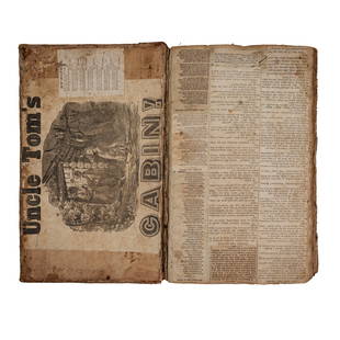
1769 ANTIQUE MAP of EUROPE framed EUROPEAN POSTAL ROADS & STATIONS
Similar Sale History
View More Items in Books

Related Books
More Items in European Books
View MoreRecommended Books, Magazines & Papers
View More


Item Details
Description
1769 ANTIQUE MAP:
MAPPA GEOGRAPHICA EXHIBENS POSTAS
omnes tam vehiculares quam verdarias Totius Germaniae cum earum accurata distantia Diligentissime propriis sumptibus excudit.
Aug. Vindelicor. : Tobias Conrad Lotter, 1769.
Title cartouche in upper left corner decorated with a raven bearing a crown, shield, sword, and orb, with a rural scene in the background.
The legend in the bottom left corner is depicted as on a large stone, over which flies an angel blow a bugle horn, and seated on the winged horse.
Size : 492 x 585 (mm), 19.37 x 23.03 (Inches)
With frame: 23 1/2 by 27 1/4 inches
Decorative and highly detailed postal map of the Northwestern part of Europe. Extends from the Mare Germanicum and the Baltic to the Adriatic and Switzerland.
Marvelous decorative cartouche and explanaory note, delineating the various types of postal roads, stations, etc.
Tobias Conrad Lotter (1717-1777) is one of the best-known German mapmakers of the eighteenth century. He engraved many of the maps published by Matthaus Seutter, to whose daughter Lotter was married. He took over Seutter’s business in 1756. Lotter’s son, M. A. Lotter, succeeded his father in the business.
WEAR, SOME SPLITS ON FOLDS, SOME DISCOLORATION.
BACKED ON CANVAS.
FRAMED UNDER THE GLASS.
Text in Latin
(913)
Reserve: $105.00
Shipping:Domestic: Flat-rate of $25.00 to anywhere within the contiguous U.S. International: Foreign shipping rates are determined by destination. International shipping may be subject to VAT. Combined shipping: Please ask about combined shipping for multiple lots before bidding. Location: This item ships from Pennsylvania
Your purchase is protected:
Photos, descriptions, and estimates were prepared with the utmost care by a fully certified expert and appraiser. All items in this sale are guaranteed authentic.
In the rare event that the item did not conform to the lot description in the sale, Jasper52 specialists are here to help. Buyers may return the item for a full refund provided you notify Jasper52 within 5 days of receiving the item.
MAPPA GEOGRAPHICA EXHIBENS POSTAS
omnes tam vehiculares quam verdarias Totius Germaniae cum earum accurata distantia Diligentissime propriis sumptibus excudit.
Aug. Vindelicor. : Tobias Conrad Lotter, 1769.
Title cartouche in upper left corner decorated with a raven bearing a crown, shield, sword, and orb, with a rural scene in the background.
The legend in the bottom left corner is depicted as on a large stone, over which flies an angel blow a bugle horn, and seated on the winged horse.
Size : 492 x 585 (mm), 19.37 x 23.03 (Inches)
With frame: 23 1/2 by 27 1/4 inches
Decorative and highly detailed postal map of the Northwestern part of Europe. Extends from the Mare Germanicum and the Baltic to the Adriatic and Switzerland.
Marvelous decorative cartouche and explanaory note, delineating the various types of postal roads, stations, etc.
Tobias Conrad Lotter (1717-1777) is one of the best-known German mapmakers of the eighteenth century. He engraved many of the maps published by Matthaus Seutter, to whose daughter Lotter was married. He took over Seutter’s business in 1756. Lotter’s son, M. A. Lotter, succeeded his father in the business.
WEAR, SOME SPLITS ON FOLDS, SOME DISCOLORATION.
BACKED ON CANVAS.
FRAMED UNDER THE GLASS.
Text in Latin
(913)
Reserve: $105.00
Shipping:
Your purchase is protected:
Photos, descriptions, and estimates were prepared with the utmost care by a fully certified expert and appraiser. All items in this sale are guaranteed authentic.
In the rare event that the item did not conform to the lot description in the sale, Jasper52 specialists are here to help. Buyers may return the item for a full refund provided you notify Jasper52 within 5 days of receiving the item.
Buyer's Premium
- 15%
1769 ANTIQUE MAP of EUROPE framed EUROPEAN POSTAL ROADS & STATIONS
Estimate $150 - $200
2 bidders are watching this item.
Shipping & Pickup Options
Item located in Pennsylvania, US$25 shipping in the US
Payment
Accepts seamless payments through LiveAuctioneers
See More Items From This Jasper52 Seller

TOP


![1779 LIVES of SAINTS in SPANISH antique VELLUM BOUND: Vida Del Sen~or San Josef [with] Vida del Sen~or San Joaquin y de Sen~ora Santa Ana by Vallejo, Jose´ Ignacio and P. Estevan Binet En Cesena, En la Impenta de Gregorio Biasini en la Insignia de Pal](https://p1.liveauctioneers.com/5584/300835/160216261_1_x.jpg?height=310&quality=70&version=1693946337)


![1715, King James Bible, Folio, Large Pulpit Size: 1715, FOLIO KING JAMES BIBLE VERSION WITH GENEVA NOTES 16" x 10". [28], 712, [2], 160, 248 pp. (text complete), + 2 (of 6) double-page maps/plans by Moxon Including plan of Jerusalem and map of Cana](https://p1.liveauctioneers.com/6752/145177/73447828_1_x.jpg?height=310&quality=70&version=1562055217)


![1719 BIBLE DUTCH BIBLIA FOLIO w/ CLASPS & MAPS antique decorative binding: Biblia: De Gantsche H Schrifture [...] Dordrecht/Amsterdam, Pieter Keur/Piter Rotterdam, 1719 (46) 332 sheets ( 664 pages), (2) 144 sheets ( 288 pages), (26) 169 sheets ( 338 pages), (4) 58 ( 116 page](https://p1.liveauctioneers.com/5584/326497/175779365_1_x.jpg?height=310&quality=70&version=1713903087)


![Kipling, Just So Stories, 1stEd. 1975 Print, Herman Vestal illustrations: "Favorite Just So Stories" by Rudyard Kipling, illustrated by H.B. Vestal, published by Grosset & Dunlap, New York. Stated printing of 1975. [First printing of this edition was issued in 1957]. Illust](https://p1.liveauctioneers.com/6304/318179/173713659_1_x.jpg?height=310&quality=70&version=1712691082)


