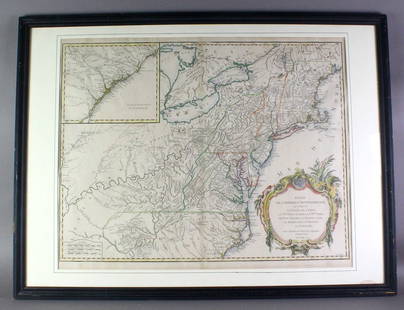
Antique Map - USA - Port of Boston - North Atlantic Ocean - Marco Coltellini
Similar Sale History
View More Items in Maps & Atlases
Related Maps & Atlases
More Items in Maps & Atlases
View MoreRecommended Transportation & Travel Collectibles
View More


Item Details
Description
Reserve: $200.00
Shipping:
Your purchase is protected:
Photos, descriptions, and estimates were prepared with the utmost care by a fully certified expert and appraiser. All items in this sale are guaranteed authentic.
In the rare event that the item did not conform to the lot description in the sale, Jasper52 specialists are here to help. Buyers may return the item for a full refund provided you notify Jasper52 within 5 days of receiving the item.
Condition
The work is in very good condition overall. There may be a few minor imperfections or fox or mottled marks to be expected with age. Please review the image carefully for condition and contact us with any questions.
Buyer's Premium
- 15%
Antique Map - USA - Port of Boston - North Atlantic Ocean - Marco Coltellini
Estimate $250 - $300
1 bidder is watching this item.
Shipping & Pickup Options
Item located in New York, NY, us$35 shipping in the US
Payment
Accepts seamless payments through LiveAuctioneers
See More Items From This Jasper52 Seller

Related Searches
TOP


![[Maps & Atlases] [North Atlantic] Ortelius, Abraham,: [Maps & Atlases] [North Atlantic] Ortelius, AbrahamSeptentrionalium regionum descrip.(Antwerp, 1603). Hand-colored engraving. Latin text on verso. Center fold verso reinforced with japanese paper. 16](https://p1.liveauctioneers.com/65/180189/90674457_1_x.jpg?height=310&quality=70&version=1601308772)


![Océanique. Partie… Iles Mariannes #2 North Mariana Islands VANDERMAELEN 1827 map: CAPTION PRINTED BELOW PICTURE: Océanique - Partie des Iles Mariannes [Note sur les îles Sandwich] - No. 2 The northern Mariana Islands, from Alamagan northwards DATE PRINTED: 1827 IMAGE SIZE](https://p1.liveauctioneers.com/5584/326888/175994449_1_x.jpg?height=310&quality=70&version=1713903186)
![Océanique. Partie… Iles Mariannes #2 North Mariana Islands VANDERMAELEN 1827 map: CAPTION PRINTED BELOW PICTURE: Océanique - Partie des Iles Mariannes [Note sur les îles Sandwich] - No. 2 The northern Mariana Islands, from Alamagan northwards DATE PRINTED: 1827 IMAGE SIZE](https://p1.liveauctioneers.com/5584/326888/175994416_1_x.jpg?height=310&quality=70&version=1713903186)


![Océanique. Nouvelle Caledonie #46. New Caledonia Vanuatu. VANDERMAELEN 1827 map: CAPTION PRINTED BELOW PICTURE: Océanique - Nouvelle Caledonie [Note sur l'île de la Nouvelle Calédonie] - No. 46 New Caledonia and the adjacent islands to the north west including part](https://p1.liveauctioneers.com/5584/326888/175994476_1_x.jpg?height=310&quality=70&version=1713903186)


