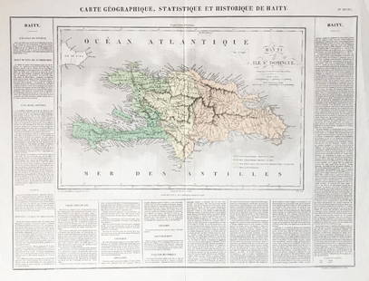
Buchon: Antique Map of USA territorial development
Similar Sale History
View More Items in Maps & AtlasesRelated Maps & Atlases
More Items in Maps & Atlases
View MoreRecommended Transportation & Travel Collectibles
View More


Item Details
Description
TITLE/CONTENT OF MAP: 'Carte de l'adjonction progressive des divers états au territoire et à l'union constitutionelle des États-Unis de l'Amérique du Nord 1825'
This fascinating map shows the territorial development of the United States up to 1825. The map states in French that at this time, the United States consisted of "24 states, one District (that of Columbia) and 6 territories (Michigan, Missouri, North-west, Oregon, Florida and Arkansas)". The map further states that "Florida will probably form a state within one year" - in fact it did not achieve statehood until 1845. The states coloured pink along the Atlantic Seaboard are the 13 original states, plus Vermont - later established on land originally claimed by both New York and New Hampshire. The area coloured yellow are the territories gained through the Louisiana Purchase of 1803. Florida territory - captured from Spain in 1821 - is coloured brown. The areas coloured green are the other then states and territories added between 1790 and 1825.
Date: 1825
IMAGE SIZE: Approx 42.5 x 67.5cm, 16.5 x 26.5 inches (Large); Please note that this is a folding map.
TYPE: Very decorative early 19th century antique hand-coloured engraved map. Text in French.
CONDITION: Good; suitable for framing.
VERSO: There is nothing printed on the reverse side, which is plain
FOLDING: This is a folding map.
ARTIST/CARTOGRAPHER/ENGRAVER: Jean Alexandre Buchon
PROVENANCE: Atlas géographique, statistique, historique et chronologique des Deux Amériques et des iles adjacentes; par J.A. Buchon, dédié à S.A.R. Le Duc d'Orléans, à Paris, à la librairie de J. Carez, éditeur, Rue Haute feuille, no 18; Chez Verdiere, Quai des Augustins, no 25; Chez Bossange, père, Rue de Richelieu, No. 60. MDCCCXXV
Please note that this lot has a confidential reserve. When you leave a bid in advance of the auction, submit your maximum. The bidder who has submitted the highest bid wins the lot, provided the bid exceeds the reserve price.
Shipping:Domestic: Flat-rate of $25.00 to anywhere within the contiguous U.S. International: Foreign shipping rates are determined by destination. Location: This item ships from United Kingdom
Your purchase is protected:
Photos, descriptions, and estimates were prepared with the utmost care by a fully certified expert and appraiser. All items in this sale are guaranteed authentic.
In the rare event that the item did not conform to the lot description in the sale, Jasper52 specialists are here to help. Buyers may return the item for a full refund provided you notify Jasper52 within 5 days of receiving the item.
This fascinating map shows the territorial development of the United States up to 1825. The map states in French that at this time, the United States consisted of "24 states, one District (that of Columbia) and 6 territories (Michigan, Missouri, North-west, Oregon, Florida and Arkansas)". The map further states that "Florida will probably form a state within one year" - in fact it did not achieve statehood until 1845. The states coloured pink along the Atlantic Seaboard are the 13 original states, plus Vermont - later established on land originally claimed by both New York and New Hampshire. The area coloured yellow are the territories gained through the Louisiana Purchase of 1803. Florida territory - captured from Spain in 1821 - is coloured brown. The areas coloured green are the other then states and territories added between 1790 and 1825.
Date: 1825
IMAGE SIZE: Approx 42.5 x 67.5cm, 16.5 x 26.5 inches (Large); Please note that this is a folding map.
TYPE: Very decorative early 19th century antique hand-coloured engraved map. Text in French.
CONDITION: Good; suitable for framing.
VERSO: There is nothing printed on the reverse side, which is plain
FOLDING: This is a folding map.
ARTIST/CARTOGRAPHER/ENGRAVER: Jean Alexandre Buchon
PROVENANCE: Atlas géographique, statistique, historique et chronologique des Deux Amériques et des iles adjacentes; par J.A. Buchon, dédié à S.A.R. Le Duc d'Orléans, à Paris, à la librairie de J. Carez, éditeur, Rue Haute feuille, no 18; Chez Verdiere, Quai des Augustins, no 25; Chez Bossange, père, Rue de Richelieu, No. 60. MDCCCXXV
Please note that this lot has a confidential reserve. When you leave a bid in advance of the auction, submit your maximum. The bidder who has submitted the highest bid wins the lot, provided the bid exceeds the reserve price.
Shipping:
Your purchase is protected:
Photos, descriptions, and estimates were prepared with the utmost care by a fully certified expert and appraiser. All items in this sale are guaranteed authentic.
In the rare event that the item did not conform to the lot description in the sale, Jasper52 specialists are here to help. Buyers may return the item for a full refund provided you notify Jasper52 within 5 days of receiving the item.
Buyer's Premium
- 15%
Buchon: Antique Map of USA territorial development
Estimate $450 - $550
8 bidders are watching this item.
Shipping & Pickup Options
Item located in United Kingdom$25 shipping in the US
Payment
See More Items From This Jasper52 Seller

Auction Curated By

Maps Expert
Related Searches
TOP


![Plan of the City of Havana. Cuba. GENTS MAG 1740 old antique map chart: CAPTION PRINTED BELOW PICTURE: [Plan of the City of Havana] DATE PRINTED: 1740 IMAGE SIZE: Approx 18.0 x 11.5cm, 7 x 4.5 inches (Small) TYPE: Antique copperplate map CONDITION: Good; suitable for fram](https://p1.liveauctioneers.com/5584/327764/176590684_1_x.jpg?height=310&quality=70&version=1714507756)


![[Maps] Gio. Ant. Magnini, Italia, 1620: [Maps] Gio. Ant. Magnini, Italia, 1620, Giovanni Antonio Magnini. Italia, data in luce da Fabio suo figliuolo al Serenissimo Ferdinado Gonzaga Duca di Matoua edi Monserrato etc. Bologna, for Sebastian](https://p1.liveauctioneers.com/188/326797/176317457_1_x.jpg?height=310&quality=70&version=1713847031)


