EARLY 18TH C. DUTCH CHART OF PACIFIC OCEAN BY FREDERIK DE WIT (1629-1706) WITH CALIFORNIA AS AN
Similar Sale History
View More Items in Maps & Atlases
Related Maps & Atlases
More Items in Maps & Atlases
View MoreRecommended Transportation & Travel Collectibles
View More


Item Details
Description
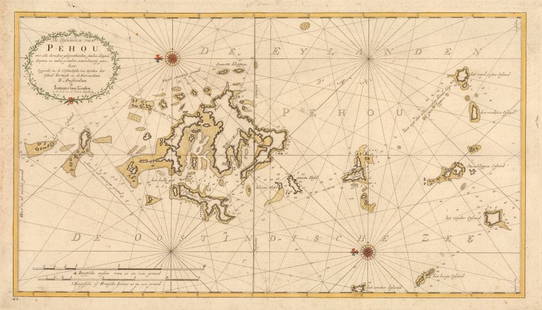
"Magnuum Mare del Zur, cum Insula California, De Groote Zuyd-Zee en't Eylandt California; Gedruck't Amsterdam by Frederick De Wit ince Calver Street". Handcolored copper engraving. Engraver: Romeyn de Hooghe. First State. First edition: ca. 1671-76. This plate ca. 1680. From: Orbis Maritimus ofte Zee Atlas. Amsterdam, c. 1680. References: Burden - II, p. 96, #469; McLaughlin - #59; Clancy - p.118 Map 7.15.; Carhart de Wit (2016) - p. 473 C26.1 - First statePacific Ocean, by Frederick de Wit. ca. 1680.This map shows California as an island and Oceania: Australia, Van Diemens Land and New Zealand.Housed in birch box frame, matted under glass, OS: 27" x 30", SS: 19 1/2" x 22 1/2". Light staining, toned, two small holes.
Buyer's Premium
- 25%
EARLY 18TH C. DUTCH CHART OF PACIFIC OCEAN BY FREDERIK DE WIT (1629-1706) WITH CALIFORNIA AS AN
Estimate $1,500 - $2,000
9 bidders are watching this item.
Shipping & Pickup Options
Item located in Thomaston, ME, usOffers In-House Shipping
Local Pickup Available
Payment
Accepts seamless payments through LiveAuctioneers

TOP


![De Fer: Map of Barcelonne, Barcelona, 1705: Map: 'Barcelonne [Barcelona] Fortifed town/city plan' Date Printed: 1705 Image Size: Approx 19.0 x 31.5cm, 7.5 x 12.25 inches (Medium) Type: Early 18th century copperplate map Condition: Fair: A tear](https://p1.liveauctioneers.com/5584/102391/52309321_1_x.jpg?height=310&quality=70&version=1491597186)
![de Fer: Antique Map of Pinerolo, Italy, 1705: Title/Content of Map: 'Pignerol [Pinerolo]' Plan of town/city & fortifications. Italy. Date Printed: 1705 Image Size: Approx 21.5 x 31.5cm, 8.5 x 12.25 inches (Large) Type: Early 18th century copperpl](https://p1.liveauctioneers.com/5584/115996/59594962_1_x.jpg?height=310&quality=70&version=1517965654)
![de Fer: Plan de Tripoli in Barbarie' fortified: TITLE/CONTENT OF MAP: '[Plan de Tripoli in Barbarie] [Tripoli, Libya]' DATE PRINTED: 1705 IMAGE SIZE: Approx 24.5 x 36.5cm, 9.75 x 14.25 inches (Large) TYPE: Early 18th century copperplate map CONDITI](https://p1.liveauctioneers.com/5584/117068/60186956_1_x.jpg?height=310&quality=70&version=1519783227)
![de Fer: Verceil'. Vercelli. Plan of town/city &: TITLE/CONTENT OF MAP: 'Verceil [Vercelli]' DATE PRINTED: 1705 IMAGE SIZE: Approx 18.5 x 26.5cm, 7.25 x 10.5 inches (Medium) TYPE: Early 18th century copperplate map CONDITION: Good; suitable for frami](https://p1.liveauctioneers.com/5584/117068/60186890_1_x.jpg?height=310&quality=70&version=1519783227)
![de Fer: Oudenarde'. Oudenaarde . Fortifed town/city: TITLE/CONTENT OF MAP: 'Oudenarde [Oudenaarde ]' DATE PRINTED: 1705 IMAGE SIZE: Approx 23.5 x 34.5cm, 9.25 x 13.75 inches (Large) TYPE: Early 18th century copperplate map CONDITION: Good; suitable for](https://p1.liveauctioneers.com/5584/117068/60186836_1_x.jpg?height=310&quality=70&version=1519783227)


![Entrée de Norton & Détroit de Bhering. Bering Strait Norton Sound BONNE 1790 map: TITLE/CONTENT OF MAP: [Cook 3e Voyage] Carte de l'entrée de Norton et du Détroit de Bhering, où l'on voit le Cap le plus Oriental de l'Asie et la pointe la plus Occidentale de l'Amé](https://p1.liveauctioneers.com/5584/326888/175994368_1_x.jpg?height=310&quality=70&version=1713903186)
![Entrée de Norton & Détroit de Bhering. Bering Strait Norton Sound BONNE 1788 map: TITLE/CONTENT OF MAP: [Cook 3e Voyage] Carte de l'entrée de Norton et du Détroit de Bhering, où l'on voit le Cap le plus Oriental de l'Asie et la pointe la plus Occidentale de l'Amé](https://p1.liveauctioneers.com/5584/326888/175994363_1_x.jpg?height=310&quality=70&version=1713903186)
![Isles de la Reine Charlotte. Nendo, Santa Cruz, Solomon Islands. BONNE 1790 map: TITLE/CONTENT OF MAP: [Voyage du Capitaine Carteret] Isles de la Reine Charlotte // Isle du Lord Egmont ou Nouvelle Grenesey // Isle de Carteret // Baye de L'Hirondelle // Havre de Byron [Voyage of Ca](https://p1.liveauctioneers.com/5584/326888/175994487_1_x.jpg?height=310&quality=70&version=1713903186)
![Isles de la Reine Charlotte. Nendo, Santa Cruz, Solomon Islands. BONNE 1788 map: TITLE/CONTENT OF MAP: [Voyage du Capitaine Carteret] Isles de la Reine Charlotte // Isle du Lord Egmont ou Nouvelle Grenesey // Isle de Carteret // Baye de L'Hirondelle // Havre de Byron [Voyage of Ca](https://p1.liveauctioneers.com/5584/326888/175994471_1_x.jpg?height=310&quality=70&version=1713903186)
![Isles de la Société. Society Islands. Huaheine Raiatea Polynesia. BONNE 1788 map: TITLE/CONTENT OF MAP: [Cook 3e Voyage] Carte des Isles de la Société // Isle de Noël // Havre d'Owarre dans Huaheine // Havre d'Oopoa dans Ulietea // Havre d'Ohamaneno dans Ulietea [Coo](https://p1.liveauctioneers.com/5584/326888/175994425_1_x.jpg?height=310&quality=70&version=1713903186)
![Carte des Isles des Amis. Friendly or Tonga Islands. Tongatapu. BONNE 1790 map: TITLE/CONTENT OF MAP: [Cook 3e Voyage] Carte des Isles des Amis // Plan du Havre de Tongataboo // Tabouai Island // Mangeea Island // Wateeoo Island [Cook's 3rd Voyage - Map of Friendly Islands (Tonga](https://p1.liveauctioneers.com/5584/326888/175994571_1_x.jpg?height=310&quality=70&version=1713903186)
![Carte des Isles des Amis. Friendly or Tonga Islands. Tongatapu. BONNE 1788 map: TITLE/CONTENT OF MAP: [Cook 3e Voyage] Carte des Isles des Amis // Plan du Havre de Tongataboo // Tabouai Island // Mangeea Island // Wateeoo Island [Cook's 3rd Voyage - Map of Friendly Islands (Tonga](https://p1.liveauctioneers.com/5584/326888/175994486_1_x.jpg?height=310&quality=70&version=1713903186)


![[Maps] Gio. Ant. Magnini, Italia, 1620: [Maps] Gio. Ant. Magnini, Italia, 1620, Giovanni Antonio Magnini. Italia, data in luce da Fabio suo figliuolo al Serenissimo Ferdinado Gonzaga Duca di Matoua edi Monserrato etc. Bologna, for Sebastian](https://p1.liveauctioneers.com/188/326797/176317457_1_x.jpg?height=310&quality=70&version=1713847031)


