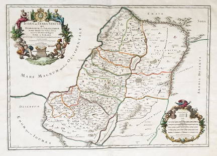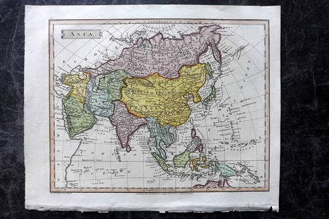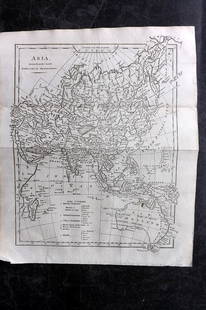
Map of Asia Minor. 1828.
Similar Sale History
View More Items in Maps & AtlasesRelated Maps & Atlases
More Items in Maps & Atlases
View MoreRecommended Transportation & Travel Collectibles
View More


Item Details
Description
Print of steel engraving titled Tableau de la retraite des dix mille“.
Author Fellx Delamarche.
Engraved by unknown.
From Atlas de la Geographie ancienne du moyen age et moderne“ by Fellx Delamarche. Paris. 1829.
Flix Delamarche was a French geographer and engineer who flourished during the 18th century and early 19th century. His father was the map publisher Charles Francois Delamarche.
Asia Minor, a peninsula also called Anatolia, comprises most of the Asian part of modern Turkey and the Armenian highland. Most people there today speak Turkish. The seas surrounding Asia Minor are the Black Sea, the Aegean Sea and the Mediterranean Sea. Because Asia Minor is between Christian Europe and Asia, many different cultures have lived there. Remnants (small parts) of these cultures are there today.Many great historical people, like the Hittites, Lydians Greeks, Persians, Armenians, Romans, Goths, Minoans, Byzantines and Turks, have lived in or occupied Asia Minor. The Roman Empire had a province called Asia, which was in Asia Minor. Later people started to call the entire continent Asia, so the peninsula Asia was called Asia Minor (little Asia).Troy is one of many famous cities that were in Asia Minor long ago.
Approx. image size 42, 3 x 29, 2/46, 2 x 33, 2 cm.Condition: good.
Condition
Condition: good.
Buyer's Premium
- 0%
Map of Asia Minor. 1828.
Estimate €7 - €9
1 bidder is watching this item.
Shipping & Pickup Options
Item located in Vilnius, ltSee Policy for Shipping
Payment

TOP


![[MAP]. ORTELIUS, Abraham. Romani Imperii Imago. 1592.: [MAP]. ORTELIUS, Abraham (1527-1598). Romani Imperii Imago. Antwerp, 1592. Engraved map with hand-coloring. Matted, framed, and double glazed, visible area 381 x 521 mm (unexamined out of frame). 6 de](https://p1.liveauctioneers.com/197/329395/177650537_1_x.jpg?height=310&quality=70&version=1715364962)

![d'Anville (Jean Baptiste Bourguignon) [Untitled Composite Atlas with 102 map sheets], [probably: d'Anville (Jean Baptiste Bourguignon) [Untitled Composite Atlas with 102 map sheets], comprising 20 double-page maps, 9 two-sheet double-page maps, 3 two-sheet maps on folding double-pages [Asia, Afri](https://p1.liveauctioneers.com/5458/329231/177514974_1_x.jpg?height=310&quality=70&version=1715269091)


![[Maps] Gio. Ant. Magnini, Italia, 1620: [Maps] Gio. Ant. Magnini, Italia, 1620, Giovanni Antonio Magnini. Italia, data in luce da Fabio suo figliuolo al Serenissimo Ferdinado Gonzaga Duca di Matoua edi Monserrato etc. Bologna, for Sebastian](https://p1.liveauctioneers.com/188/326797/176317457_1_x.jpg?height=310&quality=70&version=1713847031)
![[Maps] Martin Zeiler, Itinerarium Italiae, 1640: [Maps] Martin Zeiler, Itinerarium Italiae, 1640, Martini Zeilleri. Itinerarium Italiae Nov-Antiquae: oder, Raiss-Beschreibung durch Italien, Matthaus Merian, Frankfurt, 40 plates, most double-page, in](https://p1.liveauctioneers.com/188/326797/176317459_1_x.jpg?height=310&quality=70&version=1713847031)


![[MAP]. TODESCHI, Pietro. [Nova et Acurata Totius Americae Tabula auct. G.I. Blaeu] America quarta: [MAP]. TODESCHI, Pietro. [Nova et Acurata Totius Americae Tabula auct. G.I. Blaeu] America quarta pars orbis quam plerunq, nuvum orbem appellitant primo detecta est anno 1492 a Christophoro Columbo...](https://p1.liveauctioneers.com/197/329395/177650542_1_x.jpg?height=310&quality=70&version=1715364962)


